|
|
You are here:Home/Behind the maps |
|||||
| Behind the maps | |||||
|
|
Many people like maps. Some of them have seen a lot of maps of our world and they want more. So, this site is to present maps of other worlds for all who like maps of imaginary places. More... |
||||
|
|
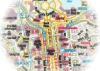
Reading books on architecture and urban planning, taking an experience of famous examples I took definite vision about how comfortable for living city could look like. One of the embodied on the paper such visions you can see on presented map of Gramen city. Ideal city or not? Let's find out about it. More... |
||||
|
|
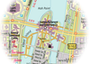
Scanseik is the capital of Scansey, one of the four Regions of Norscand. Despite its relatively small size in terms of population, only 400.000 in metro area, the city is important administrative, scientific and commercial centre of the country. More... |
||||
|
|
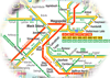
Grenlinn is the 4th largest city of Norscand (after Gramen, Scoltroit, Yordam). It has population of 830’000 within city limits and 1’250’000 in metro area. Grenlinn has all the features of large city – well developed central district, extensive and dense system of public transit, good road infrastructure. That’s why it was a challenge to me to draw the map of such complicated city.More... |
||||
|
|
After two years of planning the idea to create interactive train jorney planner and timetable was finally fullfilled. Now it's just a part of the large-scale project including all rail services of Norscand (exept urban trains) and booking system that will have similar features of railway companies in reality. More... |
||||
|
|
What language do the people of Norscand speak? What do words "gras", "scas" and others mean on the maps? Read the little essay about Norscandian written by George - a fellow enthusiast, one of the website collaborators. More... |
||||
| © 2007-2026 Norscand.net | |