| |
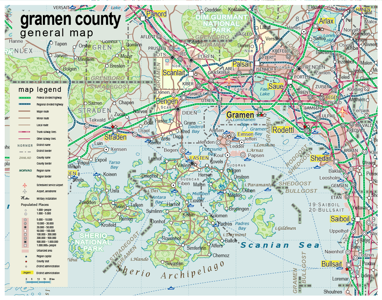
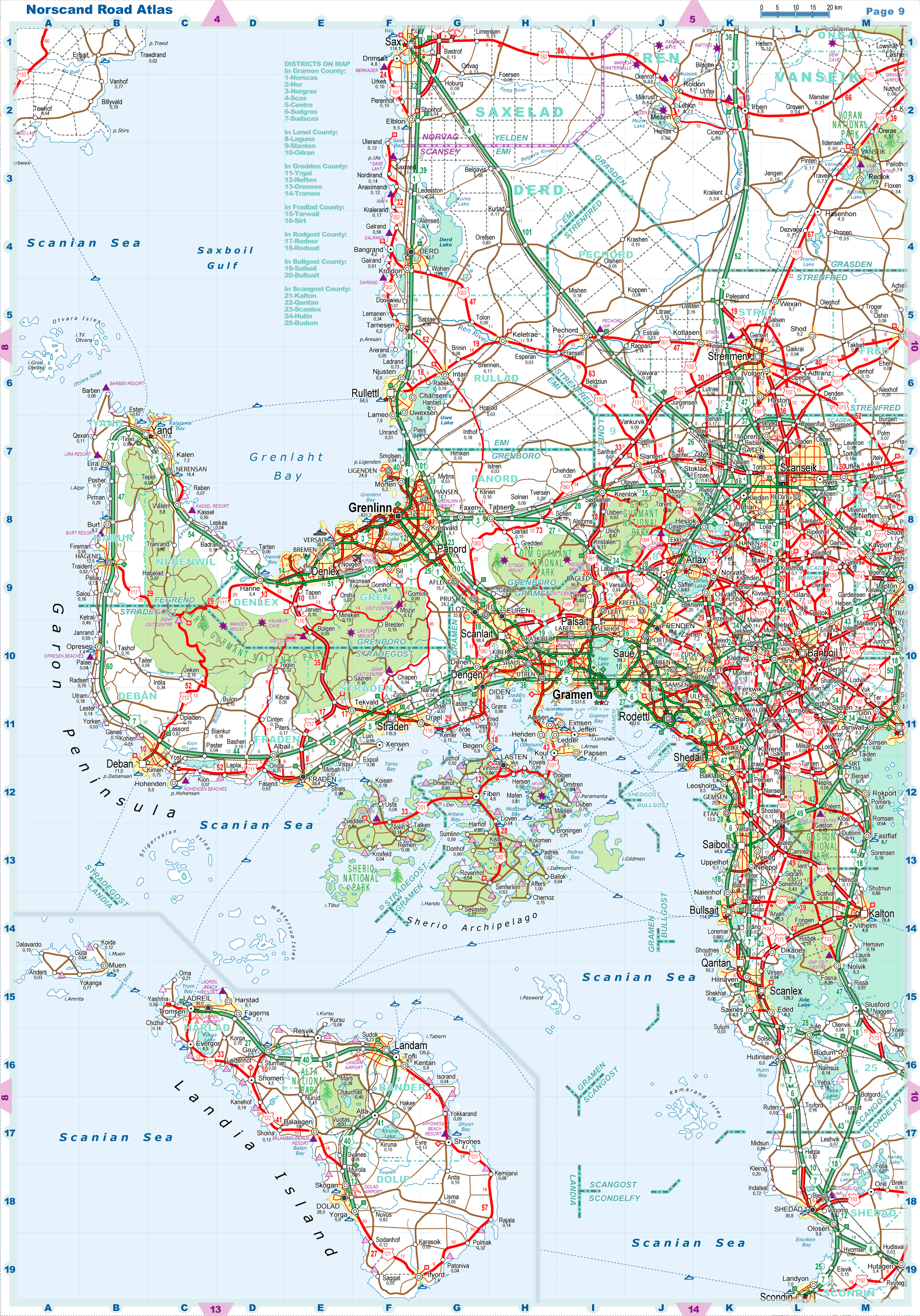
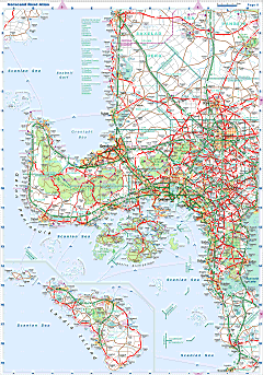
| General map (1291x1016, 356 kb) |
 |
| |
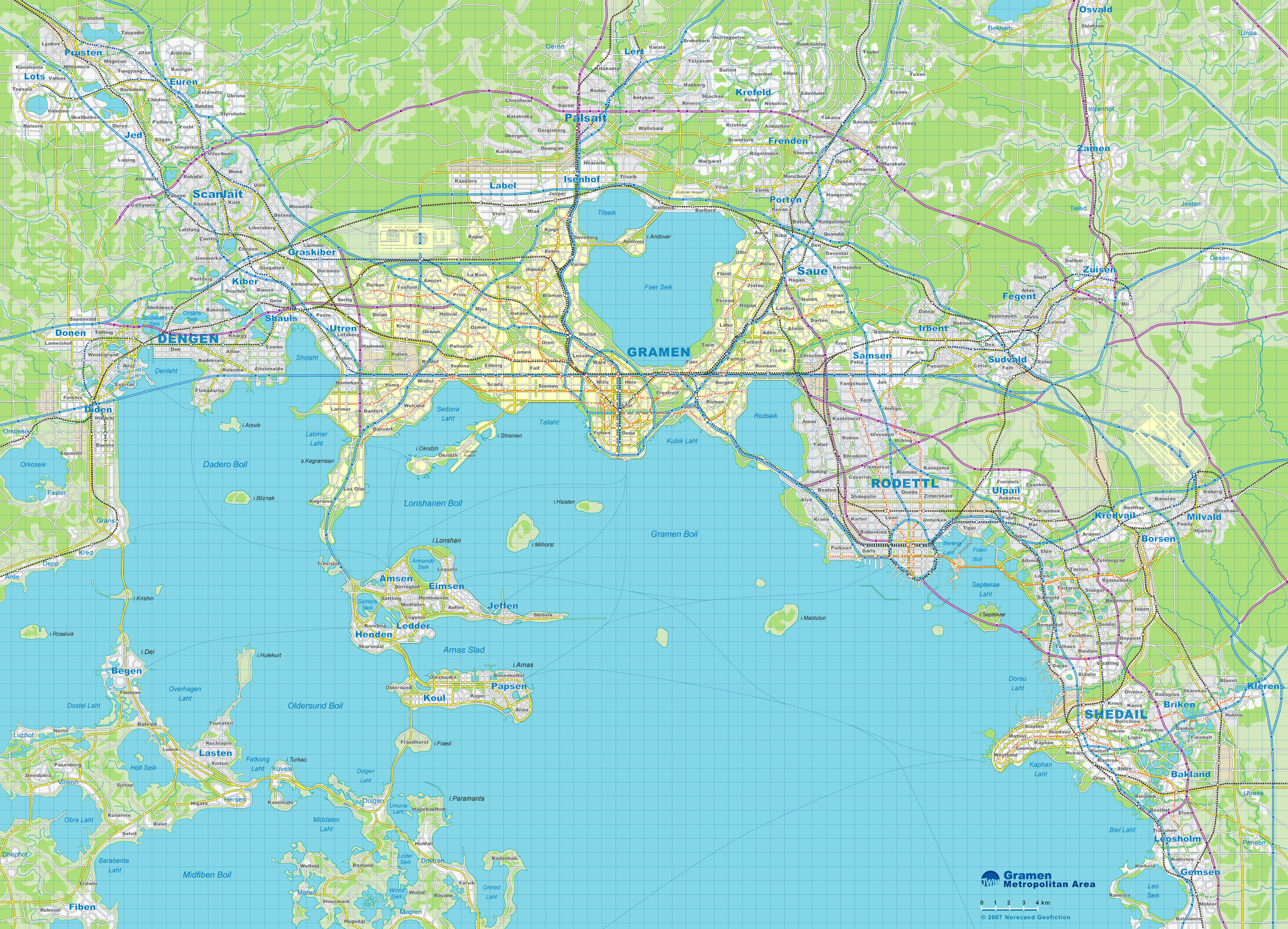
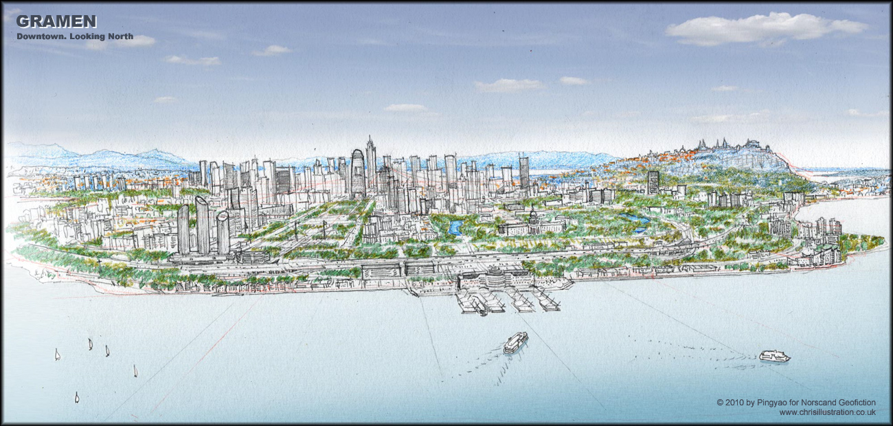
| Gramen Metropolitan Area Map(2864x2066 pix, 1.55 Mb) |
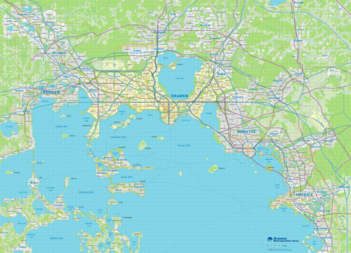 |
| |
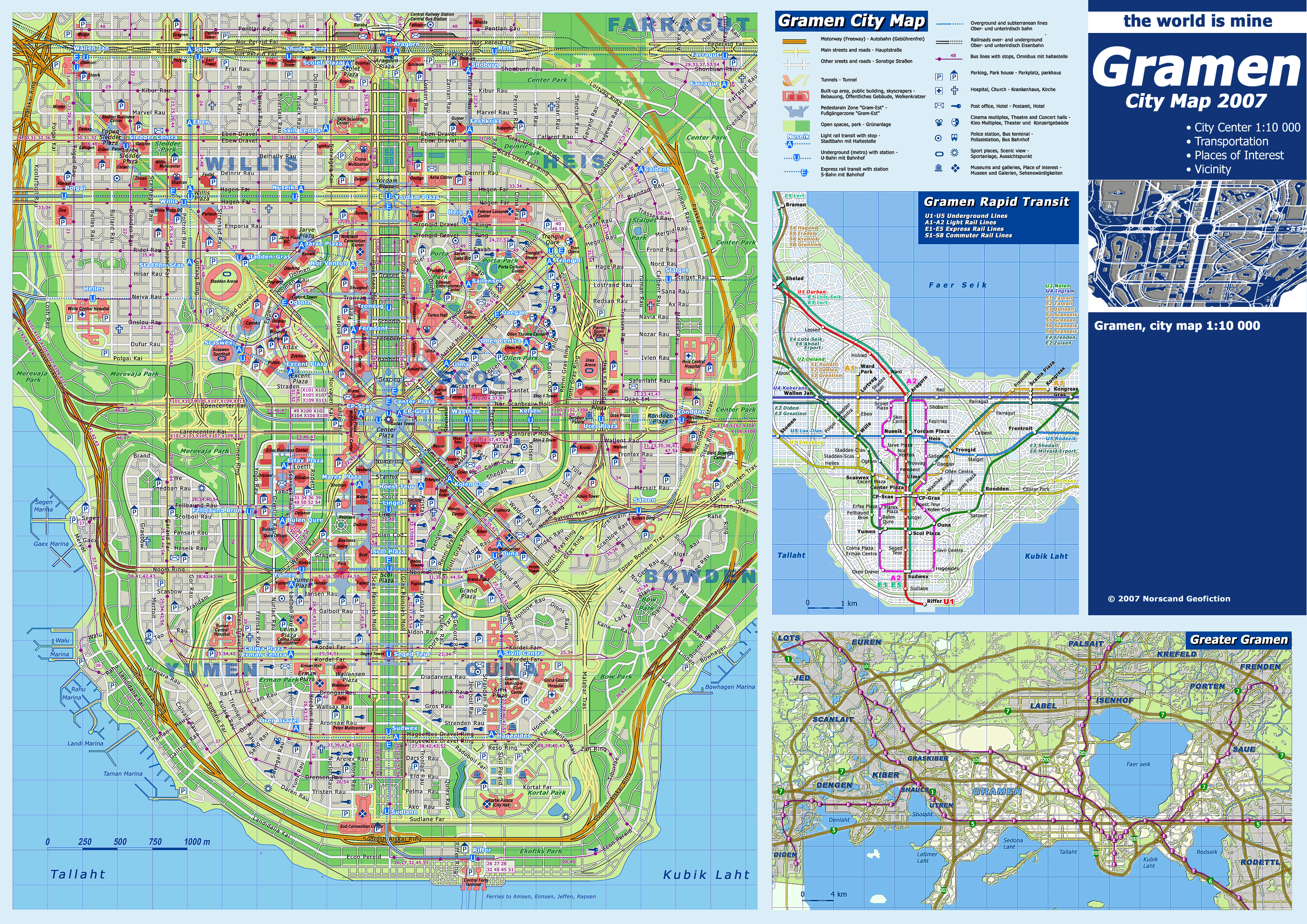
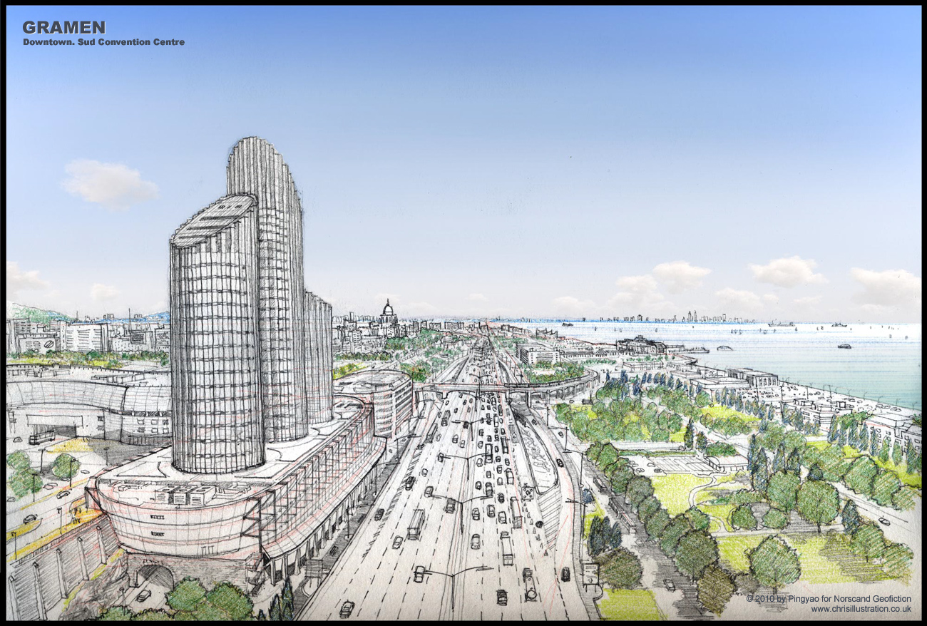
| Gramen City Map(2814x1990 pix, 1.92 Mb) |
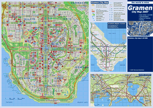 |
| |
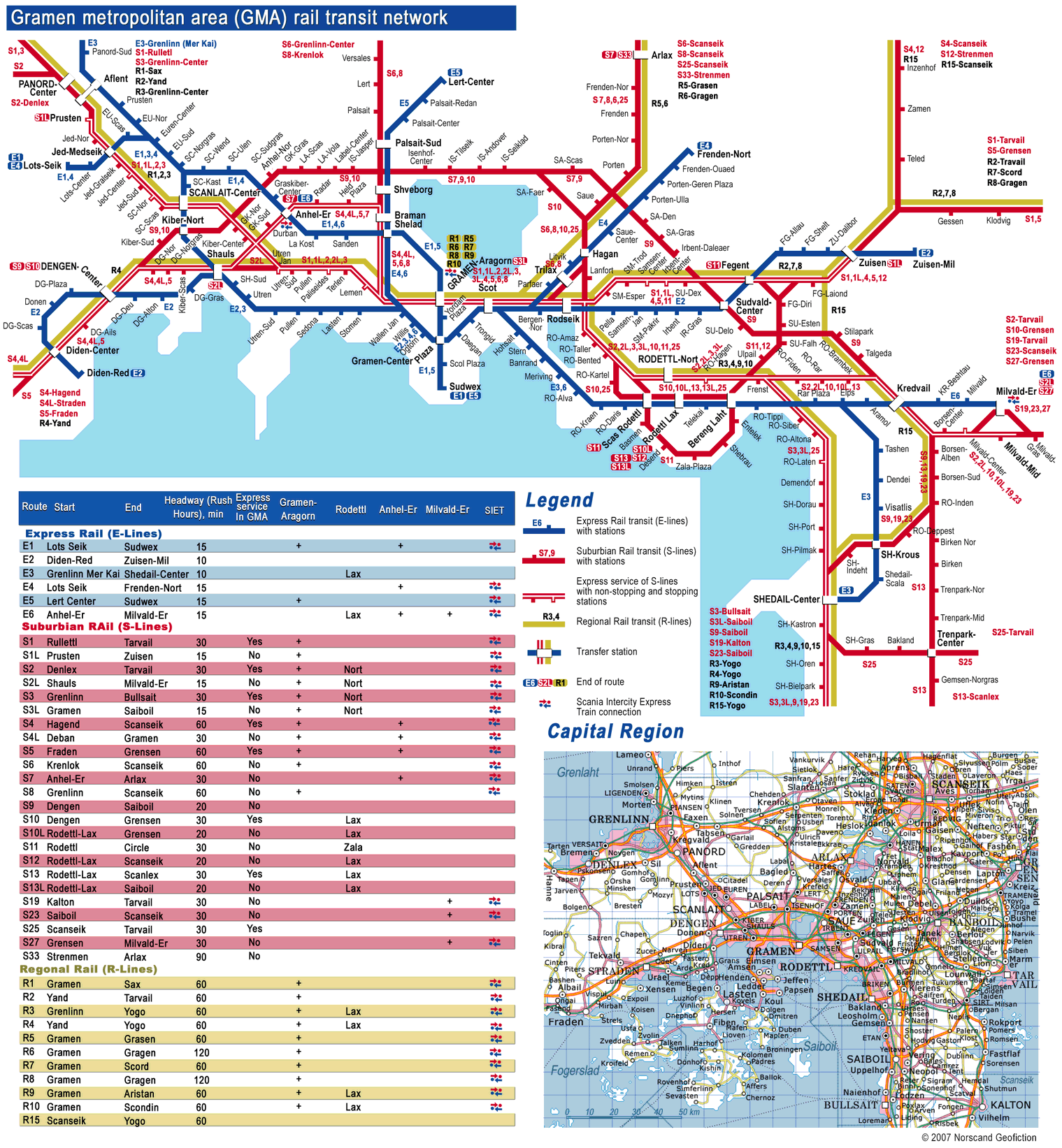
Gramen Metropolitan Area Rail Transit Map
(1519x1643 pix, 0.50 Mb) |
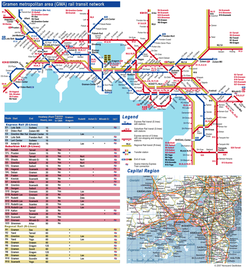 |
| |
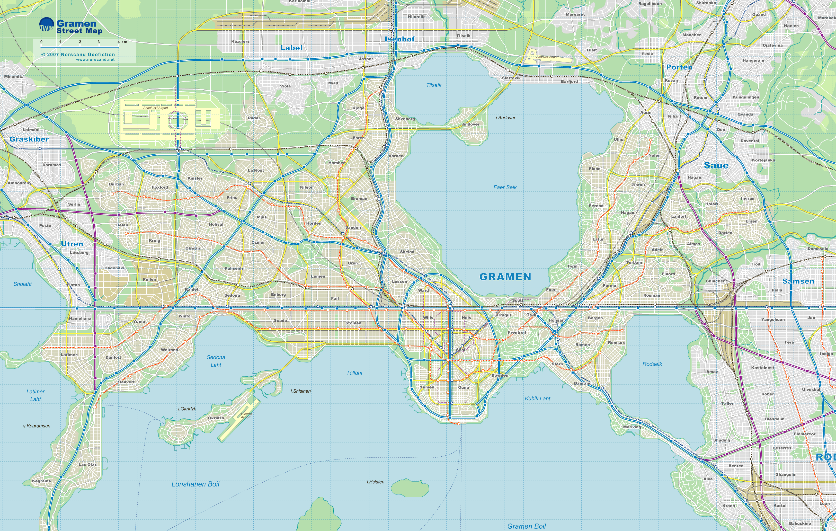
Gramen Street Map
(3250x2064 pix, 1.3 Mb) |
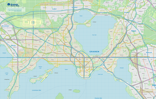 |
| |
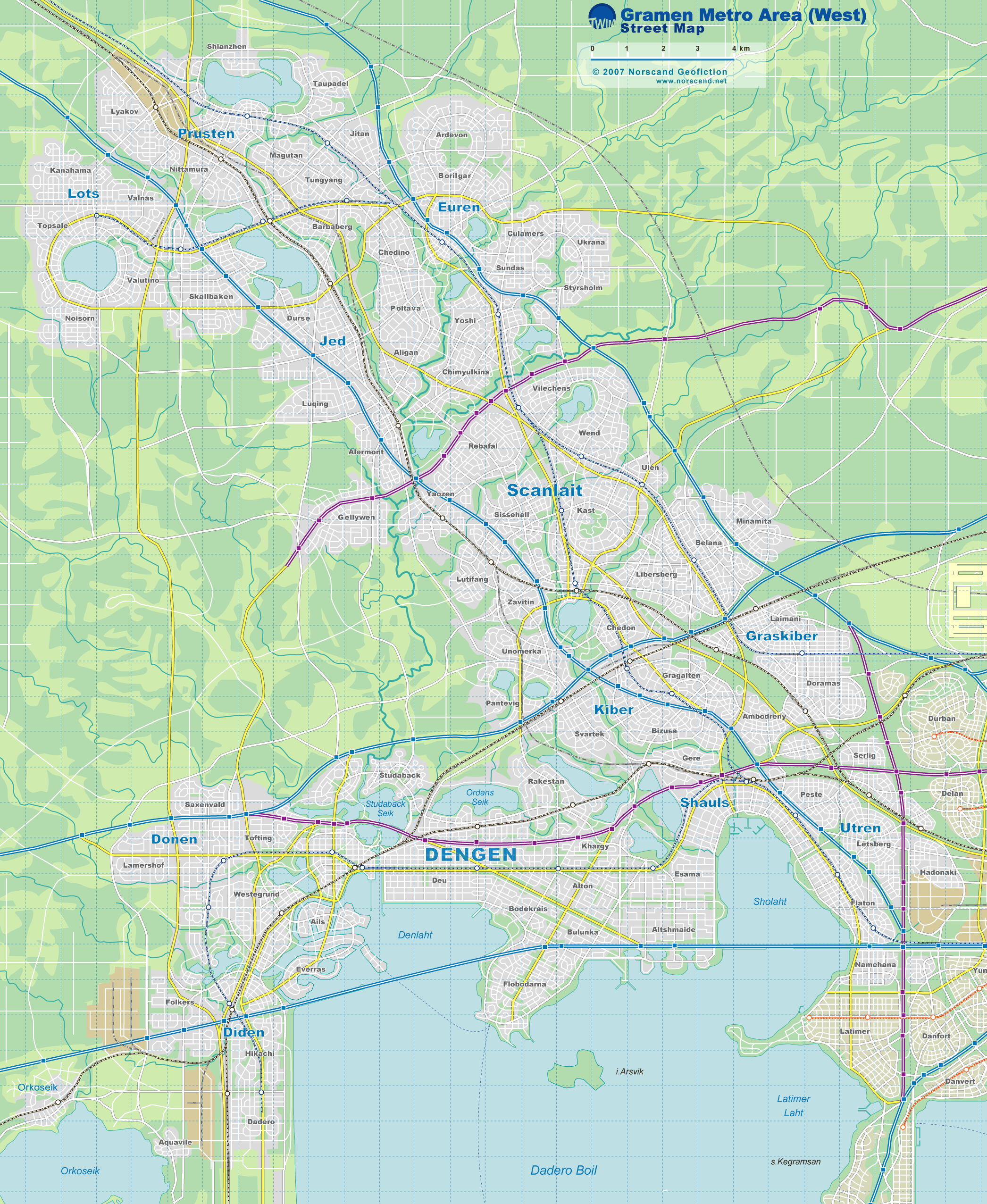
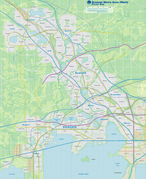
Gramen Metro Area (West) Street Map
(2092x2552 pix, 1.0 Mb) |
 |
| |
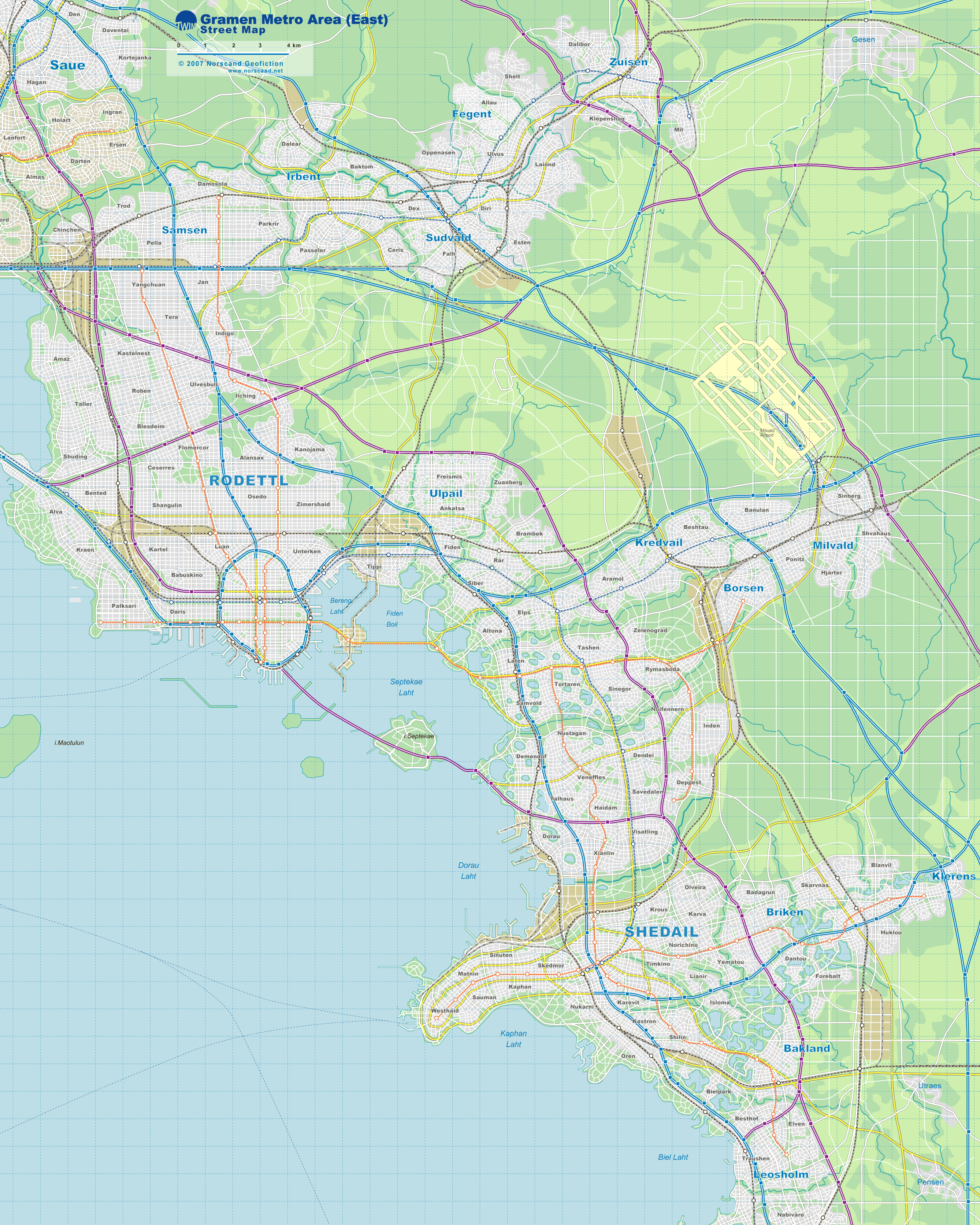
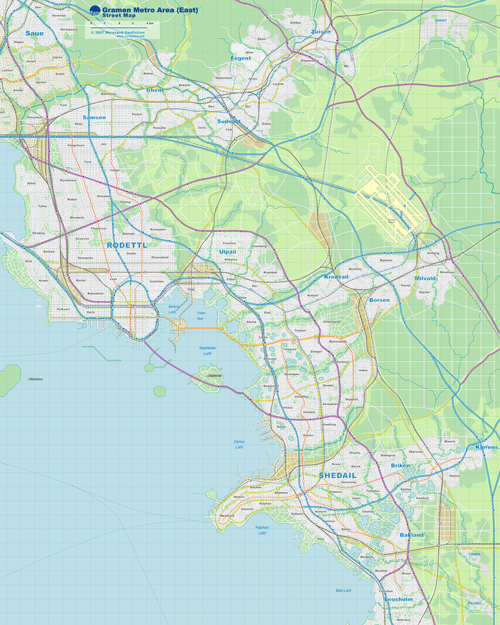
Gramen Metro Area (East) Street Map
(2676x3344 pix, 1.36 Mb) |
 |
| |
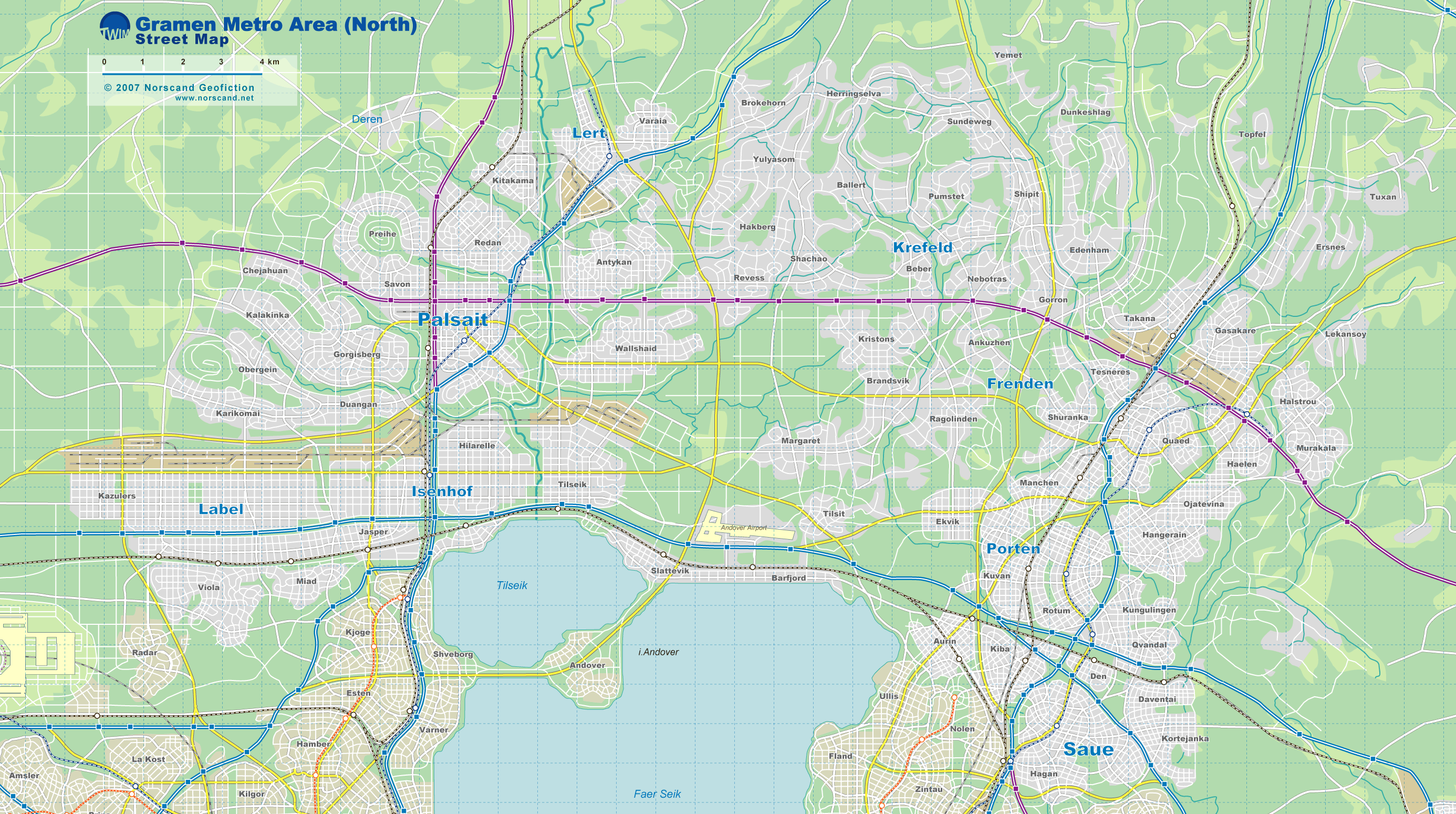
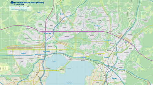
Gramen Metro Area (North) Street Map
(2772x1549 pix, 0.86 Mb) |
 |
|
|
| Flag |
Coat of Arms |
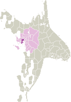
Location |
 |
 |
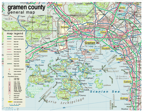
| Road maps for this area |
 |
| |
|
| Location |
Central Scansey |
| Area |
 Continental Continental |
1 869 sq.km |
| Isles |
1 039 sq.km |
| Water bodies |
91 sq.km |
| Total |
2 999 sq.km |
| Rank in Scansey |
16 of 24 |
| Rank in Norscand |
73 of 103 |
| Size comparision |
Samoa |
| Boundaries |
| Land |
135 km |
| Coastal (w/o isles) |
190 km |
| Population |
| Total |
3 499 300 |
| Rank in Scansey |
1 of 24 |
| Rank in Norscand |
1 of 103 |
| 5 Largest towns |
| Gramen |
2 531 632 |
| Dengen |
130 104 |
| Saue |
99 156 |
| Scanlait |
98 354 |
| Palsait |
91 342 |
| Administrative division |
| # of districts |
7 |
| County seat |
Gramen |
| Transportation |
| Roadways: |
|
| Total length (paved, basic network) |
1 410 km |
| Expressways |
460 km |
| Road density |
0,48 km/sq.km |
| Share of expw |
33% |
| Railways |
|
| Total length |
365 km |
| High-Speed Lines |
80 km |
| Airports |
|
| Total |
2 |
| Sched.service |
1 |
| Seaports |
|
| Total |
9 |
| |
|
|
|