| |
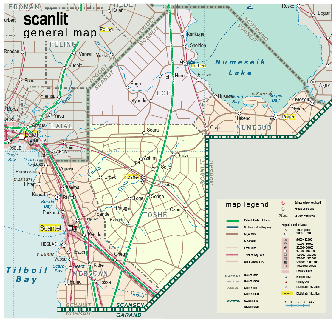
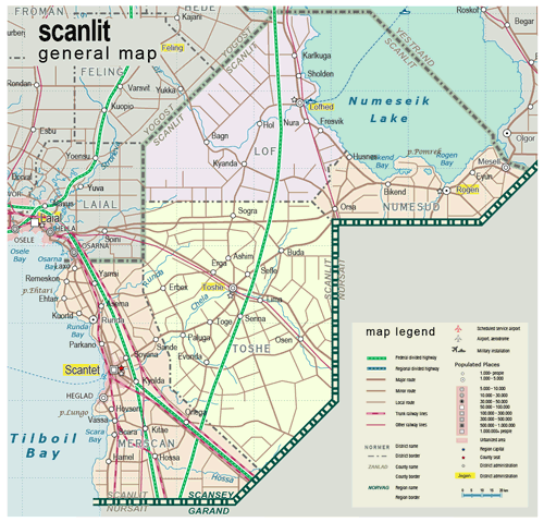
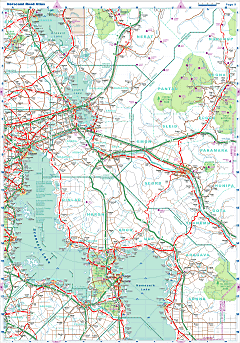
| General map (1127x1079, 181 kb) |
 |
|
|
| Flag |
Coat of Arms |
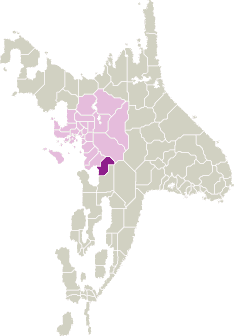
Location |
 |
 |
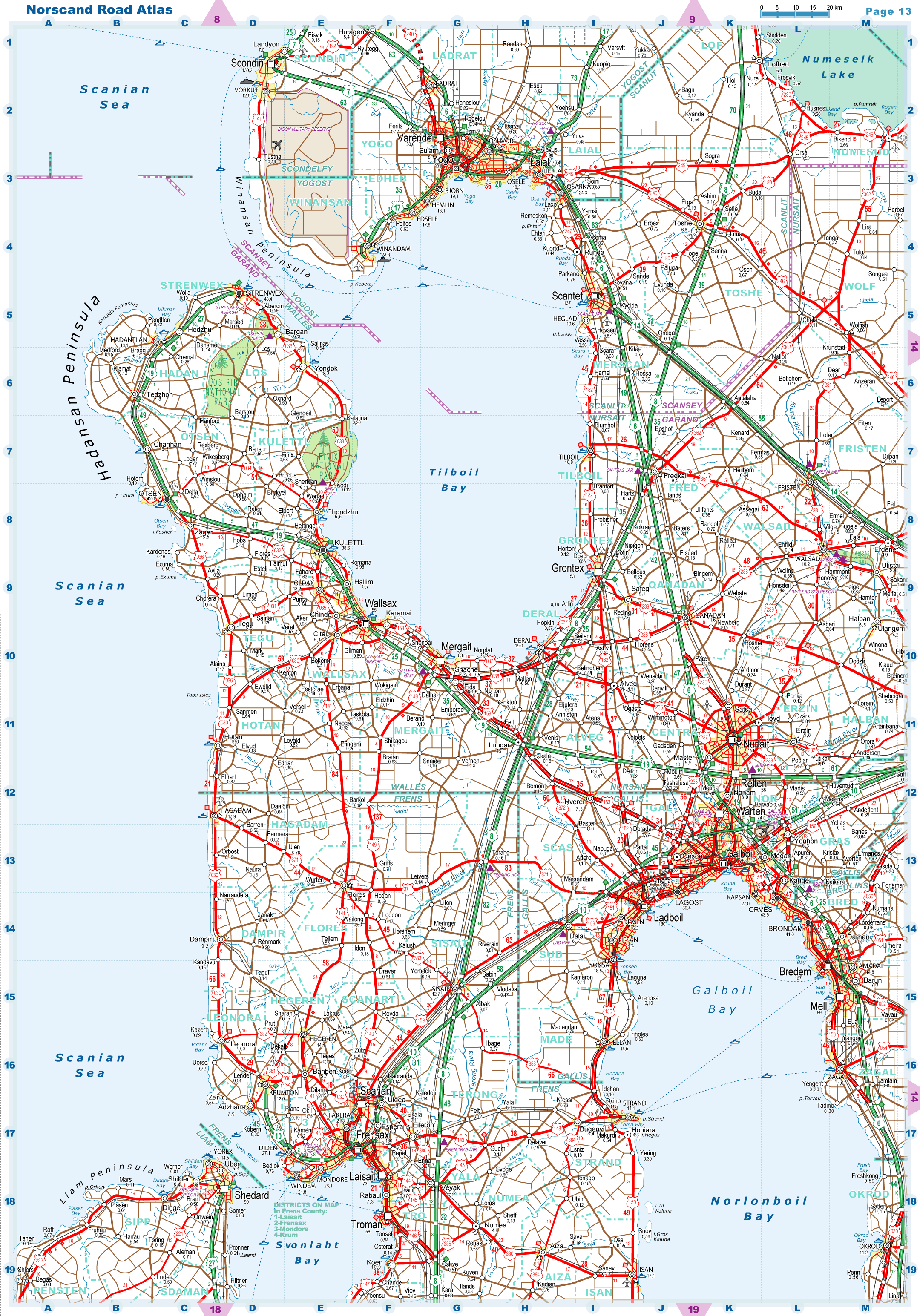
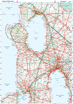
| Road maps for this area |
 |
 |
| |
|
| Location |
Southern Scansey |
| Area |
 Continental Continental |
6 724 sq.km |
| Isles |
0 sq.km |
| Water bodies |
1 323 sq.km |
| Total |
8 048 sq.km |
| Rank in Scansey |
6 of 24 |
| Rank in Norscand |
50 of 103 |
| Size comparision |
Puerto Rico |
| Boundaries |
| Land |
285 km |
| Coastal (w/o isles) |
50 km |
| Population |
| Total |
203 100 |
| Rank in Scansey |
18 of 24 |
| Rank in Norscand |
88 of 103 |
| 5 Largest towns |
| Scantet |
147 804 |
| Heglad |
10 562 |
| Toshe |
6 636 |
| Mesell |
5 368 |
| Lofhed |
5 142 |
| Administrative division |
| # of districts |
4 |
| County seat |
Scantet |
| Transportation |
| Roadways: |
|
| Total length (paved, basic network) |
2 690 km |
| Expressways |
235 km |
| Road density |
0,40 km/sq.km |
| Share of expw |
9% |
| Railways |
|
| Total length |
365 km |
| High-Speed Lines |
110 km |
| Airports |
|
| Total |
3 |
| Sched.service |
0 |
| Seaports |
|
| Total |
1 |
 |
|
|
|