| |
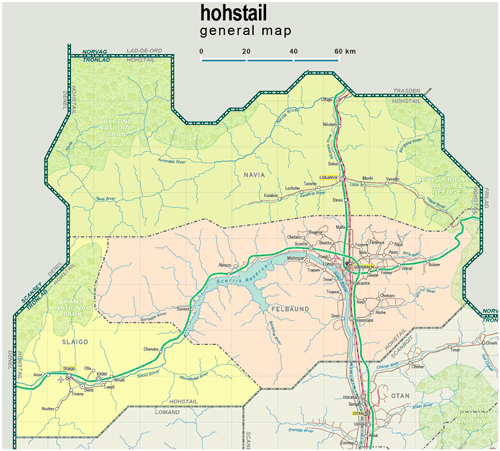
| General map (1307x1180, 0.20 mb) |
 |
|
|
| Flag |
Coat of Arms |
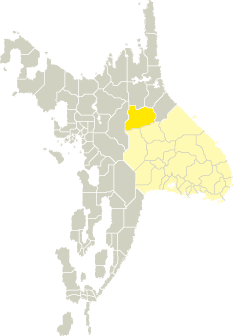
Location |
 |
 |
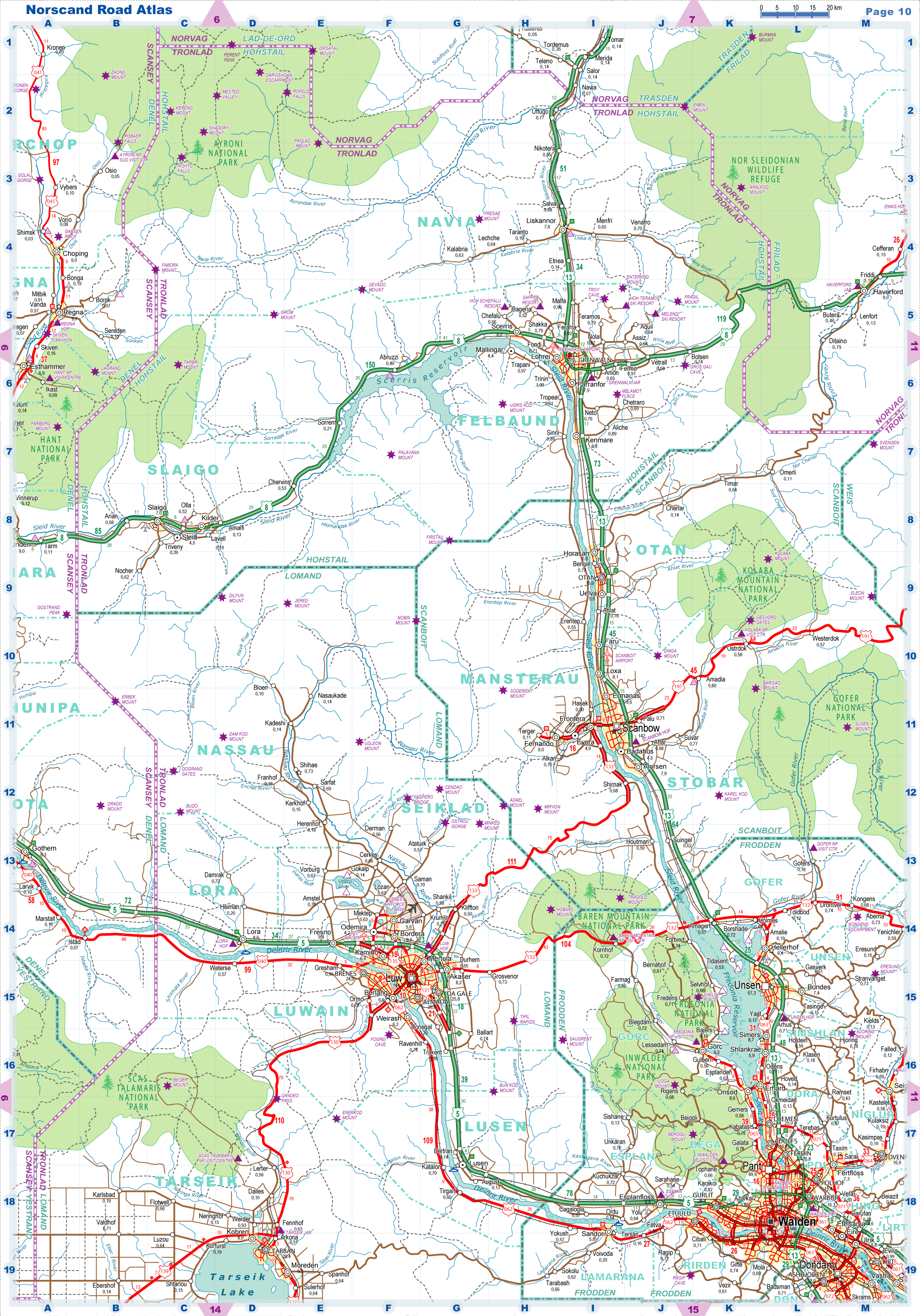
| Road maps for this area |
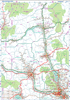 |
| |
| |
|
| Location |
Northwestern Tronlad |
| Area |
 Continental Continental |
24 123 sq.km |
| Isles |
0 sq.km |
| Water bodies |
0 sq.km |
| Total |
24 123 sq.km |
| Rank in Tronlad |
3 of 27 |
| Rank in Norscand |
6 of 103 |
| Size comparision |
New Hampshire |
| Boundaries |
| Land |
702 km |
| Coastal (w/o isles) |
0 km |
| Population |
| Total |
117 800 |
| Rank in Tronlad |
27 of 27 |
| Rank in Norscand |
102 of 103 |
| 5 Largest towns |
| Grenwaln |
29 466 |
| Lohrei |
9 126 |
| Kilder |
8 898 |
| Scerris |
7 988 |
| Farranfor |
7 930 |
| Administrative division |
| # of districts |
3 |
| County seat |
Grenwaln |
| Transportation |
| Roadways: |
|
| Total length (paved, basic network) |
1 249km |
| Expressways |
385km |
| Road density |
0,05 km/sq.km |
| Share of expw |
31% |
| Railways |
|
| Total length |
123km |
| High-Speed Lines |
0 km |
| Airports |
|
| Total |
2 |
| Sched.service |
1 |
| Seaports |
|
| Total |
0 |
| |
|
|
|