| |
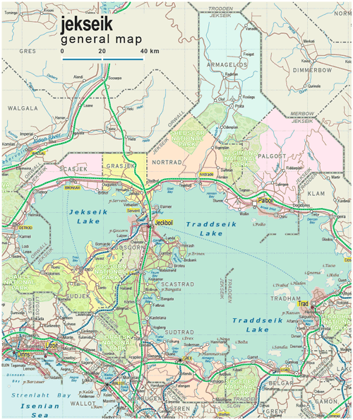
| General map (1041x1236, 0.32 mb) |
 |
|
|
| Flag |
Coat of Arms |
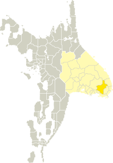
Location |
 |
 |
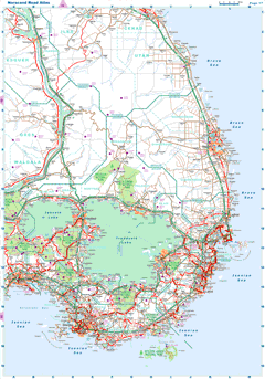
| Road maps for this area |
 |
| |
| |
|
| Location |
Southeastern Tronlad |
| Area |
 Continental Continental |
9 386 sq.km |
| Isles |
46 sq.km |
| Water bodies |
4 820 sq.km |
| Total |
14 252 sq.km |
| Rank in Tronlad |
12 of 27 |
| Rank in Norscand |
43 of 103 |
| Size comparision |
Connecticut |
| Boundaries |
| Land |
495 km |
| Coastal (w/o isles) |
0 km |
| Population |
| Total |
469 600 |
| Rank in Tronlad |
7 of 27 |
| Rank in Norscand |
38 of 103 |
| 5 Largest towns |
| Jeckboil |
150 072 |
| Palboil |
83 080 |
| Grex |
43 608 |
| Bronsax |
18 878 |
| Treo |
14 482 |
| Administrative division |
| # of districts |
9 |
| County seat |
Jeckboil |
| Transportation |
| Roadways: |
|
| Total length (paved, basic network) |
3 001km |
| Expressways |
419km |
| Road density |
0,21 km/sq.km |
| Share of expw |
14% |
| Railways |
|
| Total length |
378km |
| High-Speed Lines |
0 km |
| Airports |
|
| Total |
4 |
| Sched.service |
1 |
| Seaports |
|
| Total |
0 |
| |
|
|
|