| |
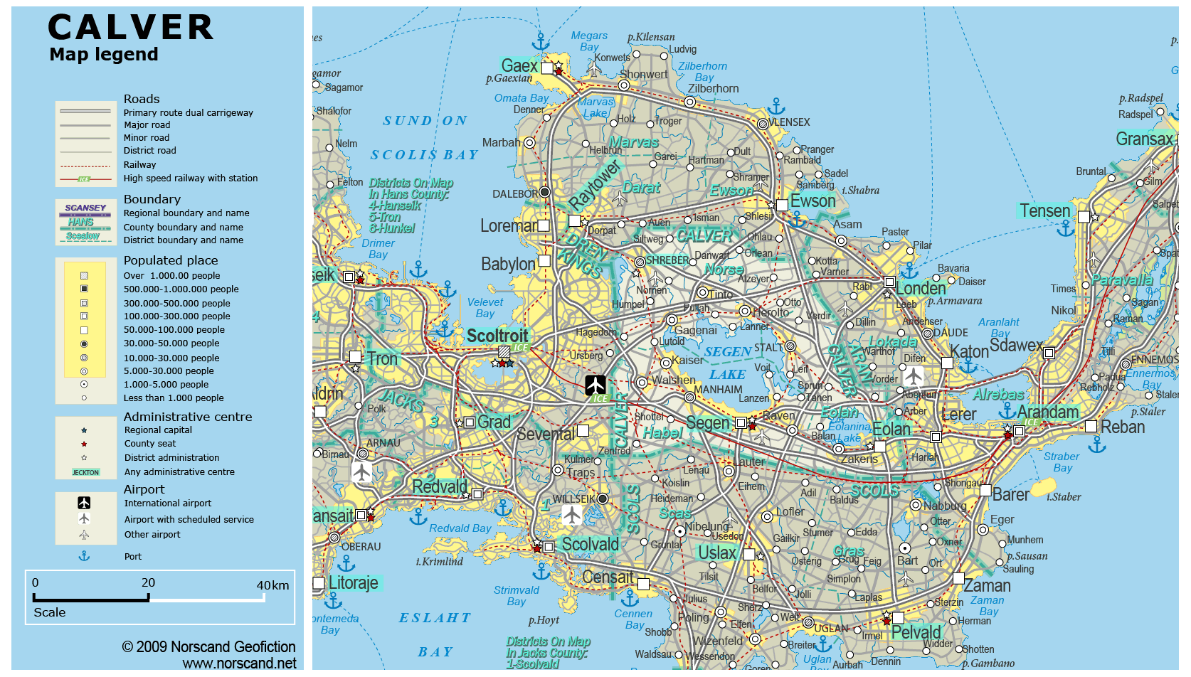
| General map (1674x952, 0.37 mb) |
 |
| |
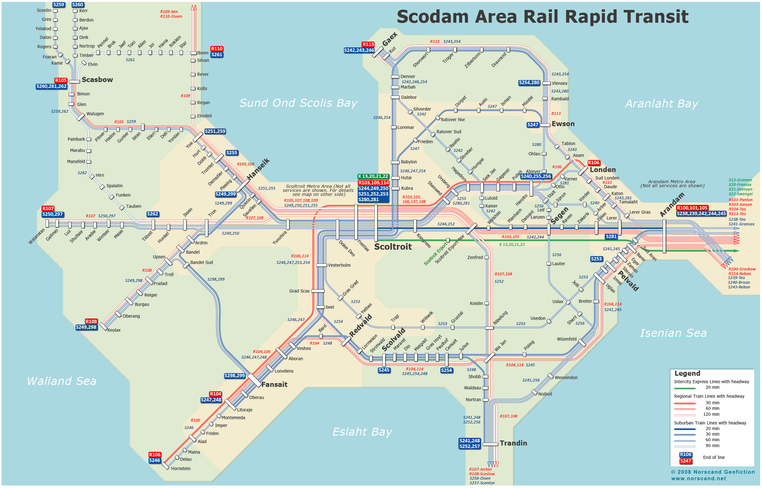
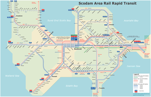
Scodam Metro Area Rail Rapid Transit Map
(2457x 1572 pix, 0.26 Mb)
|
 |
|
|
| Flag |
Coat of Arms |
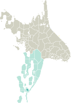
Location |
 |
 |
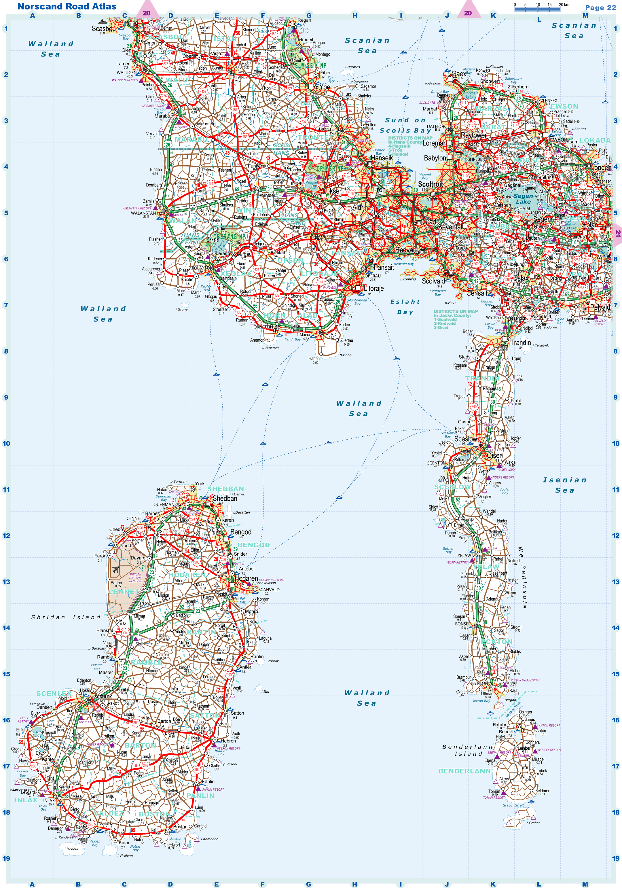
| Road maps for this area |
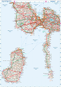 |
|
| |
|
| Location |
Southern Garand |
| Area |
 Continental Continental |
1 378 sq.km |
| Isles |
1 sq.km |
| Water bodies |
262 sq.km |
| Total |
1 641 sq.km |
| Rank in Garand |
30 of 35 |
| Rank in Norscand |
94 of 103 |
| Size comparision |
Slovenia |
| Boundaries |
| Land |
175 km |
| Coastal (w/o isles) |
0 km |
| Population |
| Total |
370 569 |
| Rank in Garand |
30 of 35 |
| Rank in Norscand |
50 of 103 |
| 5 Largest towns |
| Segen |
166 626 |
| Eolan |
69 842 |
| Manhaim |
29 604 |
| Shreber |
19 894 |
| Stalt |
17 620 |
| Administrative division |
| # of districts |
3 |
| County seat |
Segen |
| Transportation |
| Roadways: |
|
| Total length (paved, basic network) |
1 127km |
| Expressways |
322km |
| Road density |
0,69 km/sq.km |
| Share of expw |
29% |
| Railways |
|
| Total length |
259km |
| High-Speed Lines |
36 km |
| Airports |
|
| Total |
2 |
| Sched.service |
0 |
| Seaports |
|
| Total |
0 |
| |
|
|
|