| |
|
|
| Flag |
Coat of Arms |
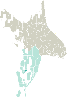
Location |
 |
 |
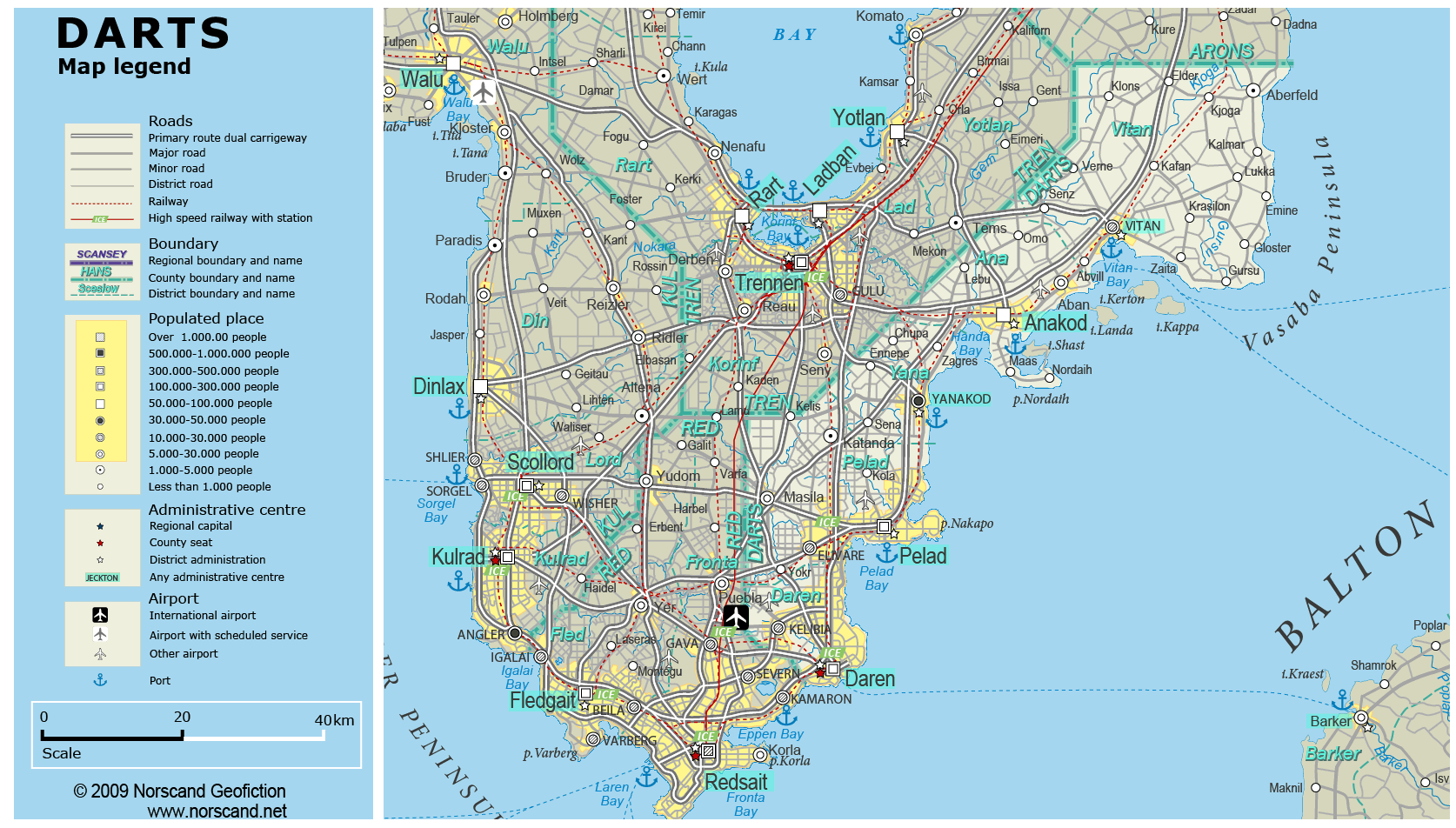
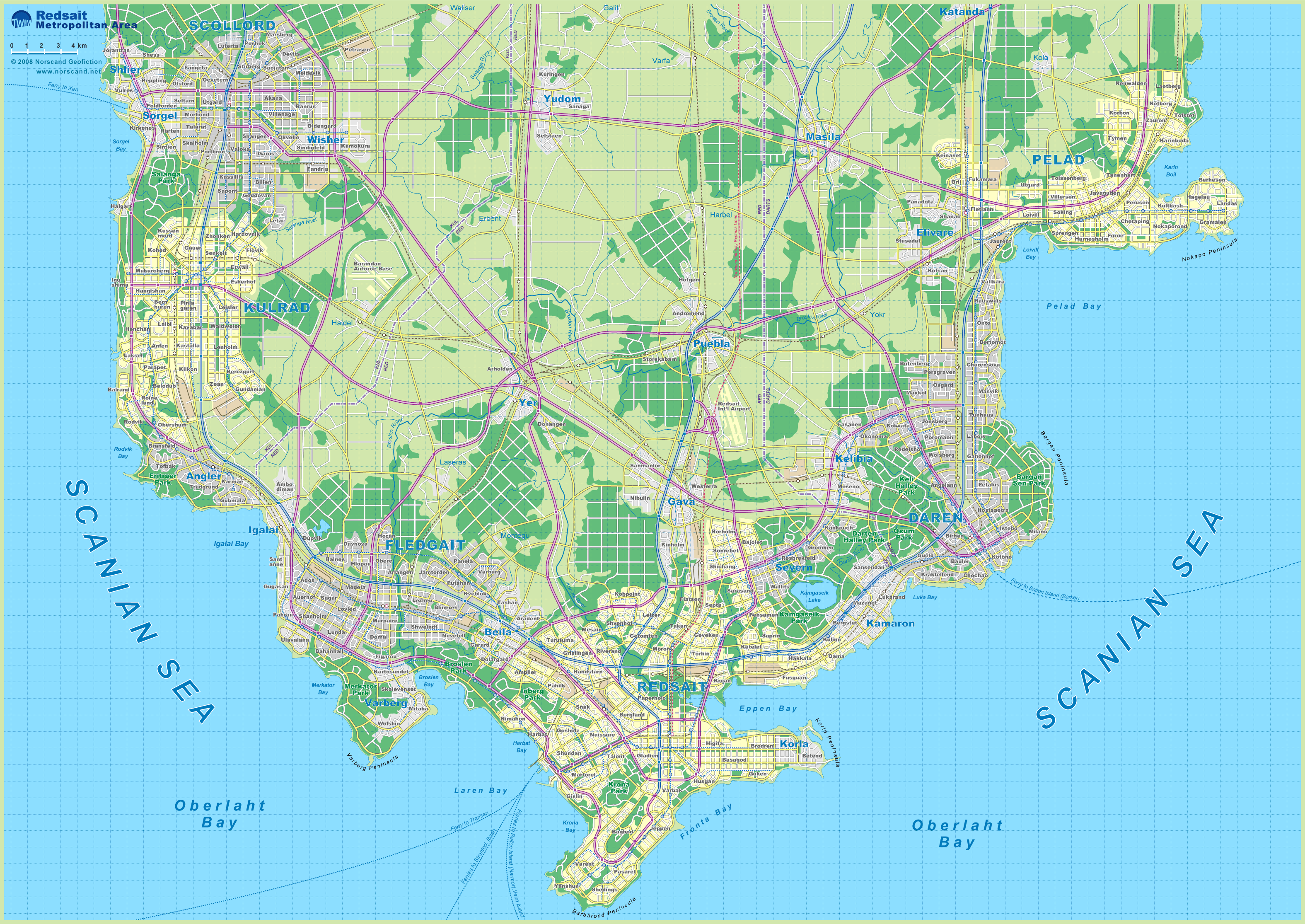
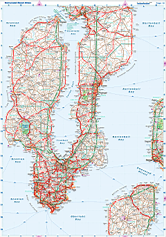
| Road maps for this area |
 |
|
| |
|
| Location |
Southwestern Garand |
| Area |
 Continental Continental |
2 186 sq.km |
| Isles |
27 sq.km |
| Water bodies |
0 sq.km |
| Total |
2 213 sq.km |
| Rank in Garand |
27 of 35 |
| Rank in Norscand |
69 of 103 |
| Size comparision |
X |
| Boundaries |
| Land |
1 149 km |
| Coastal (w/o isles) |
253 km |
| Population |
| Total |
534 765 |
| Rank in Garand |
21 of 35 |
| Rank in Norscand |
33 of 103 |
| 5 Largest towns |
| Daren |
179 132 |
| Pelad |
177 554 |
| Anakod |
54 734 |
| Yanakod |
35 048 |
| Elivare |
18 358 |
| Administrative division |
| # of districts |
5 |
| County seat |
Daren |
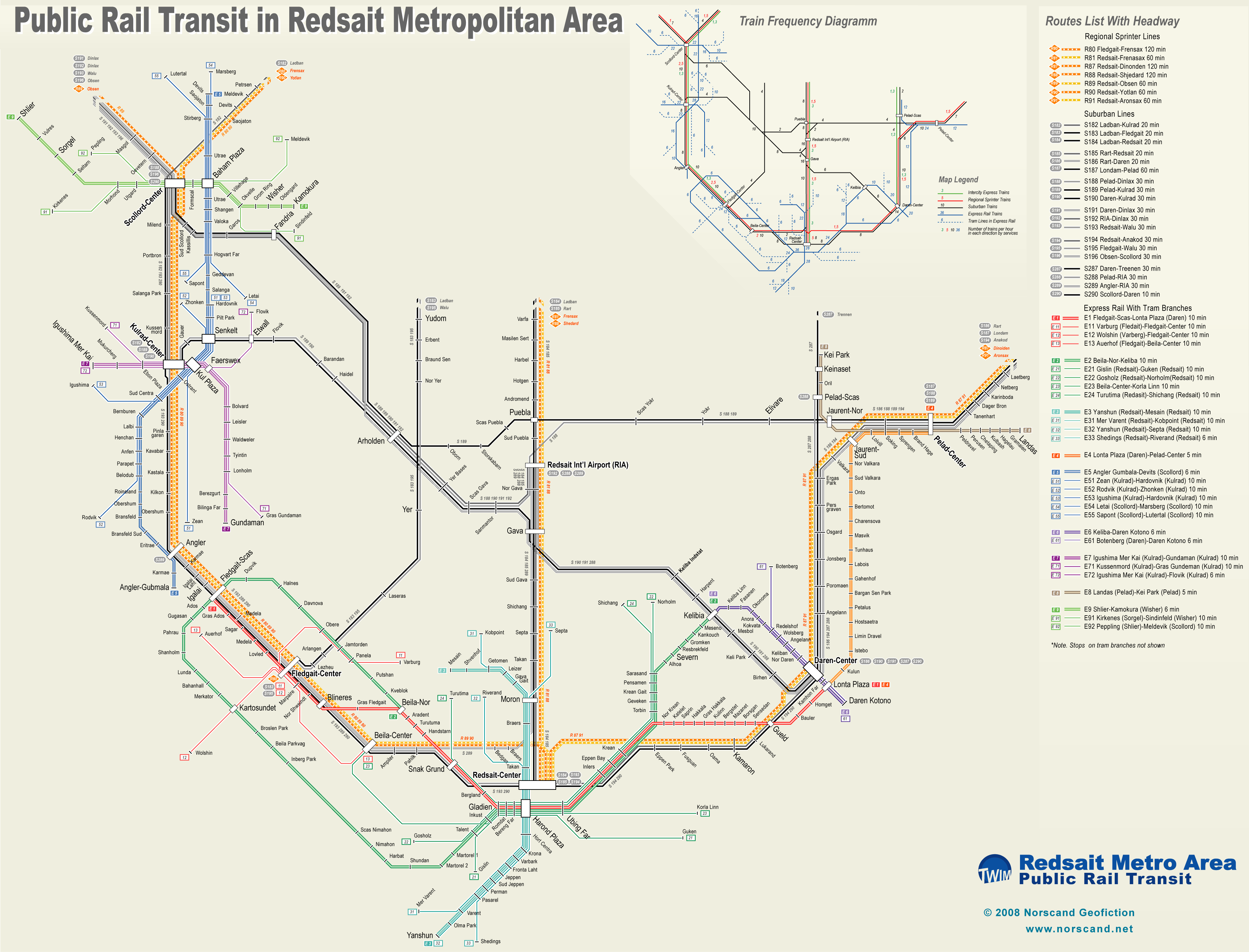
| Transportation |
| Roadways: |
|
| Total length (paved, basic network) |
2 237km |
| Expressways |
322km |
| Road density |
1,01 km/sq.km |
| Share of expw |
14% |
| Railways |
|
| Total length |
197km |
| High-Speed Lines |
0 km |
| Airports |
|
| Total |
3 |
| Sched.service |
0 |
| Seaports |
|
| Total |
5 |
 |
|
|
|