| |
|
|
| Flag |
Coat of Arms |
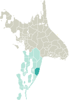
Location |
 |
 |
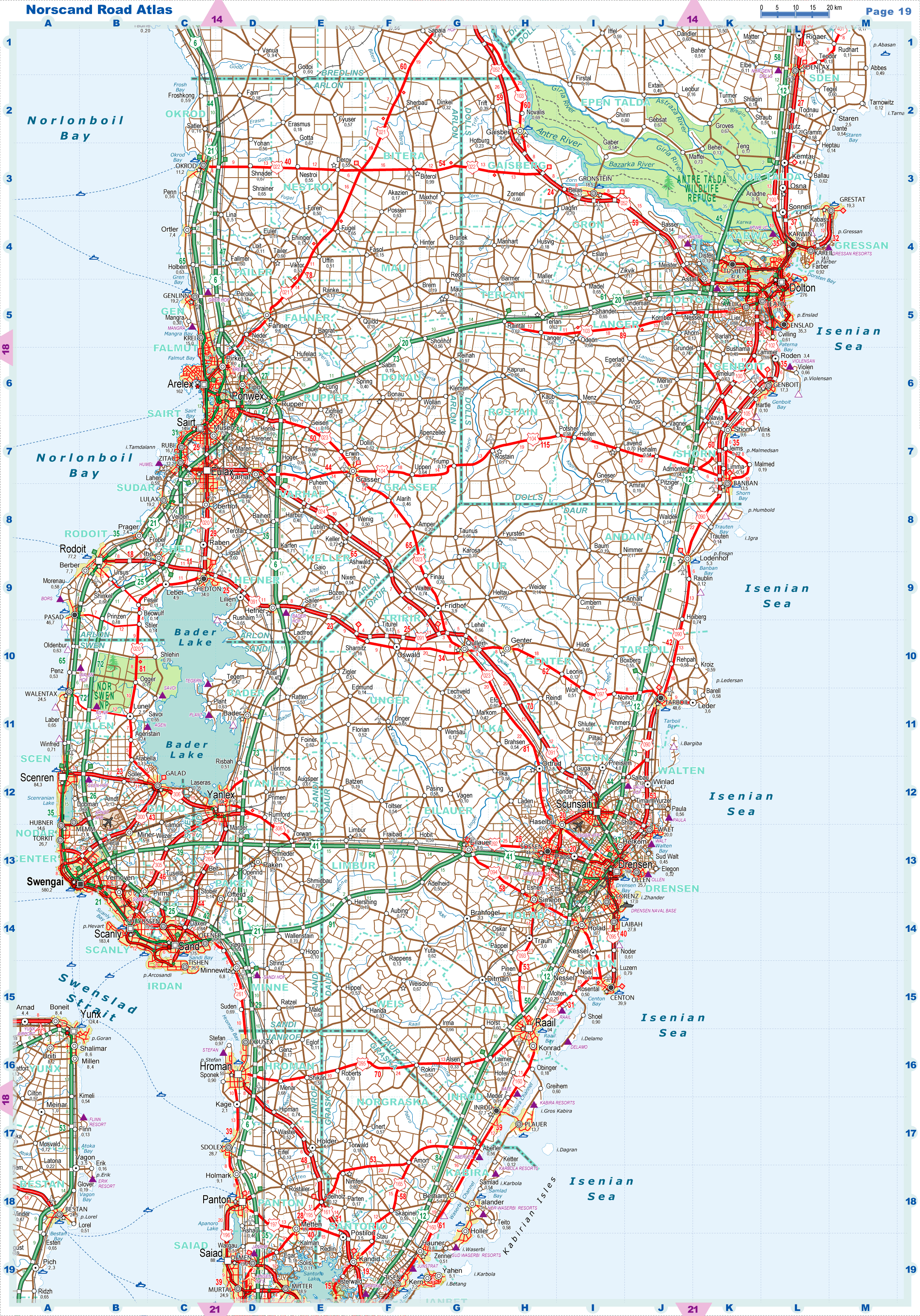
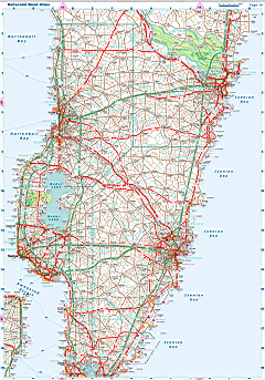
| Road maps for this area |
 |
|
| |
|
| Location |
Central Garand |
| Area |
 Continental Continental |
15 711 sq.km |
| Isles |
135 sq.km |
| Water bodies |
23 sq.km |
| Total |
15 869 sq.km |
| Rank in Garand |
3 of 35 |
| Rank in Norscand |
22 of 103 |
| Size comparision |
New Hampshire |
| Boundaries |
| Land |
314 km |
| Coastal (w/o isles) |
360 km |
| Population |
| Total |
749 248 |
| Rank in Garand |
14 of 35 |
| Rank in Norscand |
22 of 103 |
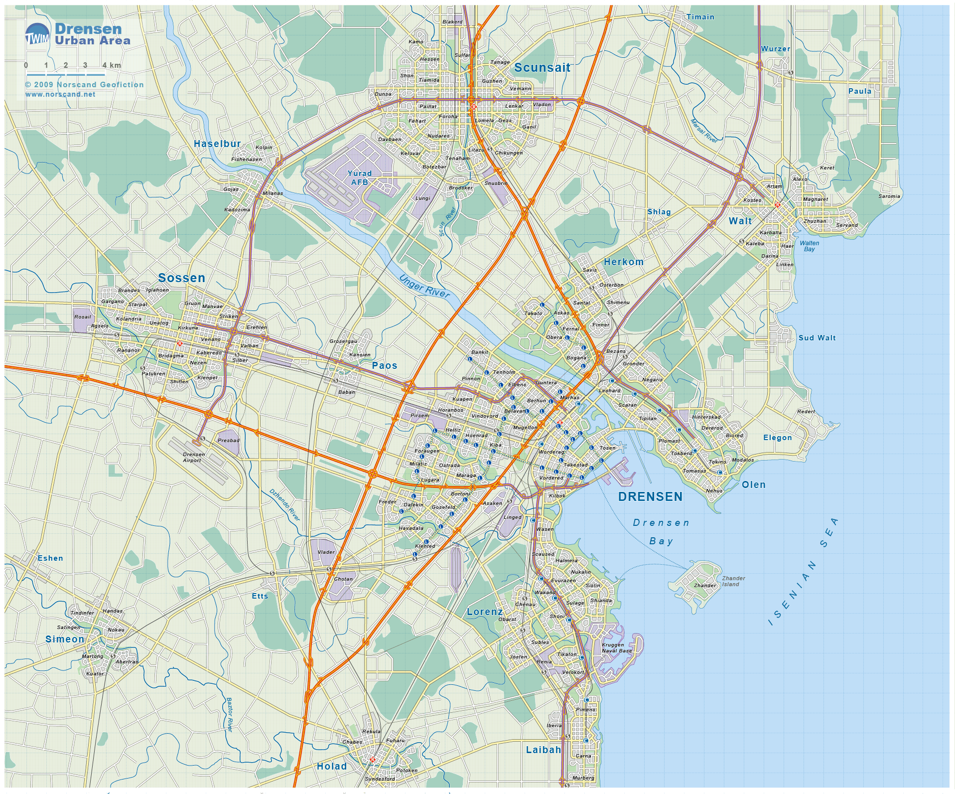
| 5 Largest towns |
| Drensen |
168 156 |
| Raail |
94 252 |
| Scunsait |
62 404 |
| Tarboil |
48 556 |
| Sossen |
44 936 |
| Administrative division |
| # of districts |
18 |
| County seat |
Drensen |
| Transportation |
| Roadways: |
|
| Total length (paved, basic network) |
10 242km |
| Expressways |
658km |
| Road density |
0,65 km/sq.km |
| Share of expw |
6% |
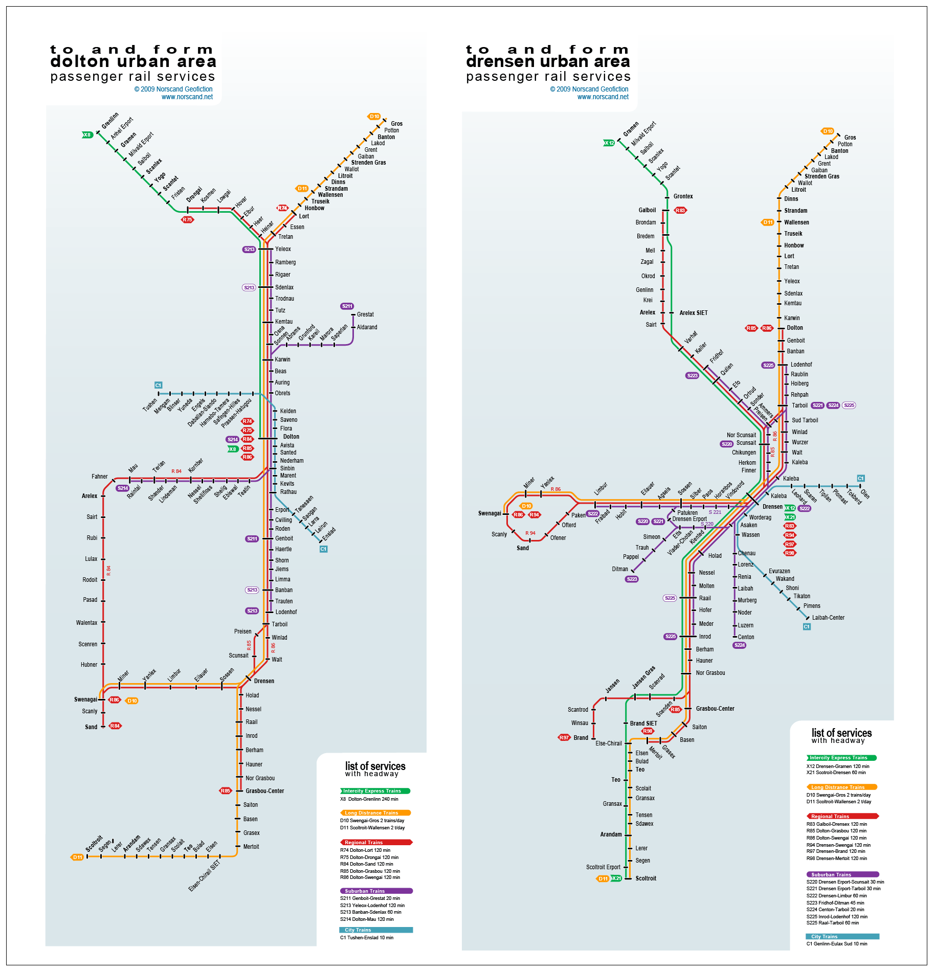
| Railways |
|
| Total length |
686km |
| High-Speed Lines |
0 km |
| Airports |
|
| Total |
10 |
| Sched.service |
1 |
| Seaports |
|
| Total |
9 |
 |
|
|
|