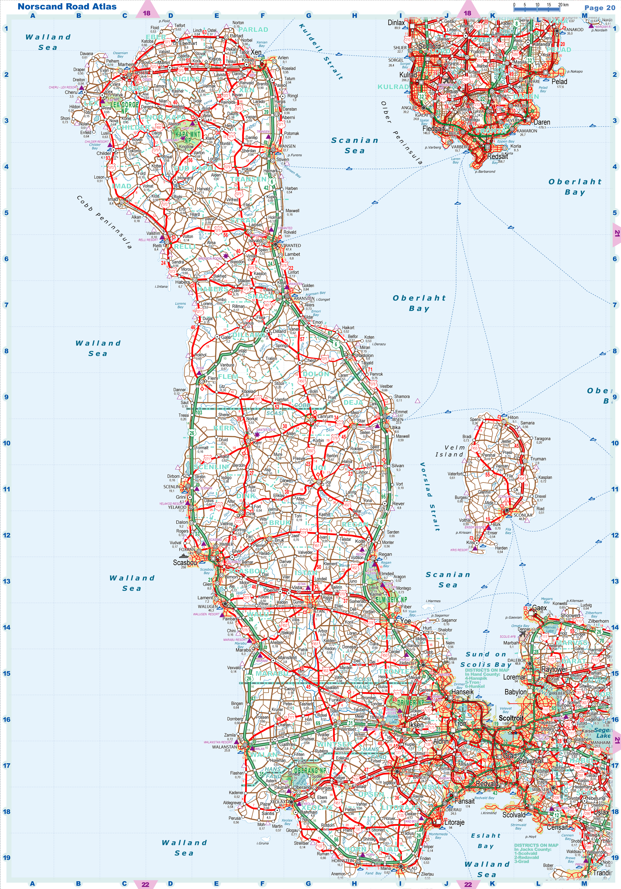
| |
|
|
| Flag |
Coat of Arms |
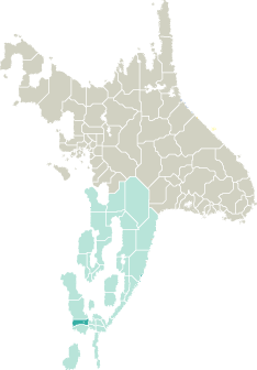
Location |
 |
 |
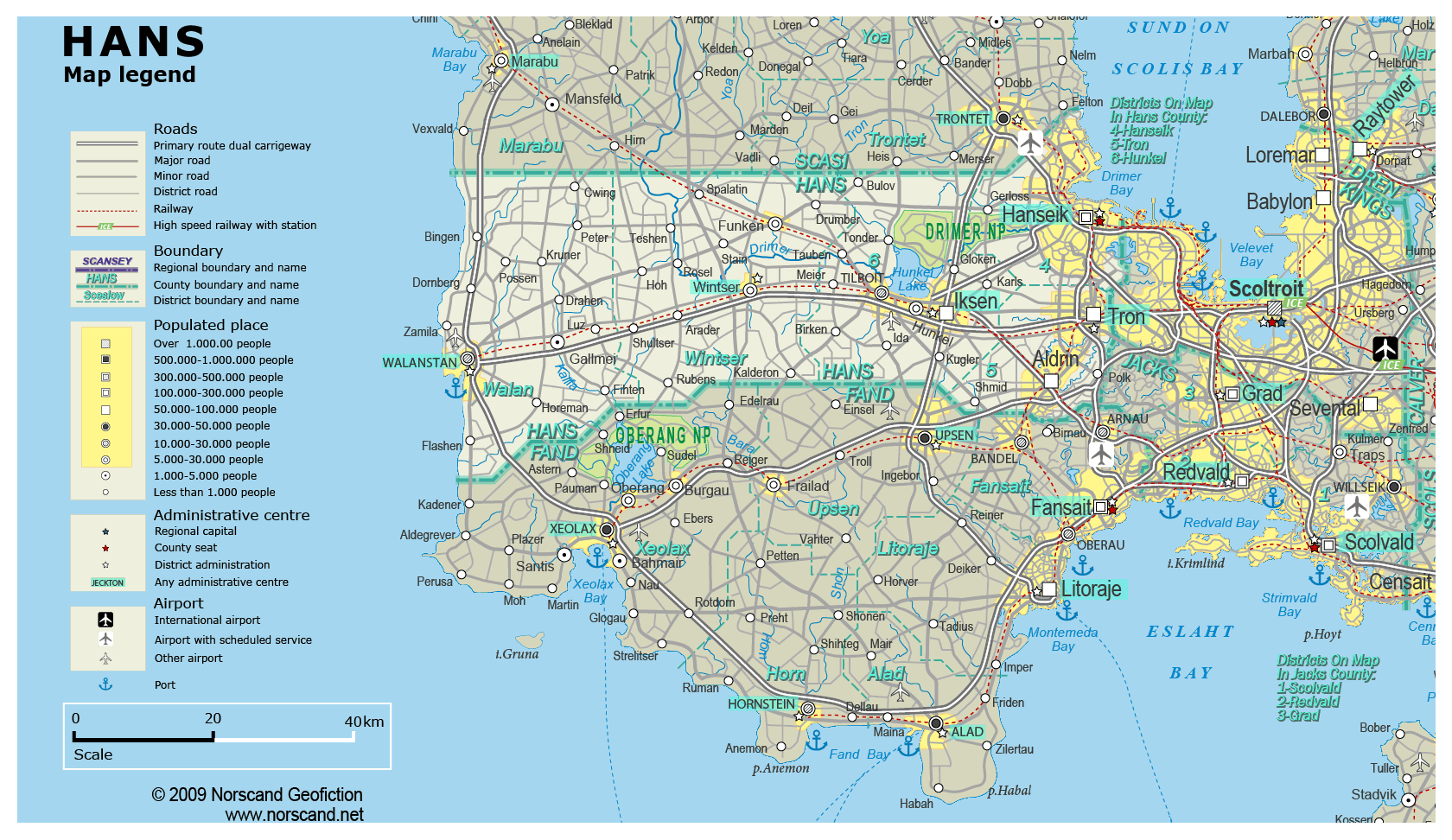
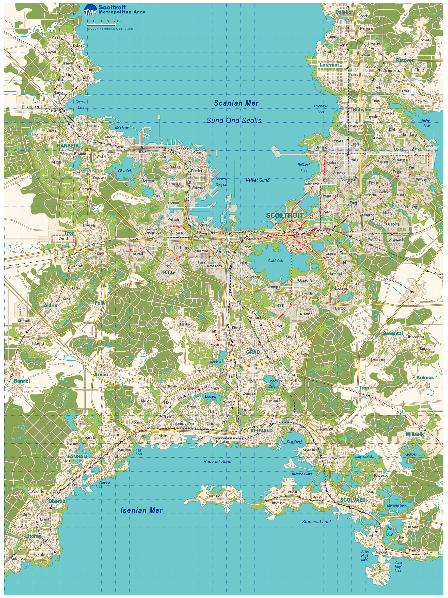
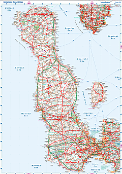
| Road maps for this area |
 |
|
| |
|
| Location |
Southern Garand |
| Area |
 Continental Continental |
2 789 sq.km |
| Isles |
1 sq.km |
| Water bodies |
35 sq.km |
| Total |
2 825 sq.km |
| Rank in Garand |
25 of 35 |
| Rank in Norscand |
72 of 103 |
| Size comparision |
X |
| Boundaries |
| Land |
224 km |
| Coastal (w/o isles) |
99 km |
| Population |
| Total |
552 384 |
| Rank in Garand |
20 of 35 |
| Rank in Norscand |
32 of 103 |
| 5 Largest towns |
| Hanseik |
288 256 |
| Tron |
69 192 |
| Aldrin |
56 626 |
| Iksen |
51 650 |
| Walanstan |
25 828 |
| Administrative division |
| # of districts |
5 |
| County seat |
Hanseik |
| Transportation |
| Roadways: |
|
| Total length (paved, basic network) |
2 452km |
| Expressways |
285km |
| Road density |
0,87 km/sq.km |
| Share of expw |
12% |
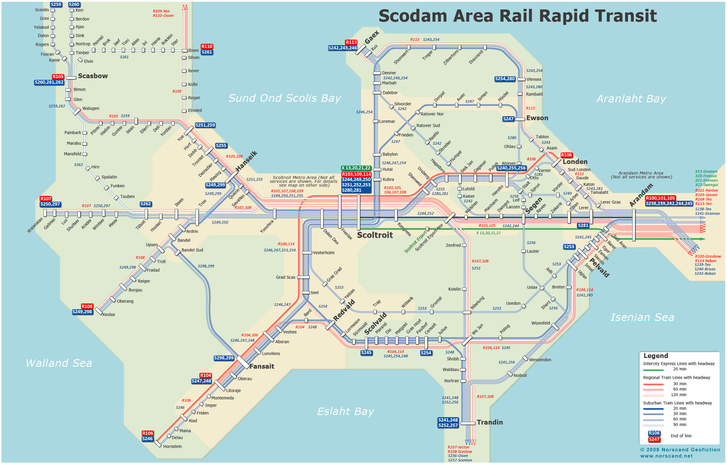
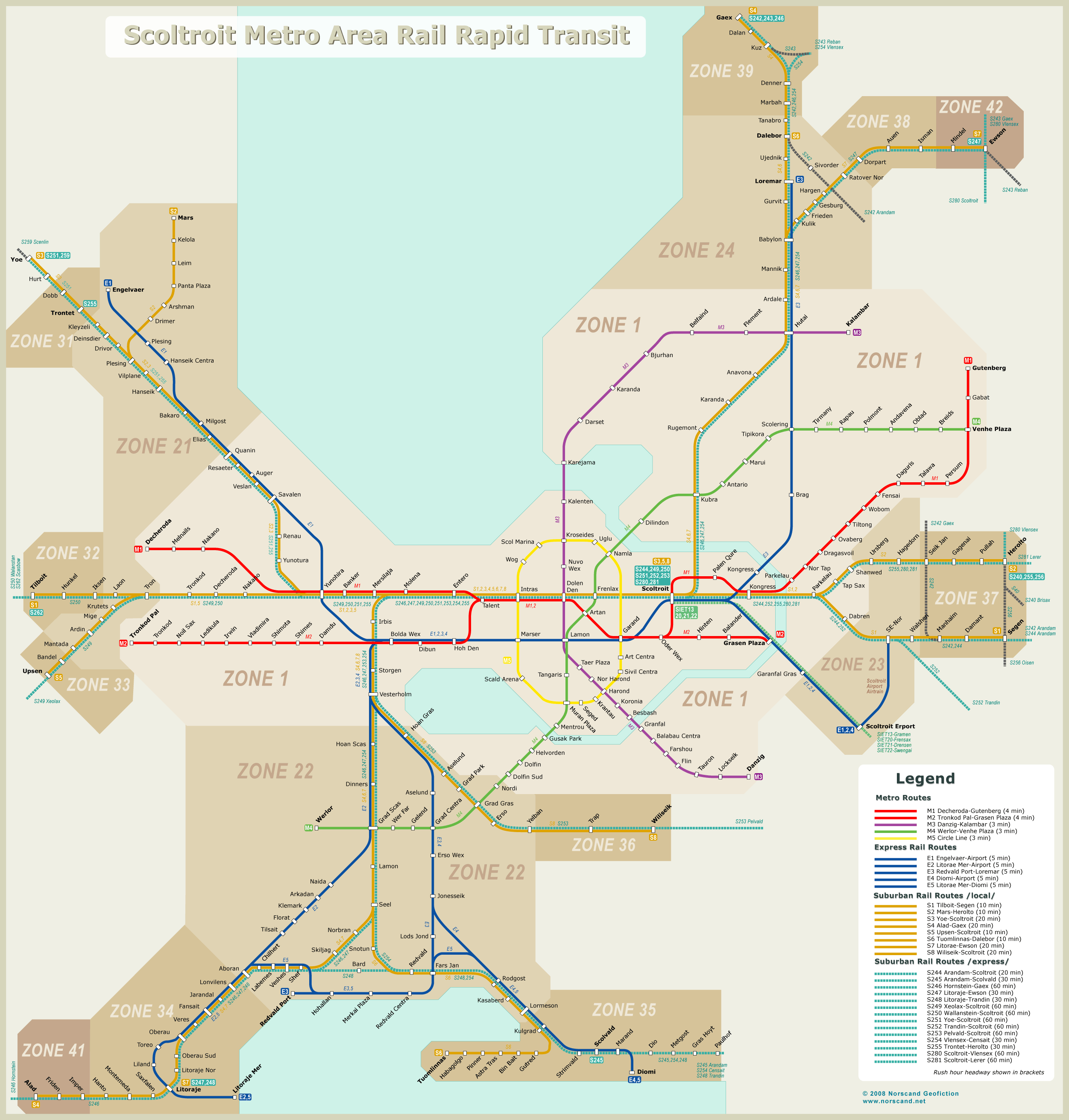
| Railways |
|
| Total length |
219km |
| High-Speed Lines |
0 km |
| Airports |
|
| Total |
3 |
| Sched.service |
1 |
| Seaports |
|
| Total |
2 |
| |
|
|
|