| |
|
|
| Flag |
Coat of Arms |
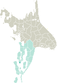
Location |
 |
 |
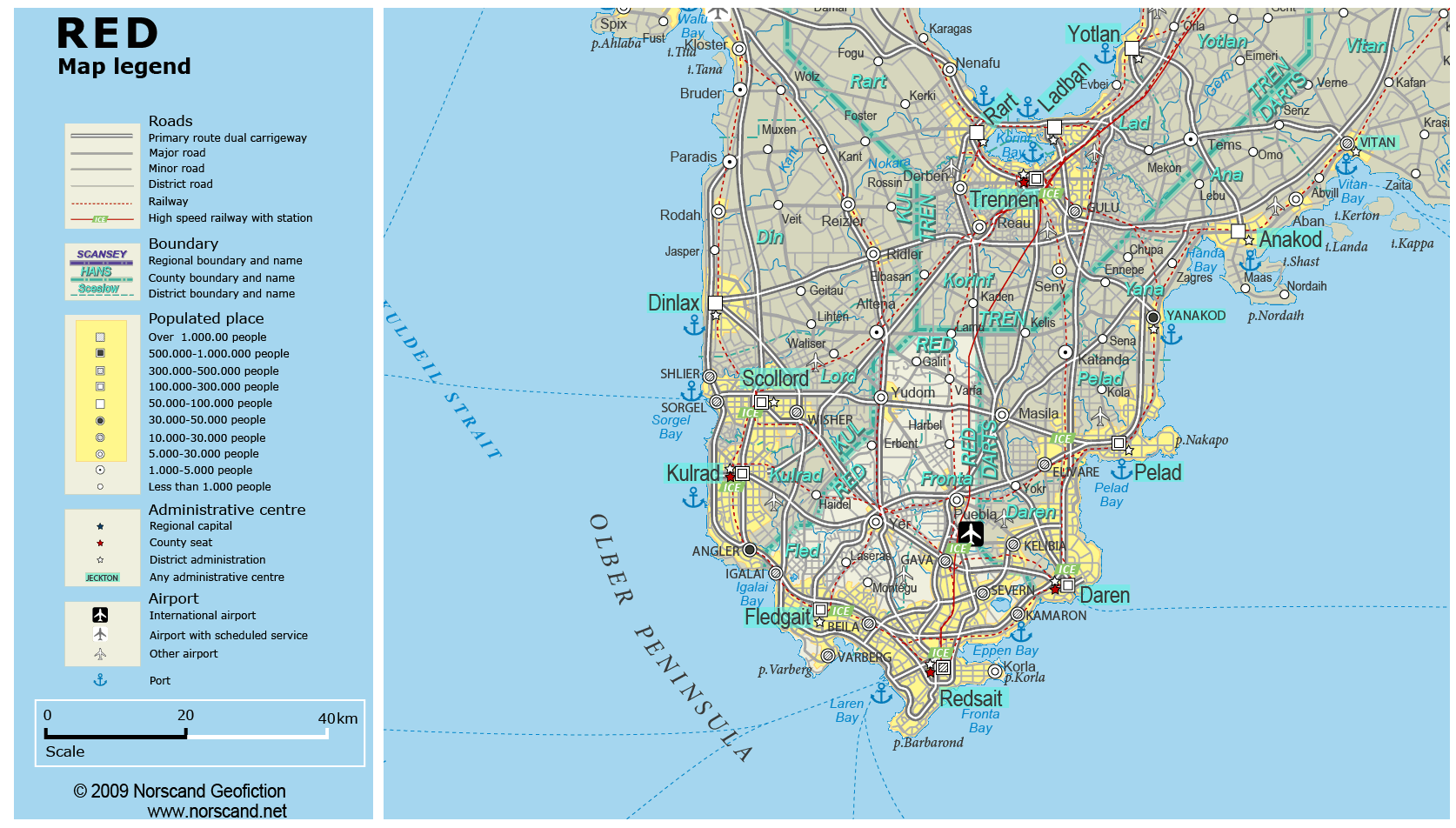
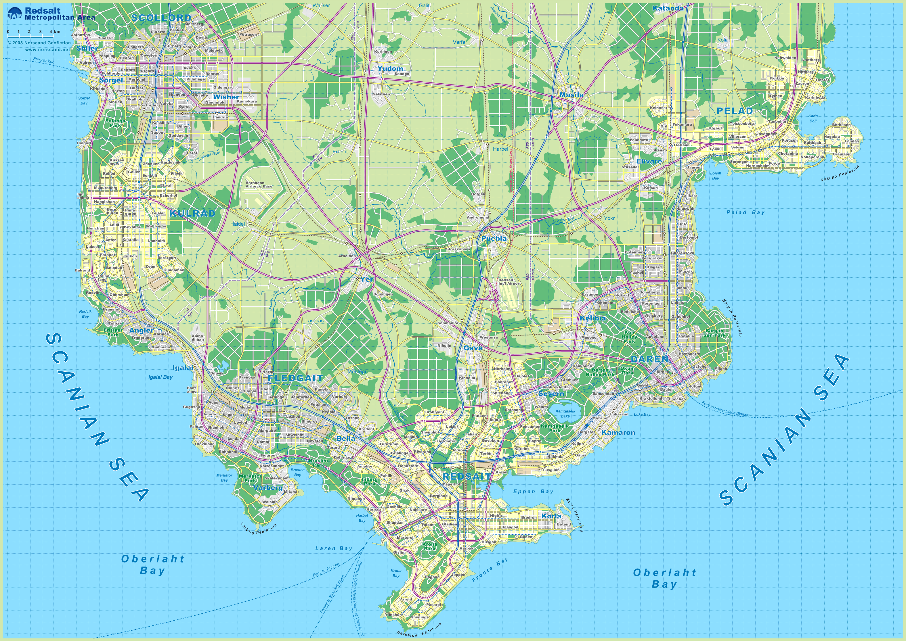
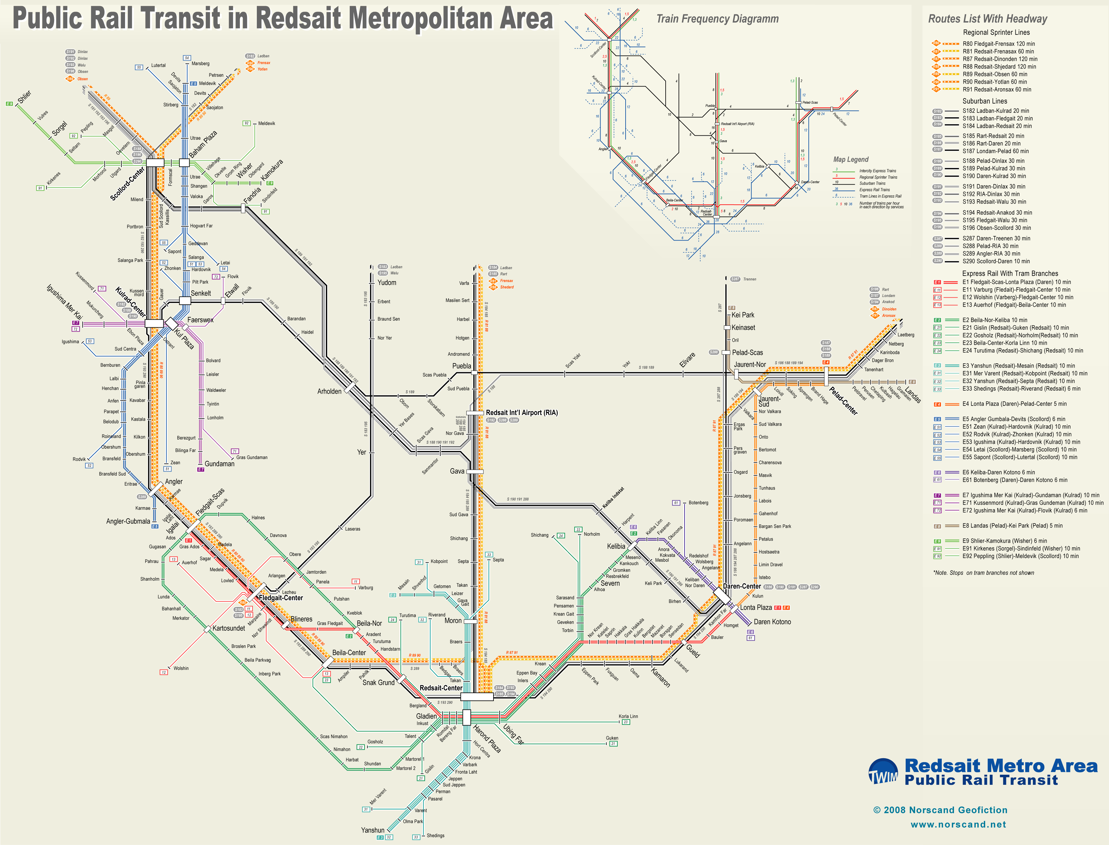
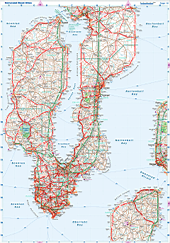
| Road maps for this area |
 |
|
| |
|
| Location |
Southwestern Garand |
| Area |
 Continental Continental |
1 223 sq.km |
| Isles |
0 sq.km |
| Water bodies |
5 sq.km |
| Total |
1 228 sq.km |
| Rank in Garand |
33 of 35 |
| Rank in Norscand |
96 of 103 |
| Size comparision |
X |
| Boundaries |
| Land |
100 km |
| Coastal (w/o isles) |
126 km |
| Population |
| Total |
687 921 |
| Rank in Garand |
16 of 35 |
| Rank in Norscand |
21 of 103 |
| 5 Largest towns |
| Redsait |
358 688 |
| Fledgait |
146 004 |
| Kamaron |
26 684 |
| Severn |
26 664 |
| Beila |
26 042 |
| Administrative division |
| # of districts |
2 |
| County seat |
Redsait |
| Transportation |
| Roadways: |
|
| Total length (paved, basic network) |
1 859km |
| Expressways |
346km |
| Road density |
1,51 km/sq.km |
| Share of expw |
19% |
| Railways |
|
| Total length |
244km |
| High-Speed Lines |
50 km |
| Airports |
|
| Total |
2 |
| Sched.service |
1 |
| Seaports |
|
| Total |
2 |
 |
|
|
|