| |
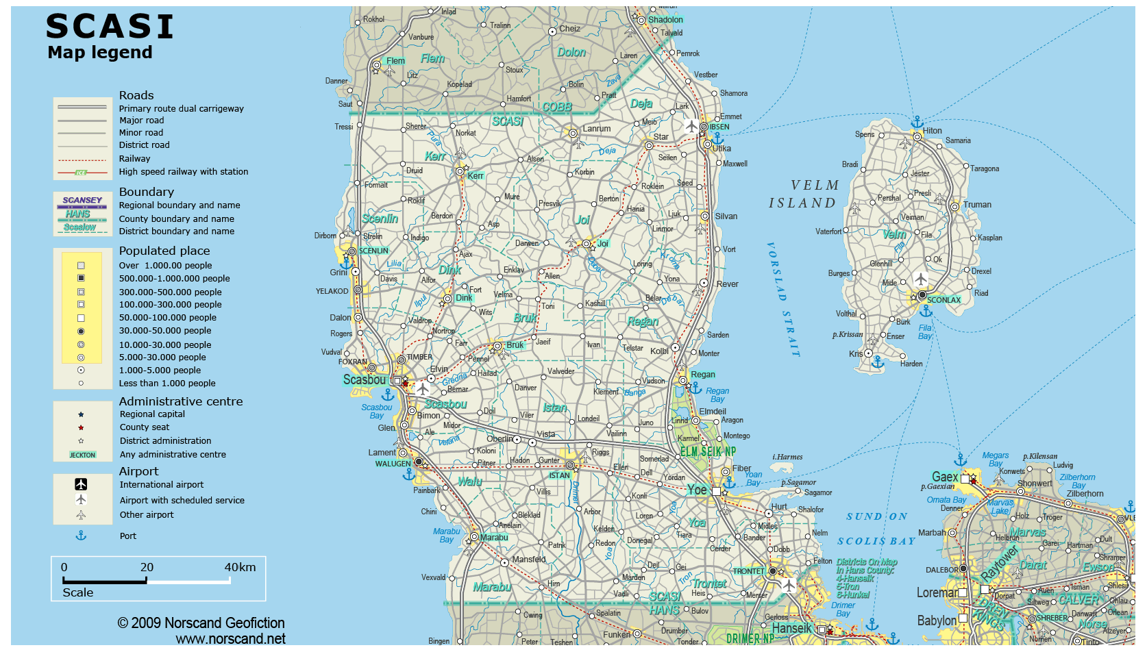
| General map (1674x952, 0.30 mb) |
 |
| |
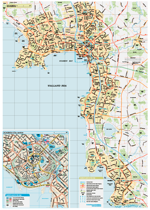
Scasbou Urban Area Map
(2655x 3751 pix, 1.4 Mb)
|
 |
|
|
| Flag |
Coat of Arms |
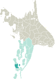
Location |
 |
 |
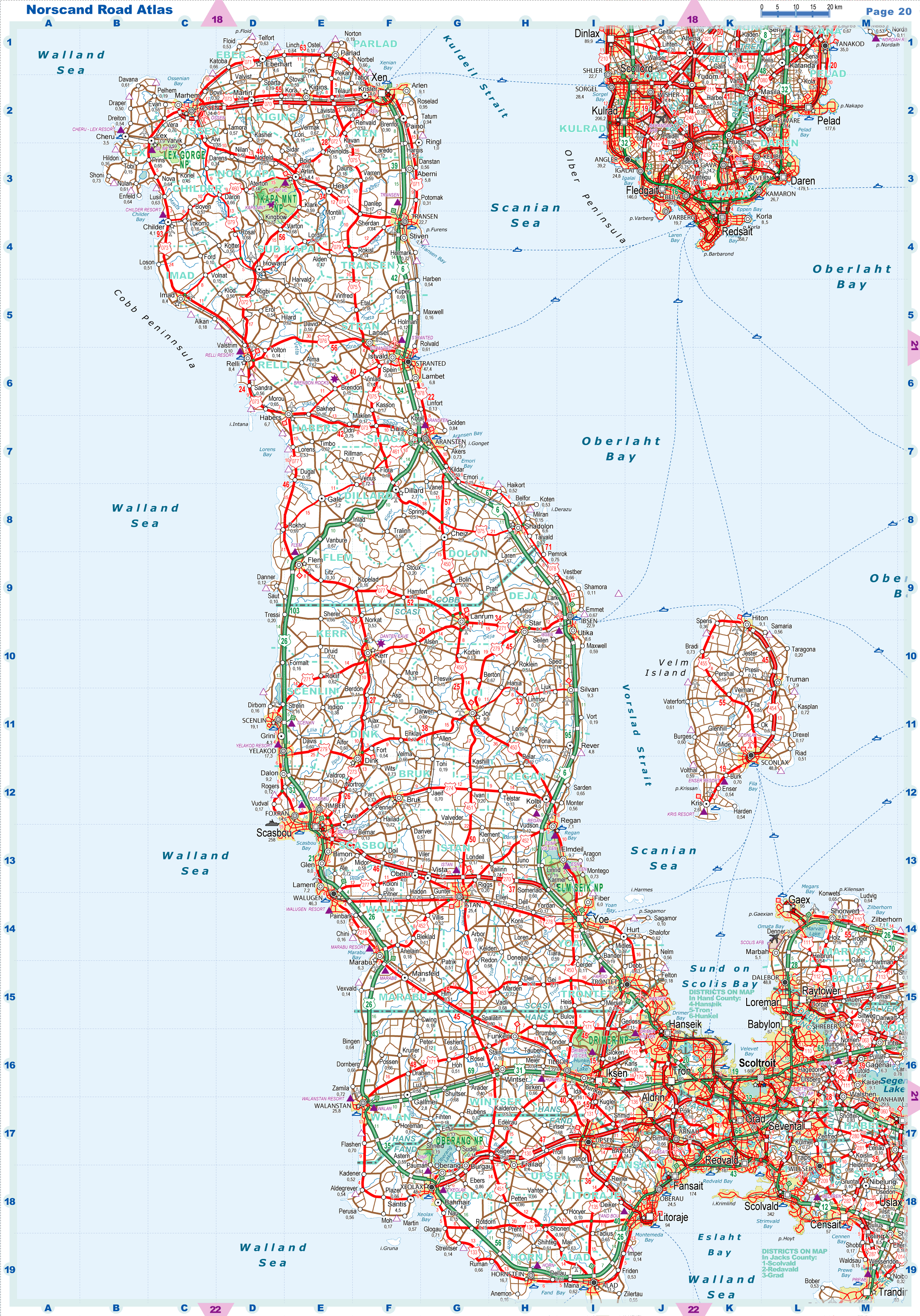
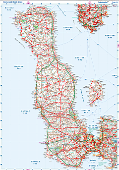
| Road maps for this area |
 |
|
| |
|
| Location |
Southwestern Garand |
| Area |
 Continental Continental |
12 039 sq.km |
| Isles |
11 sq.km |
| Water bodies |
22 sq.km |
| Total |
12 072 sq.km |
| Rank in Garand |
7 of 35 |
| Rank in Norscand |
34 of 103 |
| Size comparision |
X |
| Boundaries |
| Land |
180 km |
| Coastal (w/o isles) |
398 km |
| Population |
| Total |
840 192 |
| Rank in Garand |
6 of 35 |
| Rank in Norscand |
14 of 103 |
| 5 Largest towns |
| Scasbou |
258 292 |
| Yoe |
88 512 |
| Sconlax |
48 822 |
| Walugen |
46 324 |
| Trontet |
45 634 |
| Administrative division |
| # of districts |
14 |
| County seat |
Scasbou |
| Transportation |
| Roadways: |
|
| Total length (paved, basic network) |
7 405km |
| Expressways |
406km |
| Road density |
0,61 km/sq.km |
| Share of expw |
5% |
| Railways |
|
| Total length |
503km |
| High-Speed Lines |
0 km |
| Airports |
|
| Total |
19 |
| Sched.service |
3 |
| Seaports |
|
| Total |
9 |
| |
|
|
|