| |
|
|
| Flag |
Coat of Arms |
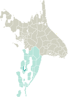
Location |
 |
 |
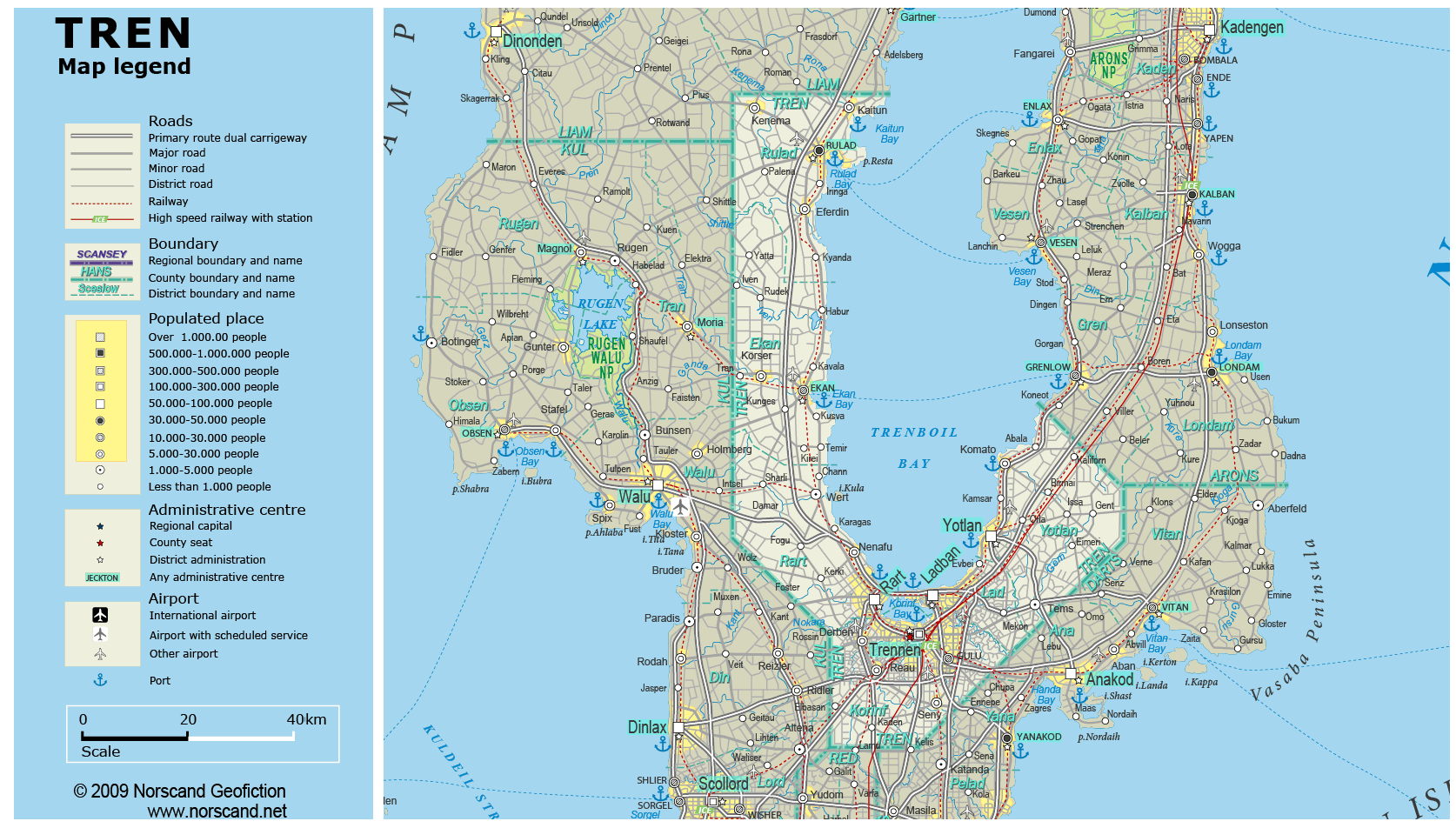
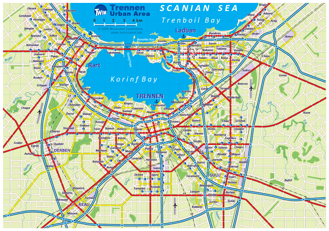
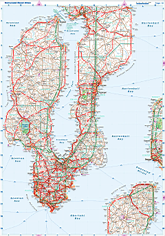
| Road maps for this area |
 |
|
| |
|
| Location |
Western Garand |
| Area |
 Continental Continental |
3 500 sq.km |
| Isles |
0 sq.km |
| Water bodies |
6 sq.km |
| Total |
3 506 sq.km |
| Rank in Garand |
22 of 35 |
| Rank in Norscand |
71 of 103 |
| Size comparision |
X |
| Boundaries |
| Land |
268 km |
| Coastal (w/o isles) |
278 km |
| Population |
| Total |
584 741 |
| Rank in Garand |
18 of 35 |
| Rank in Norscand |
29 of 103 |
| 5 Largest towns |
| Trennen |
200 714 |
| Rart |
89 974 |
| Ladban |
75 098 |
| Yotlan |
54 392 |
| Rulad |
43 192 |
| Administrative division |
| # of districts |
6 |
| County seat |
Trennen |
| Transportation |
| Roadways: |
|
| Total length (paved, basic network) |
3 508km |
| Expressways |
453km |
| Road density |
1,00 km/sq.km |
| Share of expw |
13% |
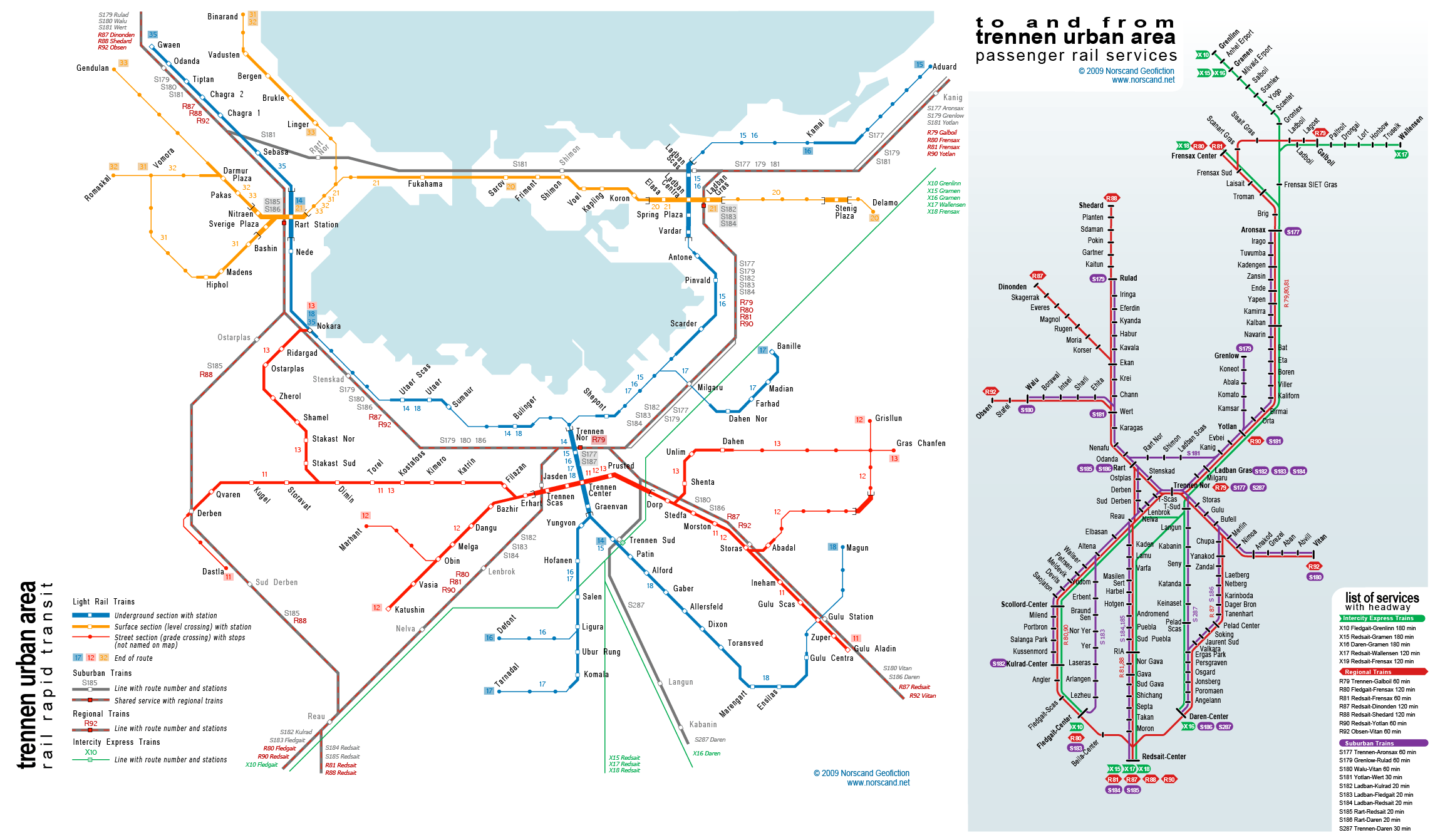
| Railways |
|
| Total length |
501km |
| High-Speed Lines |
126 km |
| Airports |
|
| Total |
6 |
| Sched.service |
0 |
| Seaports |
|
| Total |
8 |
| |
|
|
|