| |
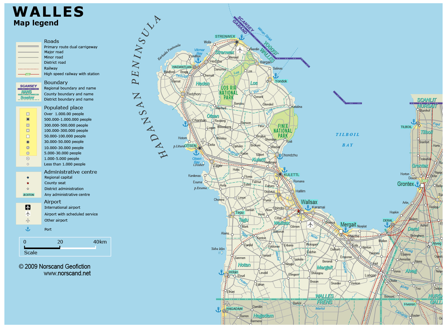
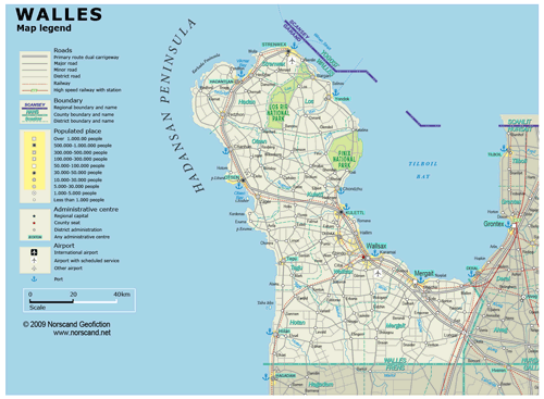
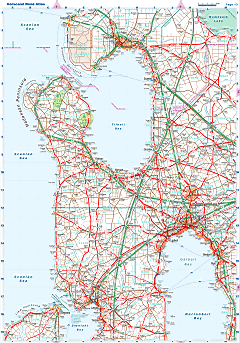
| General map (1527x1122, 0.22 mb) |
 |
| |
|
|
| Flag |
Coat of Arms |
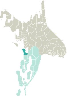
Location |
 |
 |
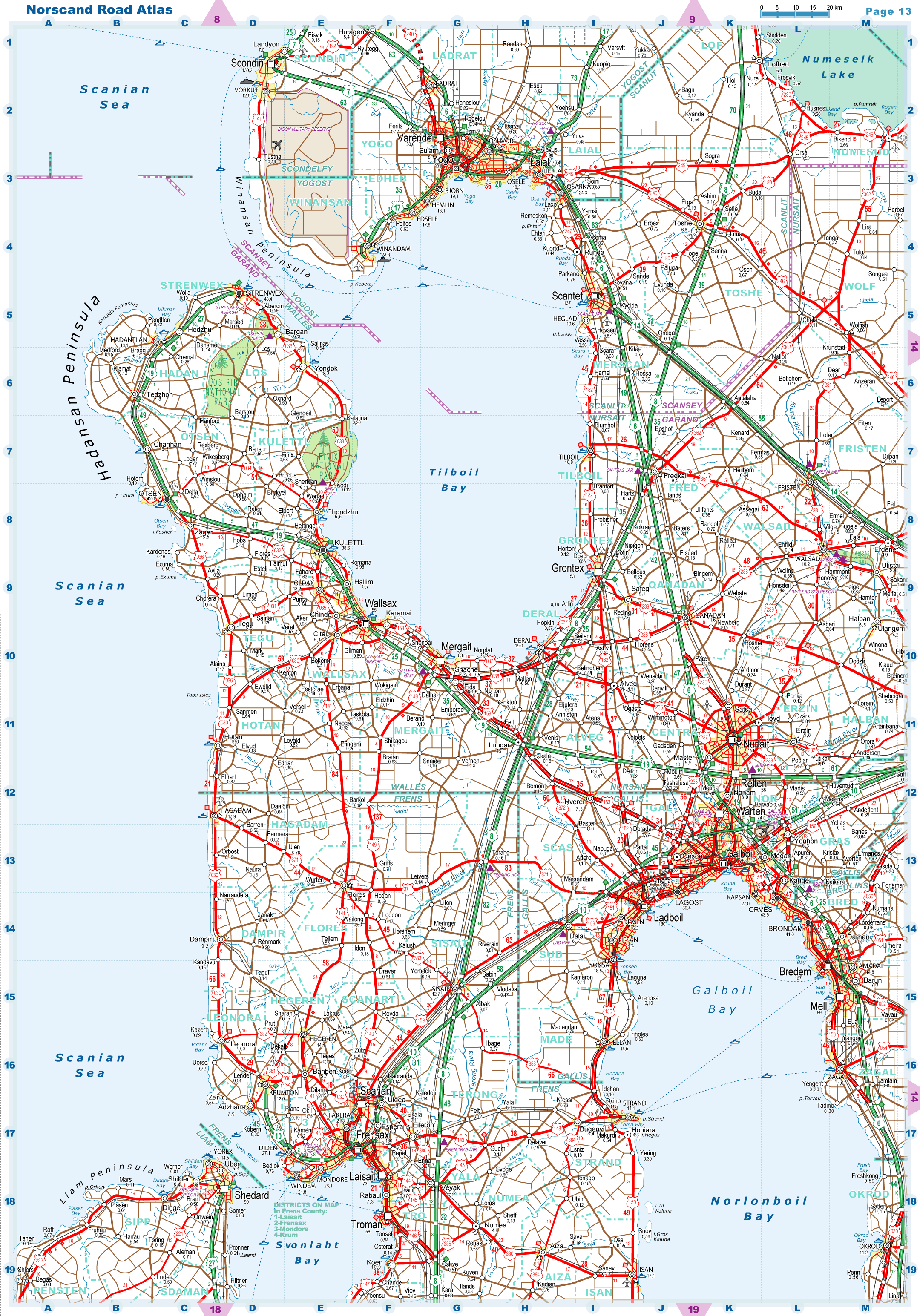
| Road maps for this area |
 |
|
| |
|
| Location |
Northwestern Garand |
| Area |
 Continental Continental |
9 694 sq.km |
| Isles |
0 sq.km |
| Water bodies |
0 sq.km |
| Total |
9 694 sq.km |
| Rank in Garand |
10 of 35 |
| Rank in Norscand |
41 of 103 |
| Size comparision |
X |
| Boundaries |
| Land |
135 km |
| Coastal (w/o isles) |
489 km |
| Population |
| Total |
531 690 |
| Rank in Garand |
22 of 35 |
| Rank in Norscand |
34 of 103 |
| 5 Largest towns |
| Wallsax |
154 590 |
| Mergait |
83 374 |
| Strenwex |
48 398 |
| Otsen |
41 996 |
| Kulettl |
38 600 |
| Administrative division |
| # of districts |
9 |
| County seat |
Wallsax |
| Transportation |
| Roadways: |
|
| Total length (paved, basic network) |
4 720km |
| Expressways |
321km |
| Road density |
0,49 km/sq.km |
| Share of expw |
7% |
| Railways |
|
| Total length |
424km |
| High-Speed Lines |
34 km |
| Airports |
|
| Total |
6 |
| Sched.service |
1 |
| Seaports |
|
| Total |
10 |
| |
|
|
|