| |
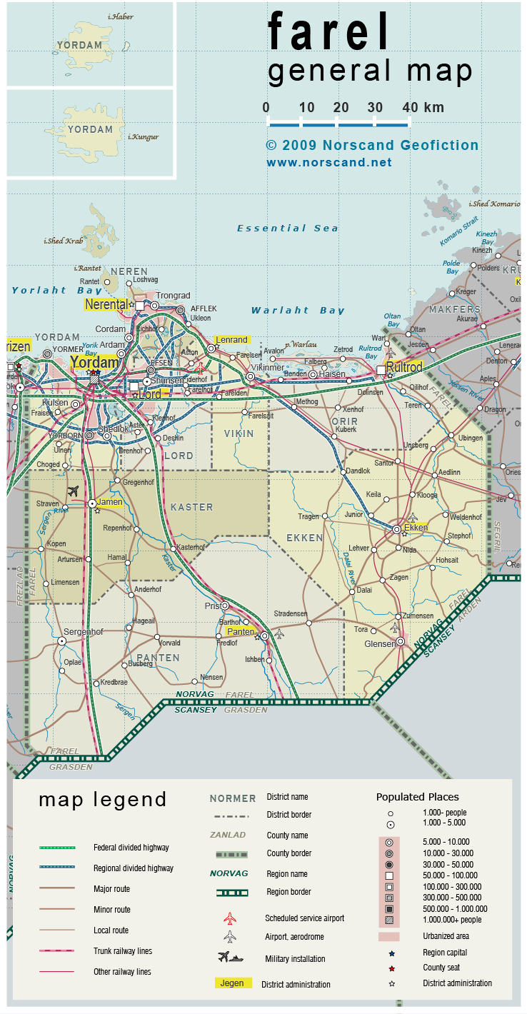
| General map (738x1420, 485 kb) |
 |
| |
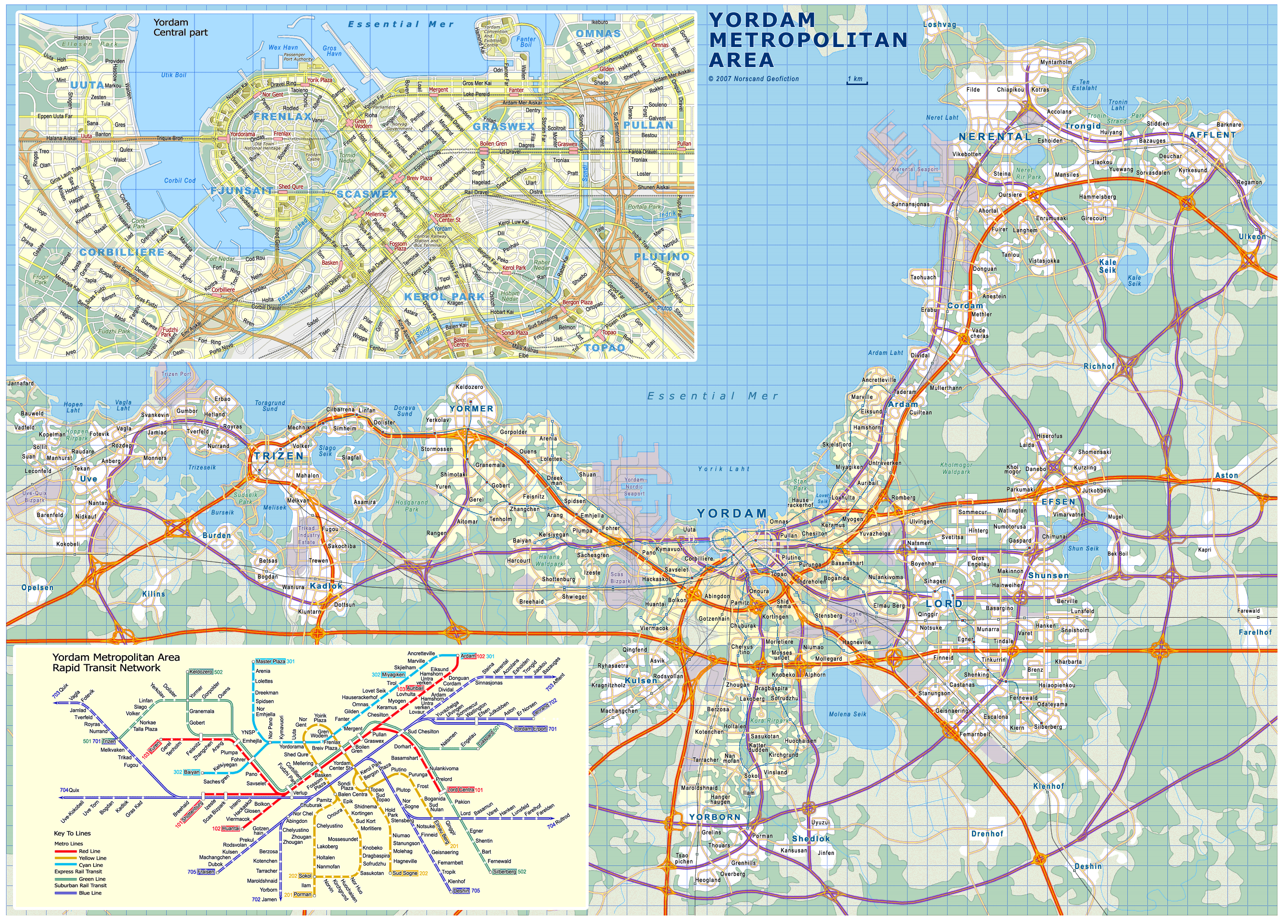
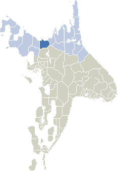
| Yordam metro area (2565x1838, 1.36 mb) |
 |
| |
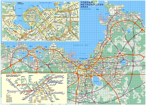
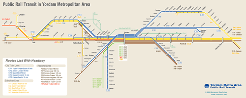
| Yordam Area Rail Rapid Transit Map (2500x1000 pix, 0.38 Mb) |
 |
|
|
| Flag |
Coat of Arms |
Location |
 |
 |
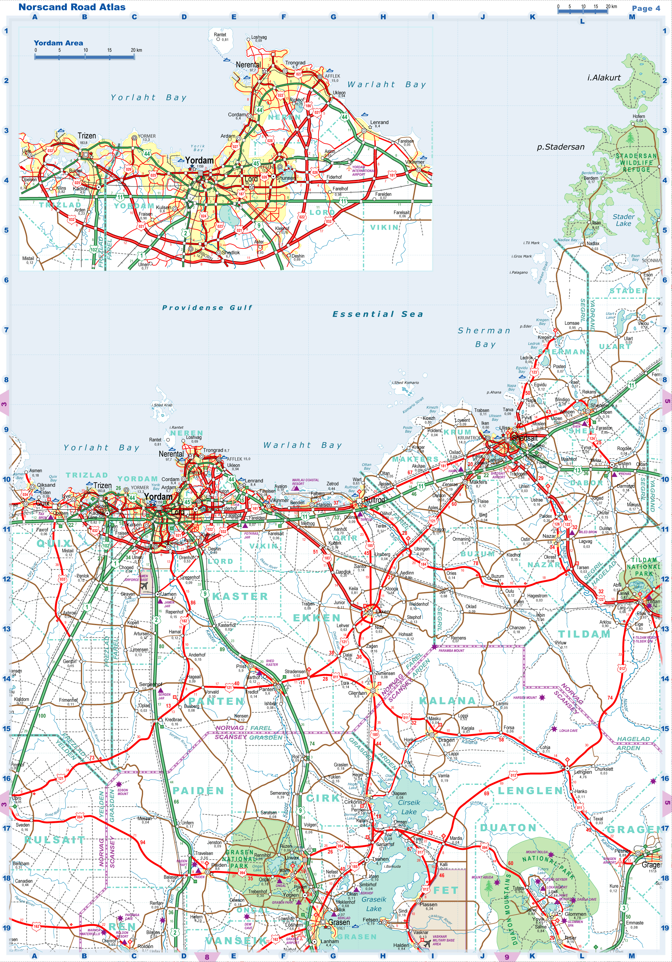
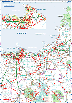
| Road maps for this area |
 |
| |
|
| Location |
Central Norvag |
| Area |
 Continental Continental |
12 520 sq.km |
| Isles |
670 sq.km |
| Water bodies |
508 sq.km |
| Total |
13 656 sq.km |
| Rank in Norvag |
12 of 17 |
| Rank in Norscand |
13 of 103 |
| Size comparision |
Connecticut |
| Boundaries |
| Land |
345 km |
| Coastal (w/o isles) |
430 km |
| Population |
| Total |
1 583 000 |
| Rank in Norvag |
1 of 17 |
| Rank in Norscand |
3 of 103 |
| 5 Largest towns/cities |
| Yordam |
1 159 000 |
| Lord |
99 800 |
| Nerental |
97 700 |
| Rultrod |
53 200 |
| Afflek |
14 900 |
| Administrative division |
| # of districts |
8 |
| County seat |
Yordam |
| Transportation |
| Roadways: |
|
| Total length (paved, basic network) |
2560 km |
| Expressways |
950 km |
| Road density |
0.19 km/sq.km |
| Share of expw |
37 % |
| Railways |
|
| Total length |
770 km |
| High-Speed Lines |
110 km |
| Airports |
|
| Total |
5 |
| Sched.service |
1 |
| Seaports |
|
| Total |
7 |
| |
|
|
|