| |
 Norvag
is divided into 17 counties. Norvag
is divided into 17 counties.
To see maps of counties and cities choose one of them:
or see
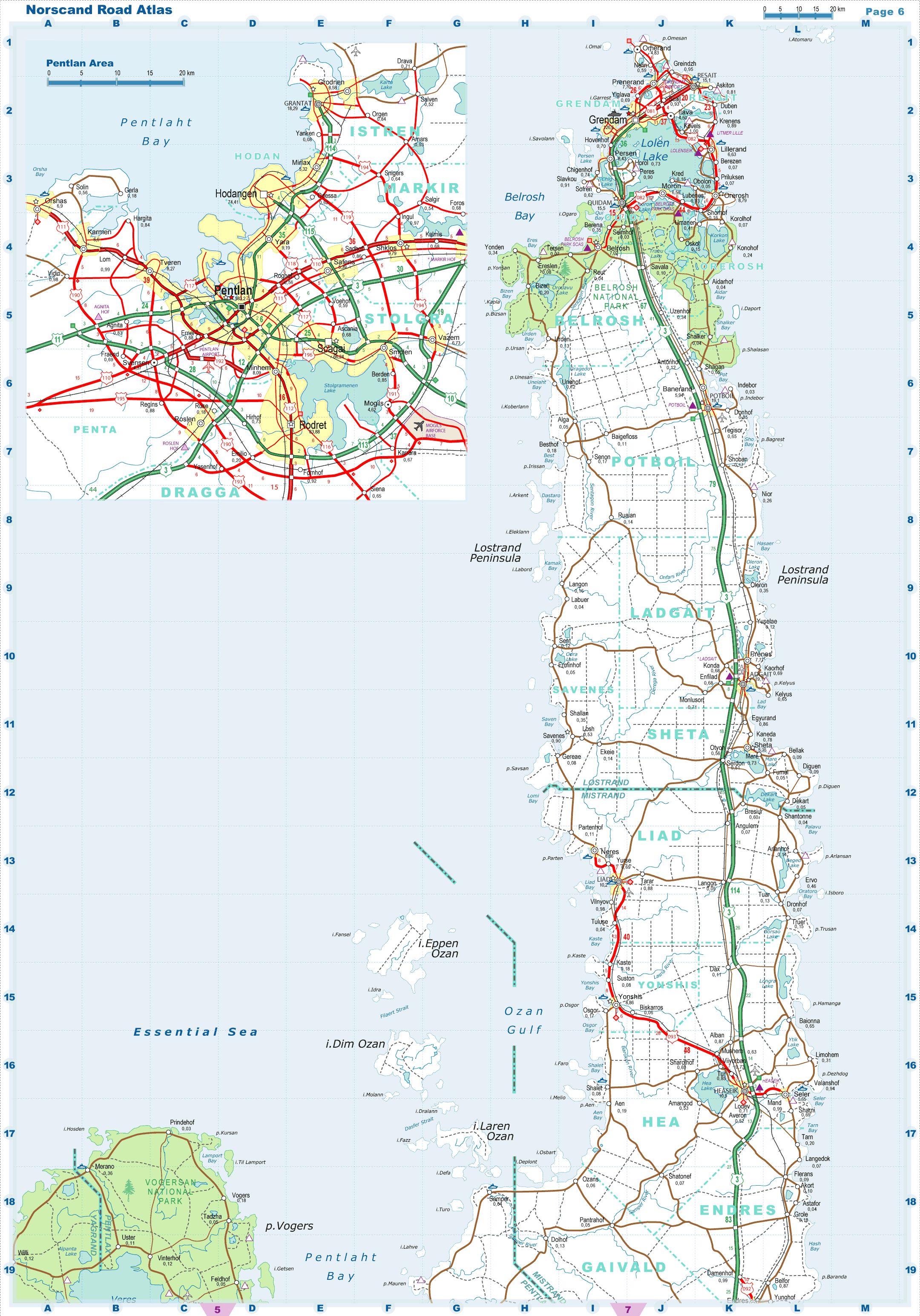
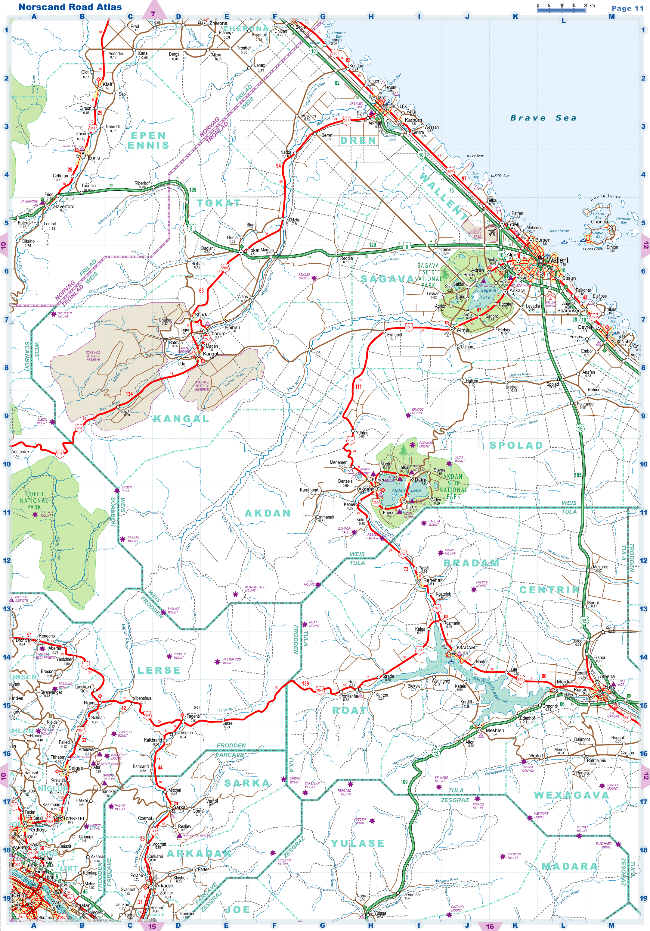
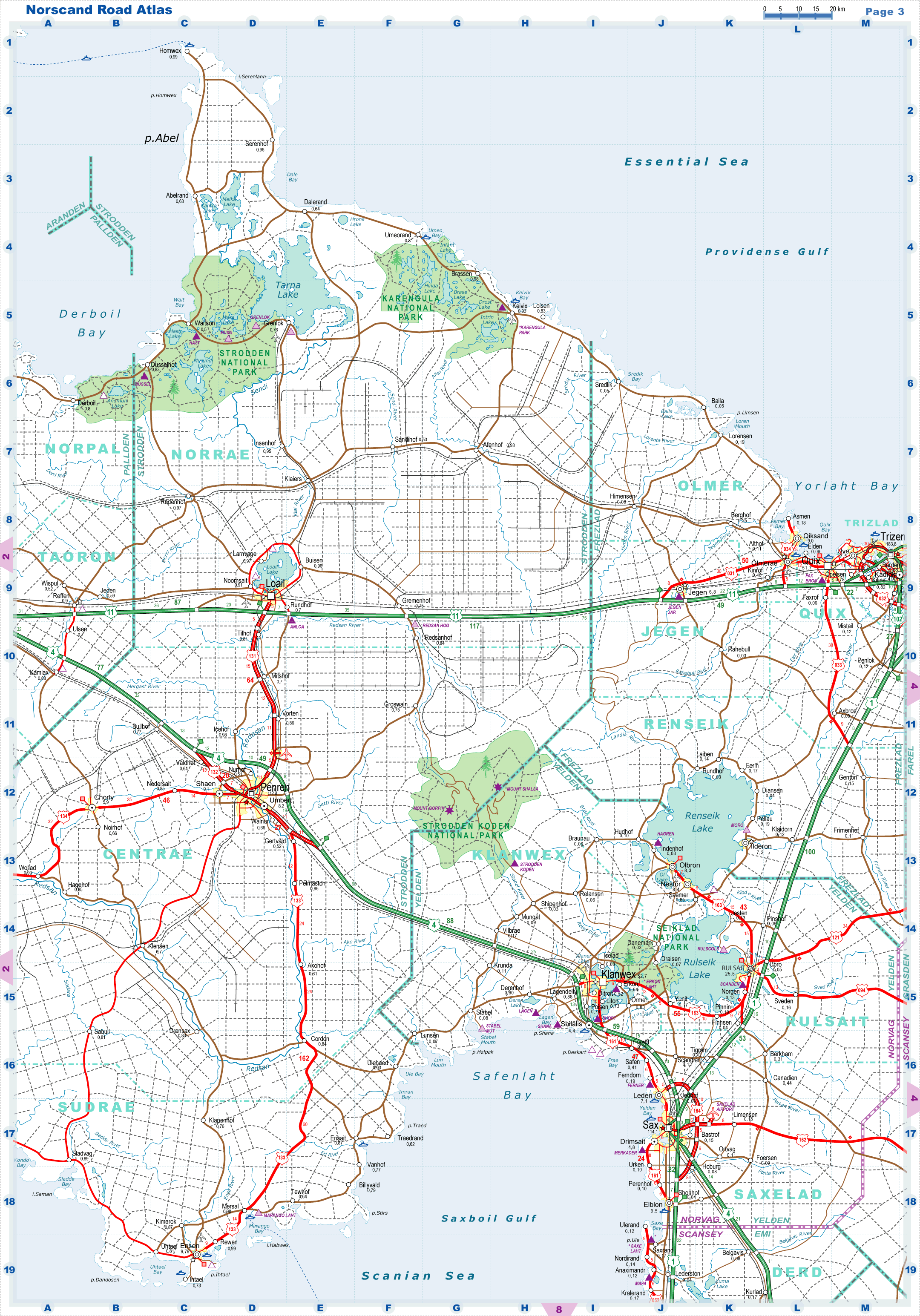
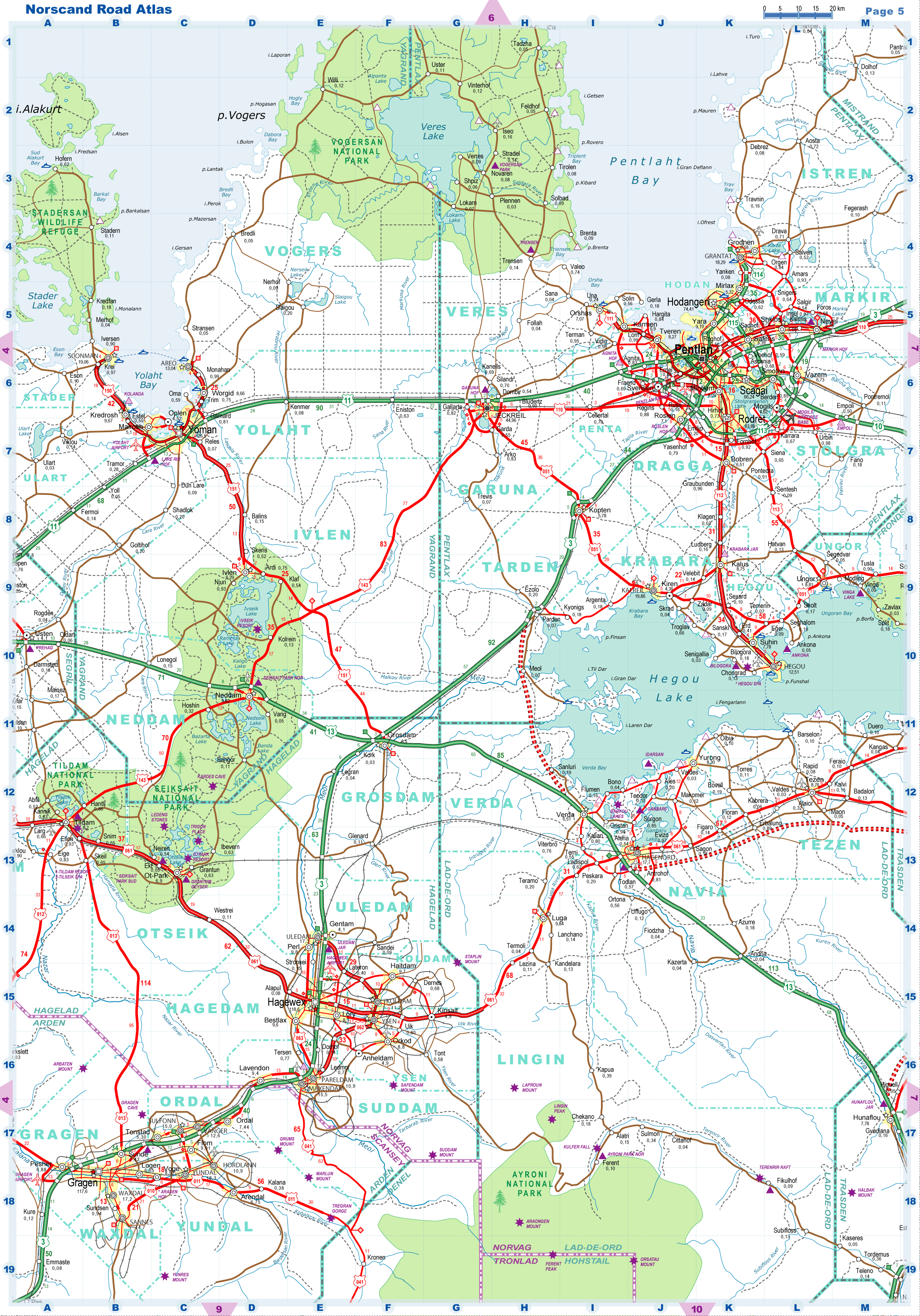
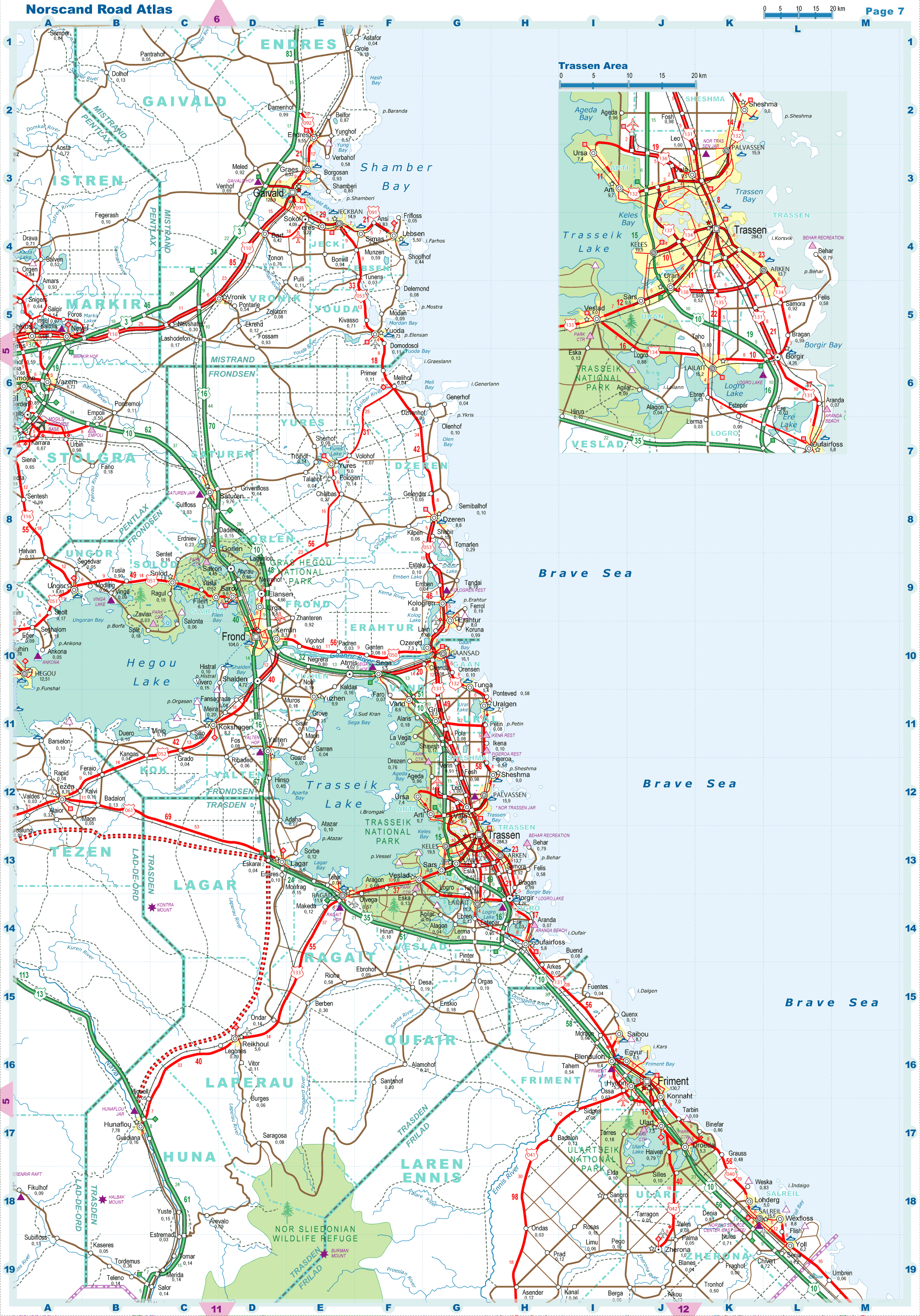
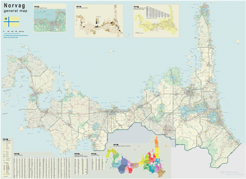
 General Map of Norvag (includes map insets of administrative division, population density, road distances chart, capital region, index of counties and districts). General Map of Norvag (includes map insets of administrative division, population density, road distances chart, capital region, index of counties and districts).
| General map (6069x4419, 2.5 mb) |
 |
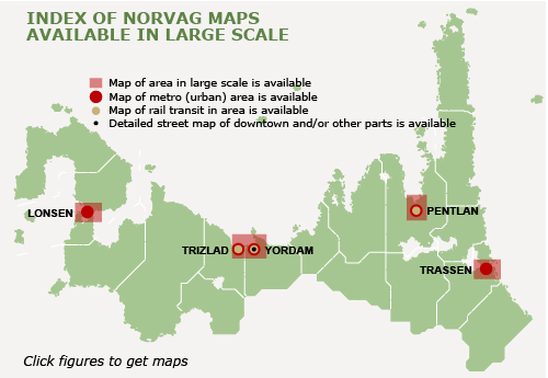
Index map
(Click area on picture to get detailed map) |
|
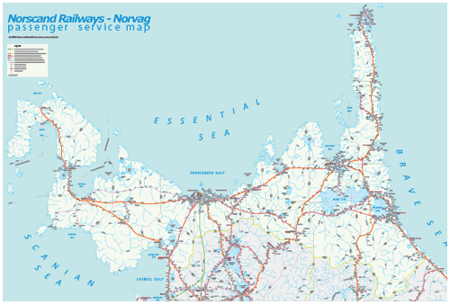
Railway passenger service map (8933x6976, 3.3 mb) |
 |
|
|
| Flag |
Coat of Arms |
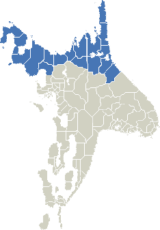
Location |
 |
 |
|
| Location |
Northern Norscand |
| Area |
 Continental Continental |
273 437 sq.km |
| Isles |
4 420 sq.km |
| Water bodies |
14 036 sq.km |
| Total |
286 148 sq.km |
| Rank in Norvag |
X |
| Rank in Norscand |
2 of 4 |
| Size comparision |
Nevada |
| Boundaries |
| Land |
1 090 km |
| Coastal (w/o isles) |
9 130 km |
| Population |
| Total |
6 735 800 |
| Rank in Norvag |
X |
| Rank in Norscand |
4 of 4 |
| 5 Largest cities |
| Yordam |
1 159 500 |
| Pentlan |
583 200 |
| Trassen |
284 300 |
| Lonsen |
268 700 |
| Trizen |
183 800 |
| Administrative division |
| # of counties |
17 |
| # of districts |
124 |
| Region capital |
Yordam |
| Transportation |
| Roadways: |
|
| Total length (paved, basic network) |
33 120 km |
| Expressways |
6 100 km |
| Road density |
0.12 km/sq.km |
| Share of expw |
18 % |
| Railways |
|
| Total length |
7870 km |
| High-Speed Lines |
110 km |
| Airports |
|
| Total |
67 |
| Sched.service |
18 |
| Seaports |
|
| Total |
112 |
 |
|
|
|
|
|
|