| |
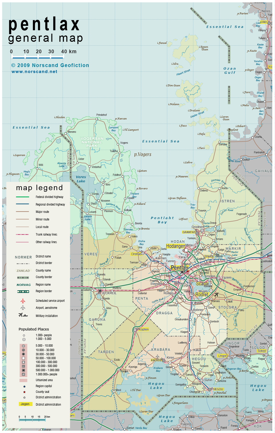
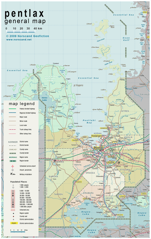
| General map (1054x1660, 753 kb) |
 |
| |
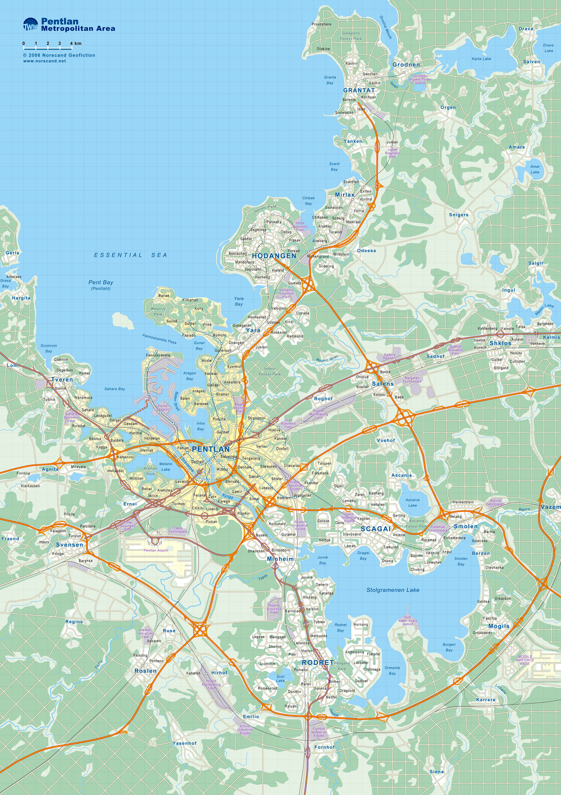
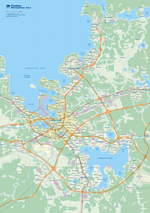
| Pentlan Metropolitan Area Map(1855x2628, 1.36 mb) |
 |
| |
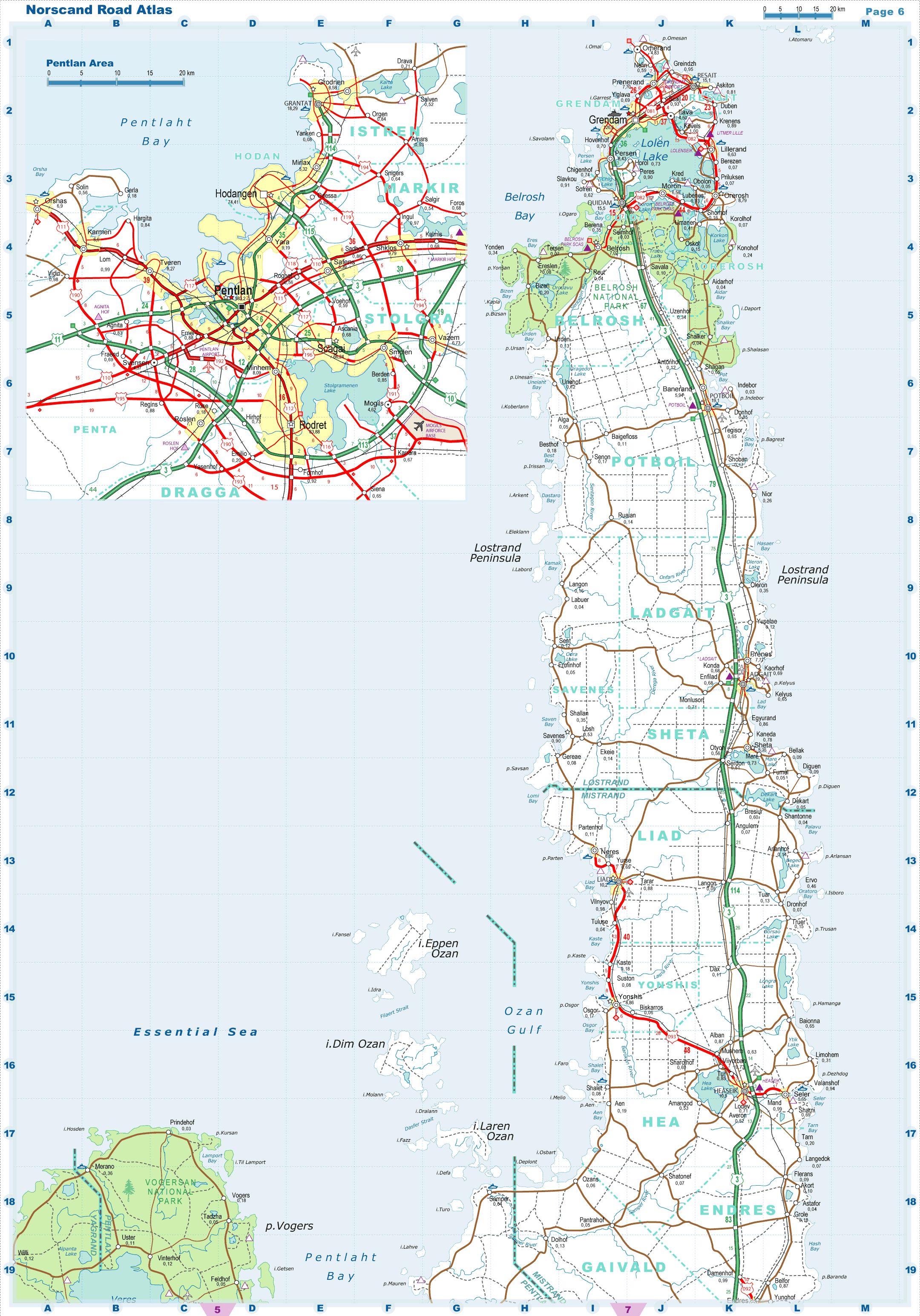
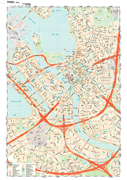
| Pentlan City Map(2602x3847, 2.3 mb) |
 |
| |
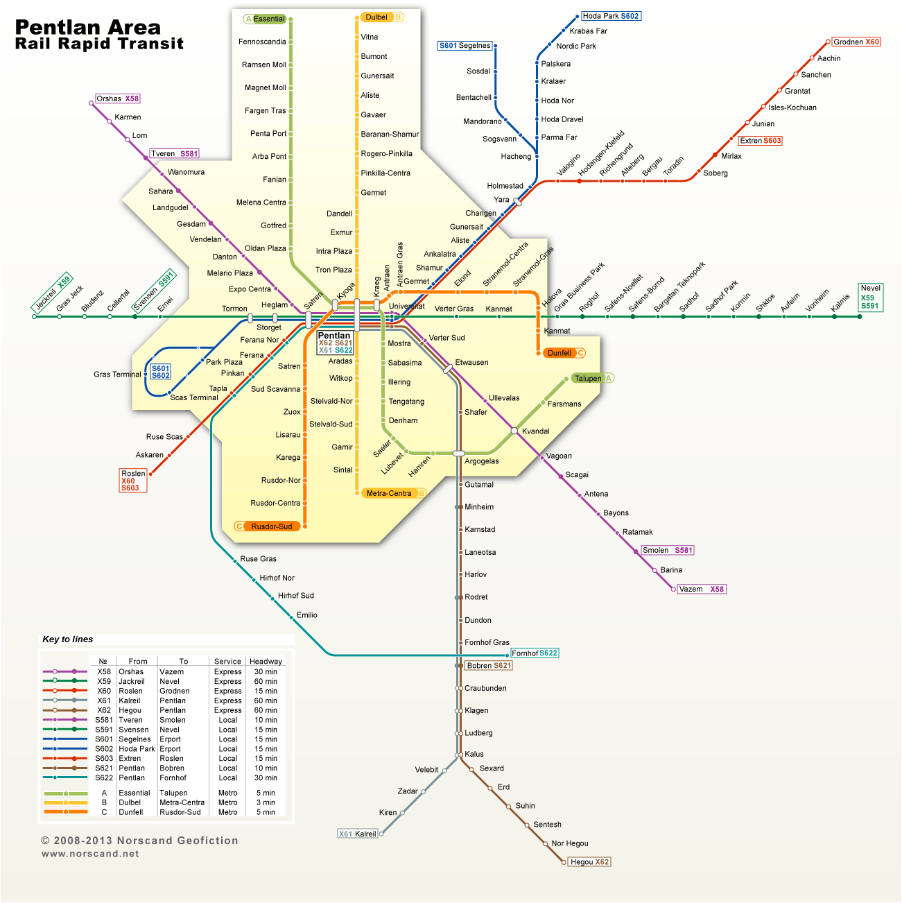
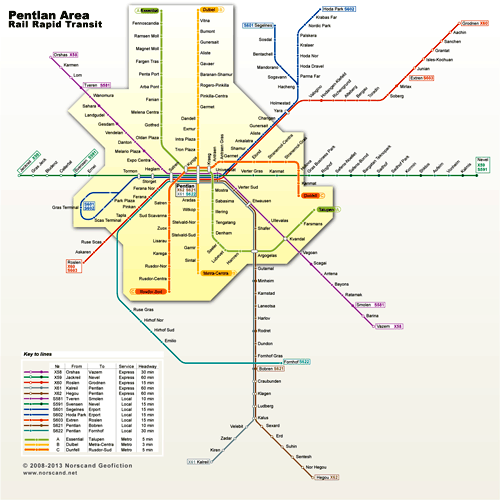
| Pentlan Area Rail Rapid Transit Map (1301x1301, 0.1 Mb) |
 |
| |
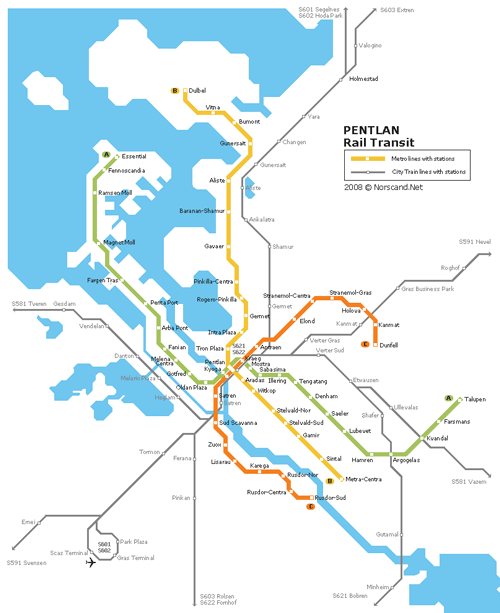
| Pentlan rail transit map in UrbanRail site style(807x989, 21 kb) |
 |
|
|
| Flag |
Coat of Arms |
Location |
 |
 |
|
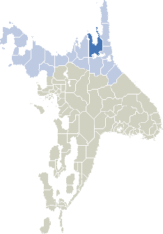
| Location |
Eastern Norvag |
| Area |
 Continental Continental |
20 053 sq.km |
| Isles |
748 sq.km |
| Water bodies |
1 983 sq.km |
| Total |
22 577 sq.km |
| Rank in Norvag |
2 of 17 |
| Rank in Norscand |
11 of 103 |
| Size comparision |
New Jersey |
| Boundaries |
| Land |
425 km |
| Coastal (w/o isles) |
680 km |
| Population |
| Total |
1 080 400 |
| Rank in Norvag |
2 of 17 |
| Rank in Norscand |
8 of 103 |
| 5 Largest towns |
| Pentlan |
583 200 |
| Rodret |
83 900 |
| Hodangen |
74 400 |
| Scagai |
66 200 |
| Jeckreil |
45 000 |
| Administrative division |
| # of districts |
11 |
| County seat |
Pentlan |
| Transportation |
| Roadways: |
|
| Total length (paved, basic network) |
3100 km |
| Expressways |
720 km |
| Road density |
0.15 km/sq.km |
| Share of expw |
23 % |
| Railways |
|
| Total length |
690 km |
| High-Speed Lines |
0 km |
| Airports |
|
| Total |
5 |
| Sched.service |
1 |
| Seaports |
|
| Total |
5 |
 |
|
|
|