| |
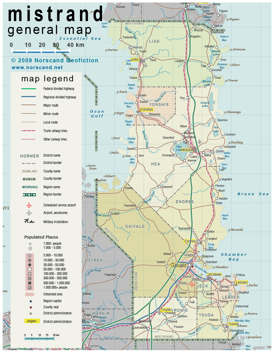
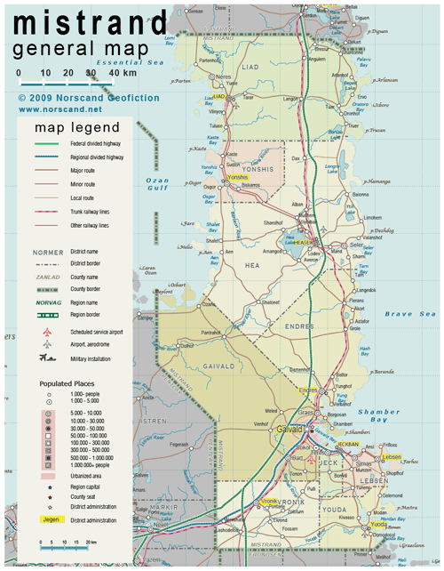
| General map (939x1026, 460 kb) |
 |
|
|
| Flag |
Coat of Arms |
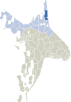
Location |
 |
 |
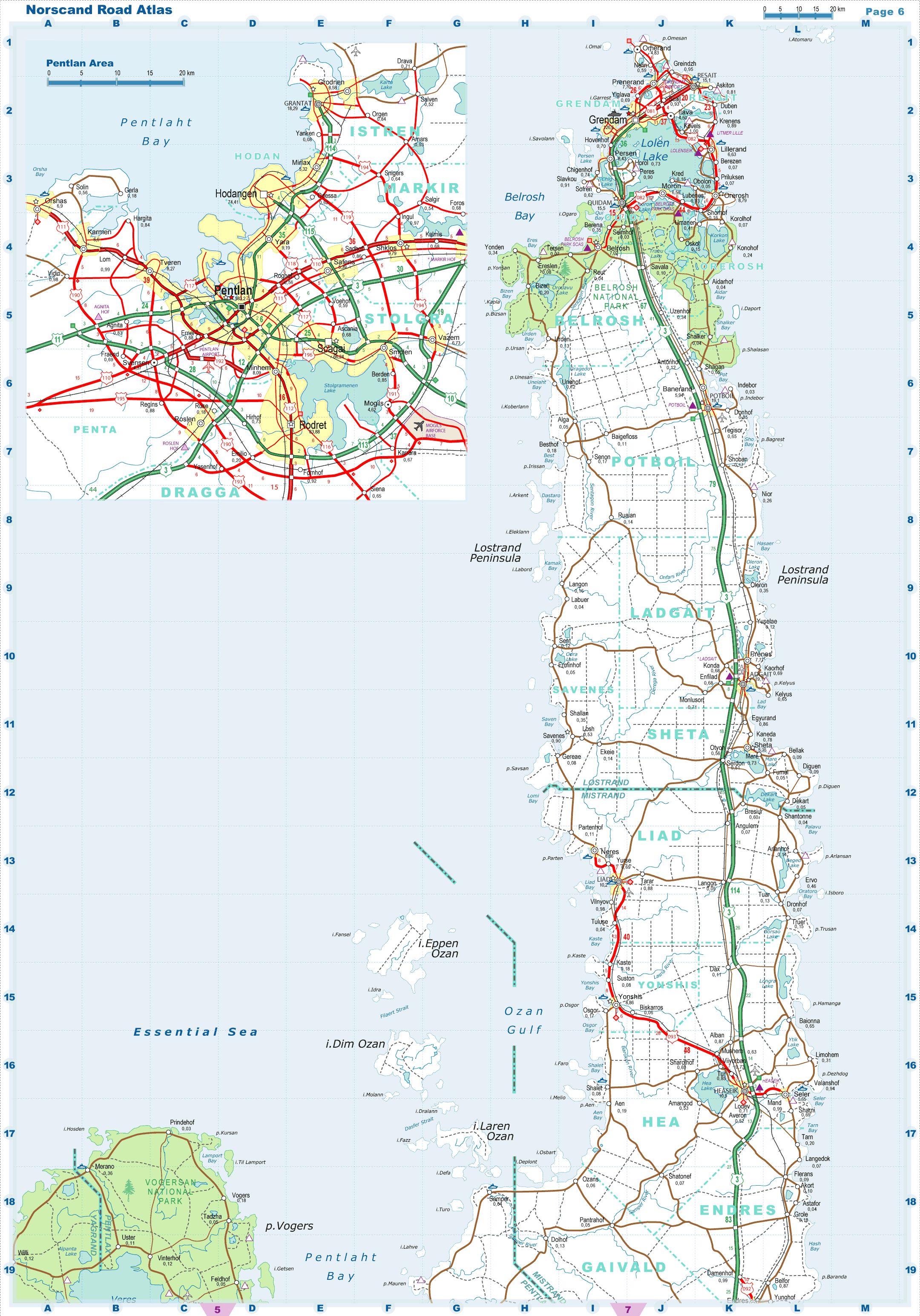
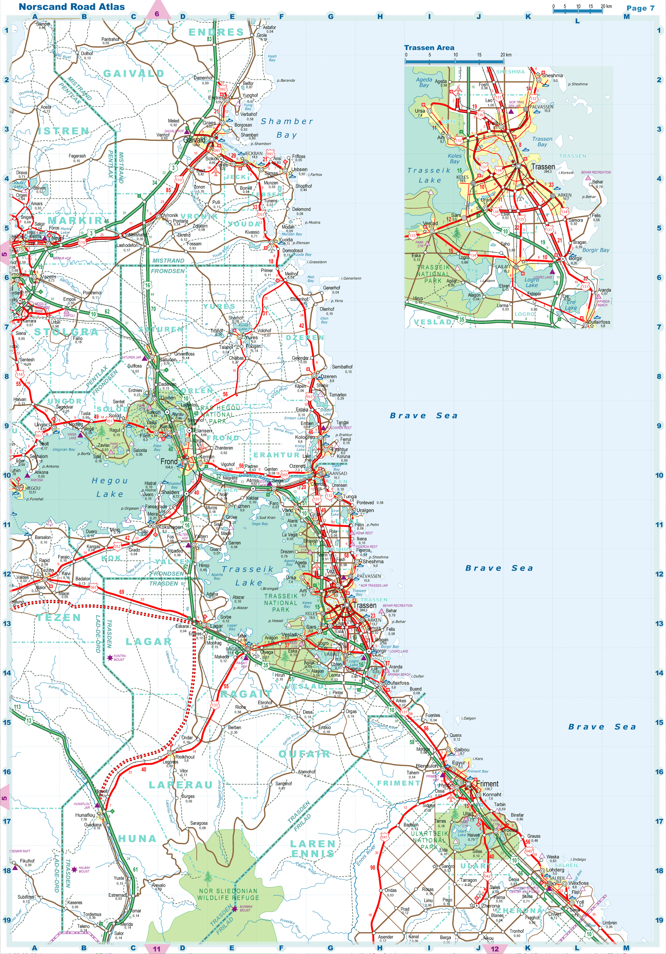
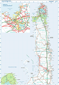
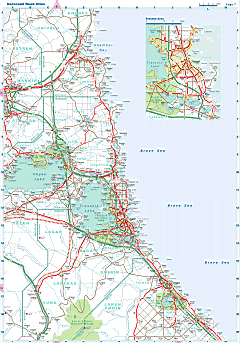
| Road maps for this area |
 |
 |
|
| Location |
Eastern Norvag |
| Area |
 Continental Continental |
14 468 sq.km |
| Isles |
128 sq.km |
| Water bodies |
177 sq.km |
| Total |
14 597 sq.km |
| Rank in Norvag |
9 of 17 |
| Rank in Norscand |
28 of 103 |
| Size comparision |
Connecticut |
| Boundaries |
| Land |
235 km |
| Coastal (w/o isles) |
800 km |
| Population |
| Total |
282 200 |
| Rank in Norvag |
9 of 17 |
| Rank in Norscand |
65 of 103 |
| 5 Largest towns |
| Gaivald |
128 900 |
| Jeckban |
15 000 |
| Heaseik |
10 600 |
| Liad |
10 200 |
| Endres |
9 600 |
| Administrative division |
| # of districts |
9 |
| County seat |
Gaivald |
| Transportation |
| Roadways: |
|
| Total length (paved, basic network) |
2100 km |
| Expressways |
340 km |
| Road density |
0.14 km/sq.km |
| Share of expw |
16 % |
| Railways |
|
| Total length |
385 km |
| High-Speed Lines |
0 km |
| Airports |
|
| Total |
4 |
| Sched.service |
1 |
| Seaports |
|
| Total |
11 |
 |
|
|
|