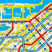
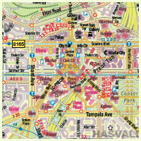
1.Arandam city centre.
Features: High-Rises - yes, Relief - flat, Pedestrian network - probably yes, Medieval or historic parts core - no, Population of area - 1.160.000 |
|
 |
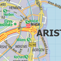
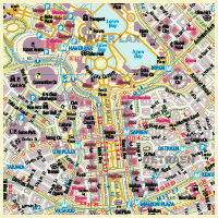
2.Aristan city centre.
Features: High-Rises - yes, Relief - flat, Pedestrian network - small, Medieval or historic parts core - small, Population of area - 370.000 |
|
 |
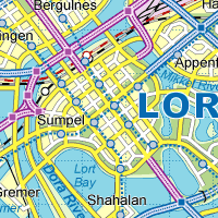
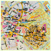
3.Lort city centre.
Features: High-Rises - yes, Relief - flat, Pedestrian network - probably yes, Medieval or historic parts core - no, Population of area - 800.000 |
|
 |
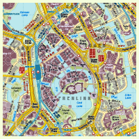
4.Swengai city centre
Features: High-Rises - yes, Relief - flat, Pedestrian network - probably yes, Medieval or historic parts core - yes, Population of area - 1.170.000 |
|
 |
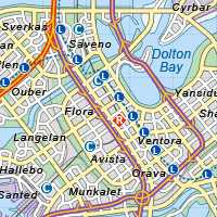
5.Dolton city centre
Features: High-Rises - yes, Relief - flat, Pedestrian network - probably yes, Medieval or historic parts core - probably yes, Population of area - 440.000 |
|
 |
6.Frensax city centre
Features: High-Rises - yes, Relief - flat, Pedestrian network - probably yes, Medieval or historic parts core - yes, Population of area - 530.000 |
|
 |
7.Gros city centre
Features: High-Rises - yes, Relief - hilly, Pedestrian network - probably yes, Medieval or historic parts core - yes, Population of area - 860.000 |
|
 |
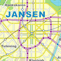
8.Jansen city centre
Features: High-Rises - yes, Relief - hilly, Pedestrian network - probably yes, Medieval or historic parts core - small, Population of area - 1.500.000 |
|
 |
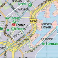
9.Lonsen city centre
Features: High-Rises - yes, Relief - flat, Pedestrian network - probably yes, Medieval or historic parts core - yes, Population of area - 320.000 |
|
 |
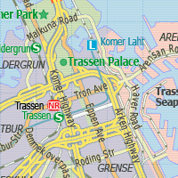
10.Trassen city centre
Features: High-Rises - yes, Relief - flat, Pedestrian network - probably yes, Medieval or historic parts core - yes, Population of area - 430.000 |
|
 |
11.Tronlax city centre
Features: High-Rises - yes, Relief - hilly, Pedestrian network - probably yes, Medieval or historic parts core - yes, Population of area - 540.000 |
|
 |
5th PLACE
Map is ready! Choose next city
12.Pentlan city centre
Features: High-Rises - yes, Relief - flat, Pedestrian network - probably yes, Medieval or historic parts core - yes, Population of area - 970.000 |
|
 |
4th PLACE
Map is ready! Choose next city
13.Scanseik city centre.
Features: High-Rises - yes, Relief - hilly, Pedestrian network - yes, Medieval or historic parts core - yes, Population of area - 400.000 |
|
 |
3rd PLACE
Map is ready! Choose next city
14.Grenlinn city centre.
Features: High-Rises - yes, Relief - hilly, Pedestrian network - yes, Medieval or historic parts core - yes, Population of area - 1.250.000 |
|
 |
2nd PLACE!
Map is ready! Choose next city
15.Walden city centre
Features: High-Rises - yes, Relief - hilly, Pedestrian network - probably yes, Medieval or historic parts core - yes, Population of area - 1.060.000 |
|
 |
1st PLACE!
Map is ready! Choose next city
16.Yogo city centre
Features: High-Rises - yes, Relief - flat, Pedestrian network - yes, Medieval or historic parts core - yes, Population of area - 590.000 |
|
 |
|
|
Results Poll archive |
