| |
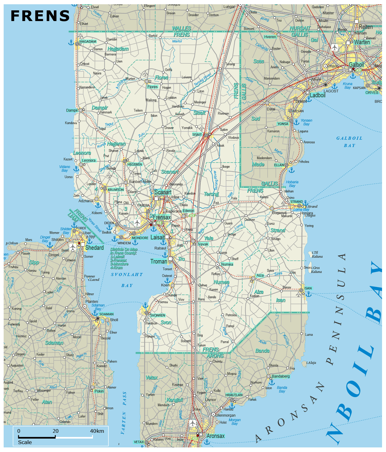
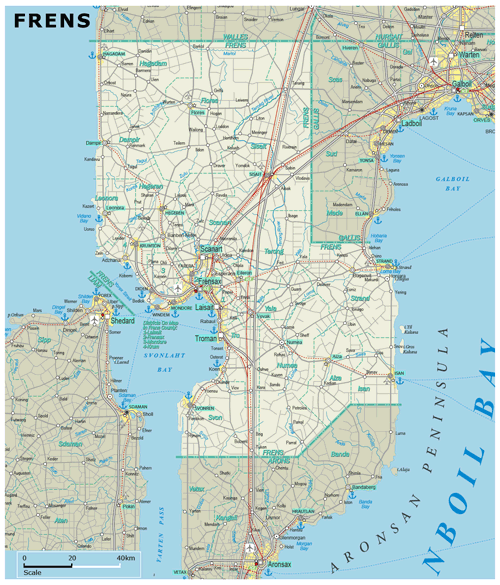
| General map (1267x1482, 0.40 mb) |
 |
| |
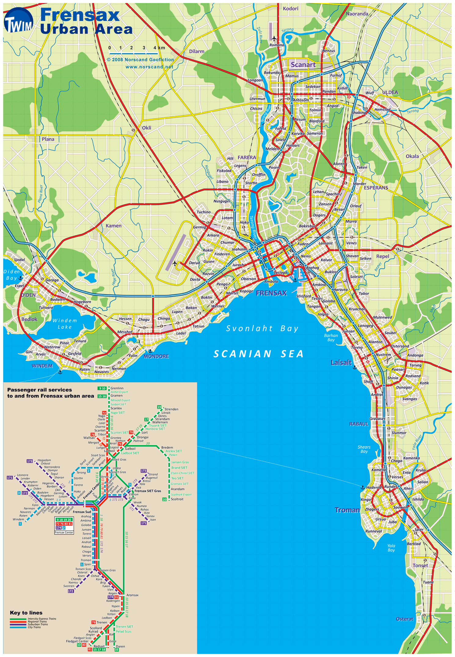
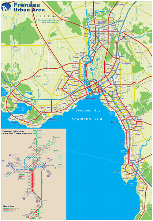
Frensax Urban Area Map
(1490 x 2149 pix, 0.8 Mb)
|
 |
| |
|
|
| Flag |
Coat of Arms |
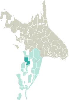
Location |
 |
 |
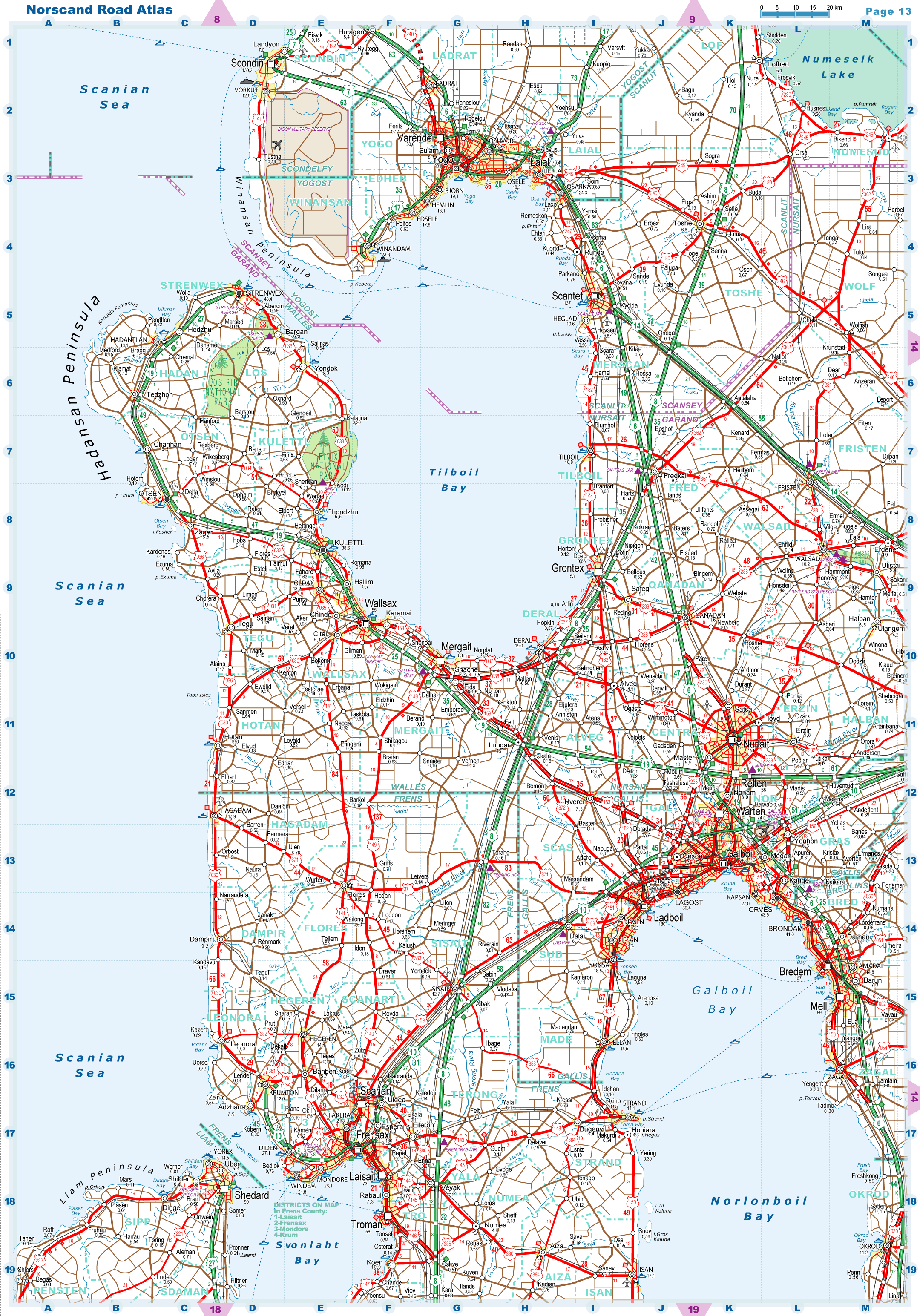
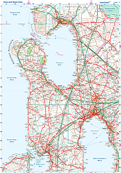
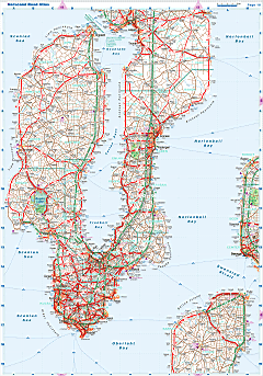
| Road maps for this area |
 |
 |
| |
|
| Location |
Northwestern Garand |
| Area |
 Continental Continental |
15 321 sq.km |
| Isles |
17 sq.km |
| Water bodies |
0 sq.km |
| Total |
15 338 sq.km |
| Rank in Garand |
4 of 35 |
| Rank in Norscand |
24 of 103 |
| Size comparision |
X |
| Boundaries |
| Land |
301 km |
| Coastal (w/o isles) |
497 km |
| Population |
| Total |
755 888 |
| Rank in Garand |
13 of 35 |
| Rank in Norscand |
20 of 103 |
| 5 Largest towns |
| Frensax |
180 138 |
| Scanart |
88 308 |
| Laisait |
73 466 |
| Troman |
56 042 |
| Diden |
27 110 |
| Administrative division |
| # of districts |
19 |
| County seat |
Frensax |
| Transportation |
| Roadways: |
|
| Total length (paved, basic network) |
6 368km |
| Expressways |
382km |
| Road density |
0,42 km/sq.km |
| Share of expw |
6% |
| Railways |
|
| Total length |
1 027km |
| High-Speed Lines |
278 km |
| Airports |
|
| Total |
9 |
| Sched.service |
1 |
| Seaports |
|
| Total |
13 |
| |
|
|
|