| |
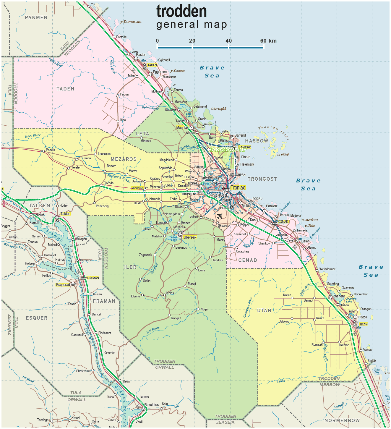
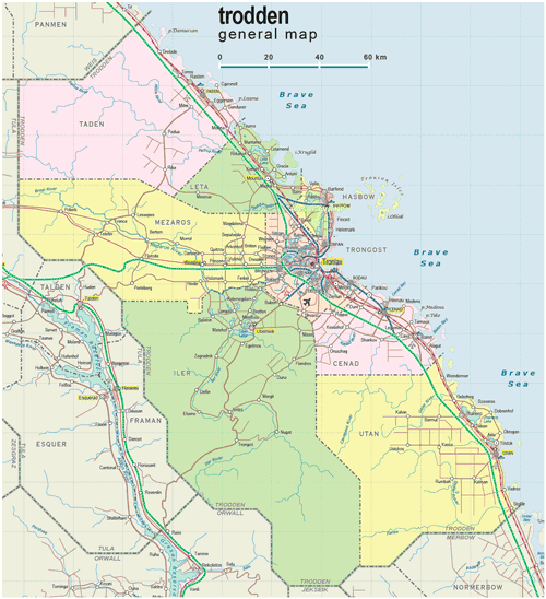
| General map (1323x1451, 0.25 mb) |
 |
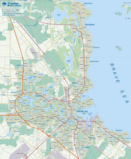
| Tronlax Metro Area map (2061x2171, 0.9 mb) |
 |
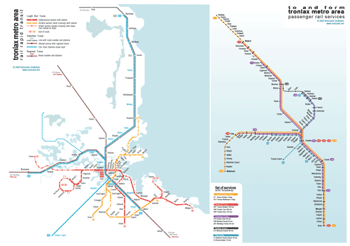
| Tronlax Metro Area Rail Transit map (2002x1411, 0.34 mb) |
 |
|
|
| Flag |
Coat of Arms |
Location |
 |
 |
|
| Location |
Eastern Tronlad |
| Area |
 Continental Continental |
22 509 sq.km |
| Isles |
140 sq.km |
| Water bodies |
131 sq.km |
| Total |
22 780 sq.km |
| Rank in Tronlad |
5 of 27 |
| Rank in Norscand |
8 of 103 |
| Size comparision |
New Jersey |
| Boundaries |
| Land |
434 km |
| Coastal (w/o isles) |
525 km |
| Population |
| Total |
654 500 |
| Rank in Tronlad |
4 of 27 |
| Rank in Norscand |
26 of 103 |
| 5 Largest towns |
| Tronlax |
279 146 |
| Hasbow |
49 428 |
| Brunsen |
28 108 |
| Delesen |
27 364 |
| Naigel |
18 632 |
| Administrative division |
| # of districts |
8 |
| County seat |
Tronlax |
| Transportation |
| Roadways: |
|
| Total length (paved, basic network) |
3 274km |
| Expressways |
528km |
| Road density |
0,14 km/sq.km |
| Share of expw |
16% |
| Railways |
|
| Total length |
452km |
| High-Speed Lines |
0 km |
| Airports |
|
| Total |
7 |
| Sched.service |
1 |
| Seaports |
|
| Total |
5 |
 |
|
|
|