| |
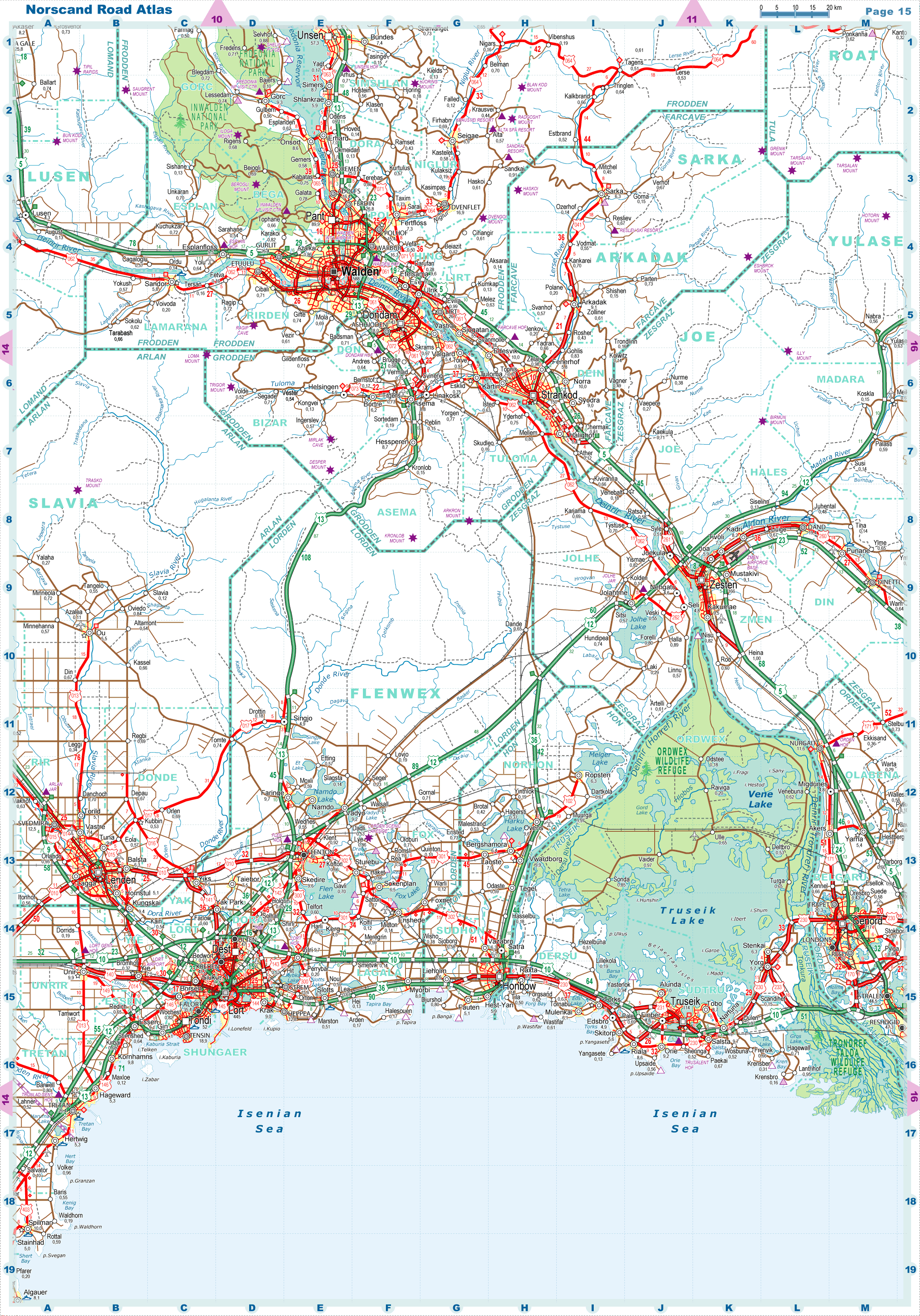
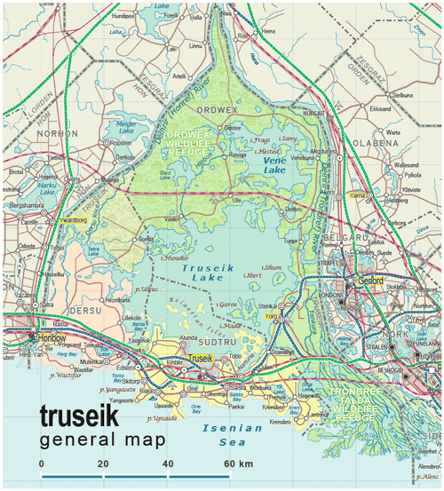
| General map (846x935, 0.23 mb) |
 |
|
|
| Flag |
Coat of Arms |
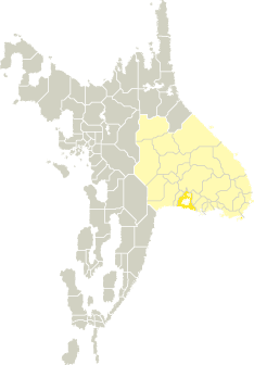
Location |
 |
 |
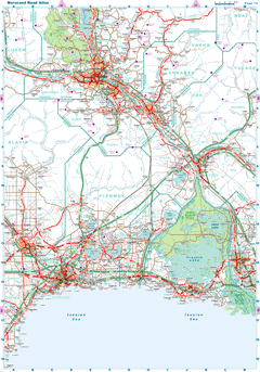
| Road maps for this area |
 |
| |
| |
|
| Location |
Southern Tronlad |
| Area |
 Continental Continental |
5 385 sq.km |
| Isles |
259 sq.km |
| Water bodies |
2 405 sq.km |
| Total |
8 049 sq.km |
| Rank in Tronlad |
13 of 27 |
| Rank in Norscand |
56 of 103 |
| Size comparision |
X |
| Boundaries |
| Land |
0 km |
| Coastal (w/o isles) |
397 km |
| Population |
| Total |
228 100 |
| Rank in Tronlad |
19 of 27 |
| Rank in Norscand |
84 of 103 |
| 5 Largest towns |
| Truseik |
114 278 |
| Salsta |
9 700 |
| Orie |
9 228 |
| Tobo |
8 696 |
| Riala |
8 566 |
| Administrative division |
| # of districts |
3 |
| County seat |
Truseik |
| Transportation |
| Roadways: |
|
| Total length (paved, basic network) |
1 182km |
| Expressways |
248km |
| Road density |
0,15 km/sq.km |
| Share of expw |
21% |
| Railways |
|
| Total length |
324km |
| High-Speed Lines |
111 km |
| Airports |
|
| Total |
2 |
| Sched.service |
0 |
| Seaports |
|
| Total |
1 |
| |
|
|
|