| |
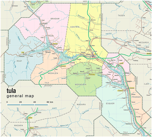
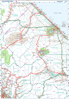
| General map (1334x1207, 0.20 mb) |
 |
|
|
| Flag |
Coat of Arms |
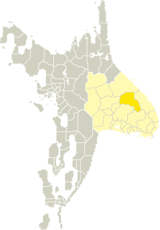
Location |
 |
 |
| Road maps for this area |
 |
 |
| |
|
| Location |
Eastern Tronlad |
| Area |
 Continental Continental |
22 067 sq.km |
| Isles |
0 sq.km |
| Water bodies |
0 sq.km |
| Total |
22 067 sq.km |
| Rank in Tronlad |
6 of 27 |
| Rank in Norscand |
10 of 103 |
| Size comparision |
Israel |
| Boundaries |
| Land |
711 km |
| Coastal (w/o isles) |
0 km |
| Population |
| Total |
134 600 |
| Rank in Tronlad |
26 of 27 |
| Rank in Norscand |
101 of 103 |
| 5 Largest towns |
| Tula |
26 560 |
| Bradam |
13 490 |
| Framan |
10 956 |
| Talden |
9 502 |
| Meshlen |
9 424 |
| Administrative division |
| # of districts |
8 |
| County seat |
Tula |
| Transportation |
| Roadways: |
|
| Total length (paved, basic network) |
2 353km |
| Expressways |
364km |
| Road density |
0,11 km/sq.km |
| Share of expw |
15% |
| Railways |
|
| Total length |
205km |
| High-Speed Lines |
0 km |
| Airports |
|
| Total |
8 |
| Sched.service |
1 |
| Seaports |
|
| Total |
0 |
 |
|
|
|