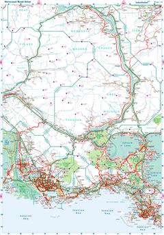
| |
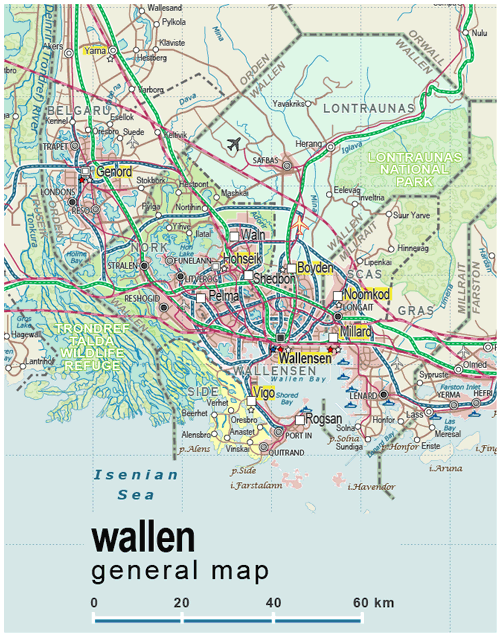
| General map (672x855, 0.18 mb) |
 |
| |
Wallensen Metro Area Map
(2810x2841 pix, 1.43 Mb) |
 |
| |
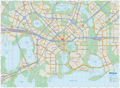
Wallensen Street Map (Central Part)
(3396x2502 pix, 2.06 Mb) |
 |
| |
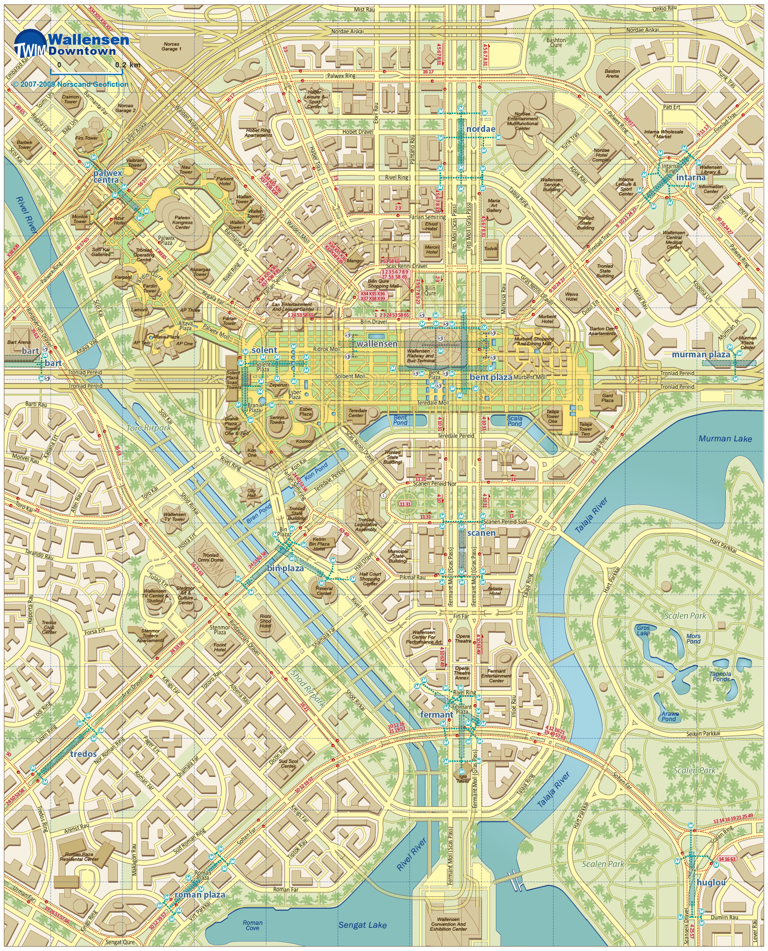
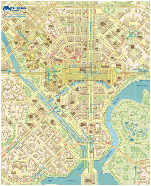
Wallensen Downtown Map
(1590x1964 pix, 2.84 Mb) |
 |
| |
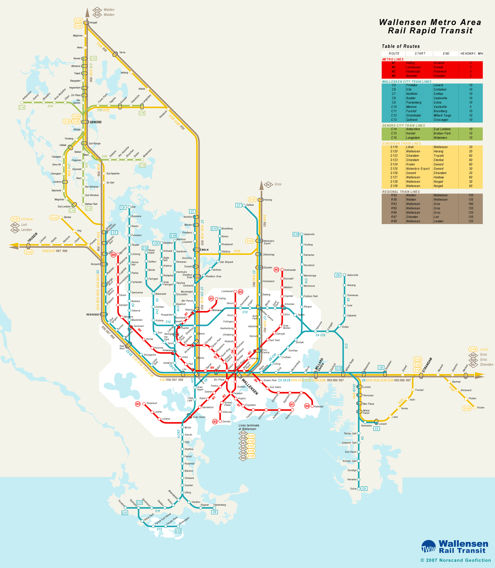
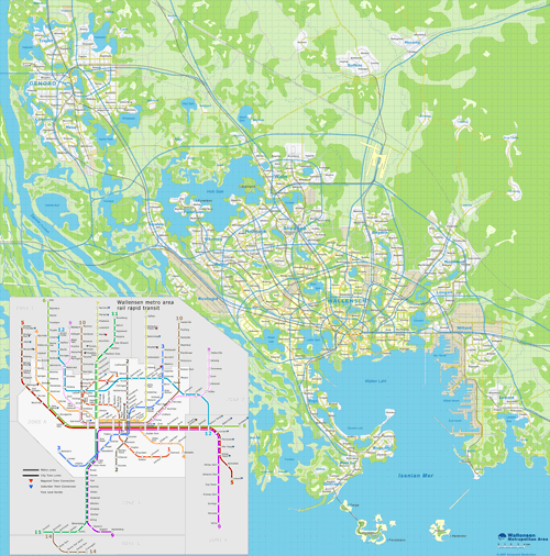
Wallensen Metro Area Rail Rapid Transit Map
(1977x2270 pix, 0.28 Mb) |
 |
|
|
| Flag |
Coat of Arms |
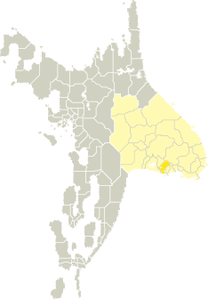
Location |
 |
 |
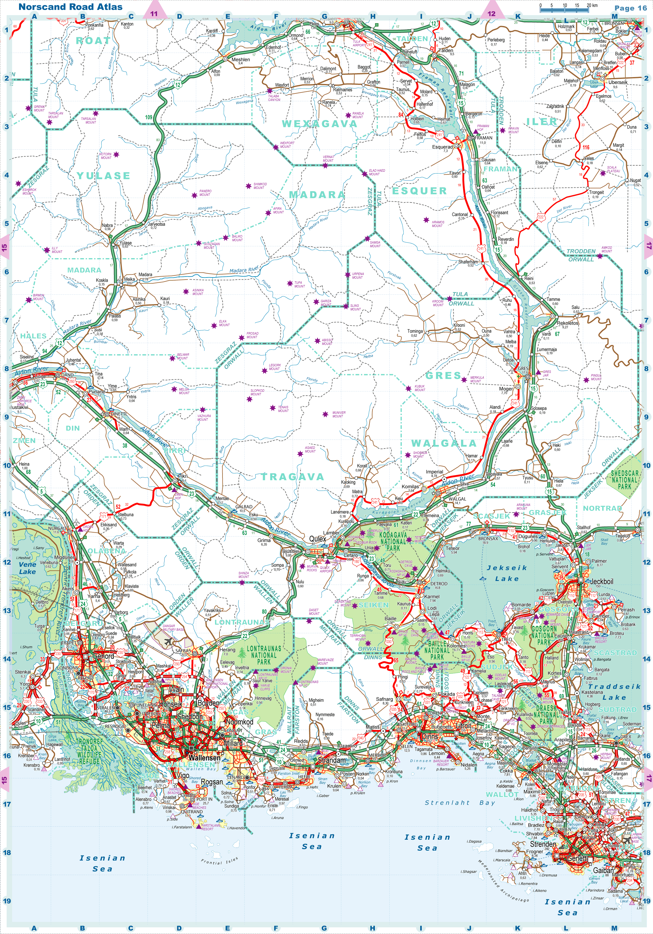
| Road maps for this area |
 |
| |
| |
|
| Location |
Southern Tronlad |
| Area |
 Continental Continental |
3 853 sq.km |
| Isles |
58 sq.km |
| Water bodies |
193 sq.km |
| Total |
4 104 sq.km |
| Rank in Tronlad |
19 of 27 |
| Rank in Norscand |
68 of 103 |
| Size comparision |
X |
| Boundaries |
| Land |
191 km |
| Coastal (w/o isles) |
93 km |
| Population |
| Total |
1 568 700 |
| Rank in Tronlad |
1 of 27 |
| Rank in Norscand |
4 of 103 |
| 5 Largest towns |
| Wallensen |
817 426 |
| Hohseik |
119 304 |
| Shedbon |
84 052 |
| Boyden |
75 312 |
| Waln |
73 246 |
| Administrative division |
| # of districts |
4 |
| County seat |
Wallensen |
| Transportation |
| Roadways: |
|
| Total length (paved, basic network) |
1 930km |
| Expressways |
625km |
| Road density |
0,47 km/sq.km |
| Share of expw |
32% |
| Railways |
|
| Total length |
588km |
| High-Speed Lines |
38 km |
| Airports |
|
| Total |
2 |
| Sched.service |
1 |
| Seaports |
|
| Total |
1 |
| |
|
|
|