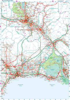
| |
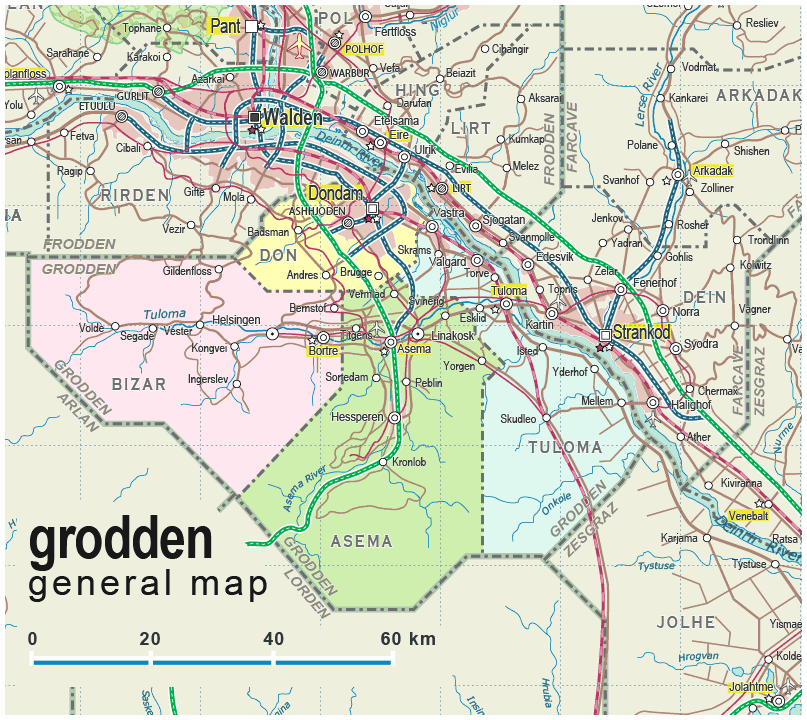
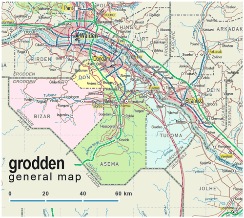
| General map (807x720, 0.15 mb) |
 |
| |
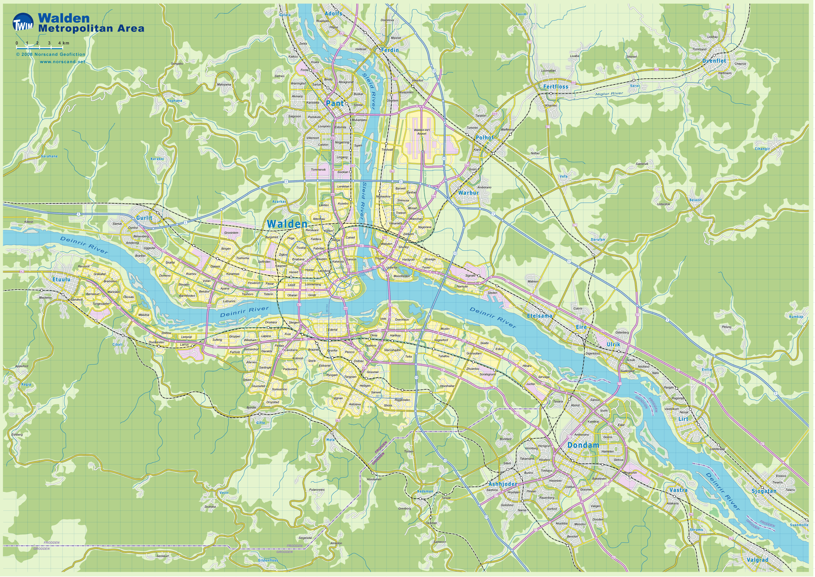
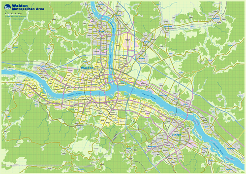
Walden Metro Area Map
(2820x1992 pix, 1.0 Mb) |
 |
| |
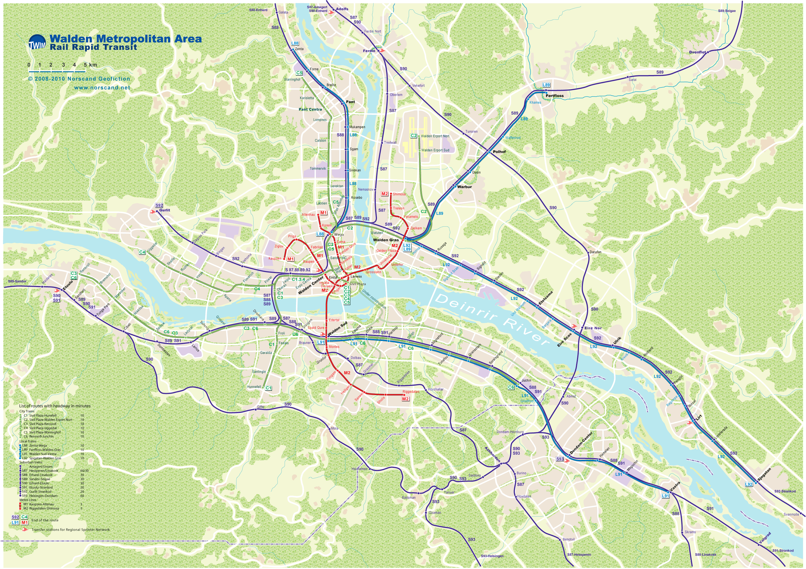
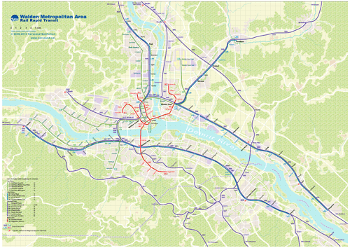
Walden Metro Area Rail Rapid Transit Map
(2806x1986 pix, 0.68 Mb) |
 |
|
|
| Flag |
Coat of Arms |
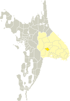
Location |
 |
 |
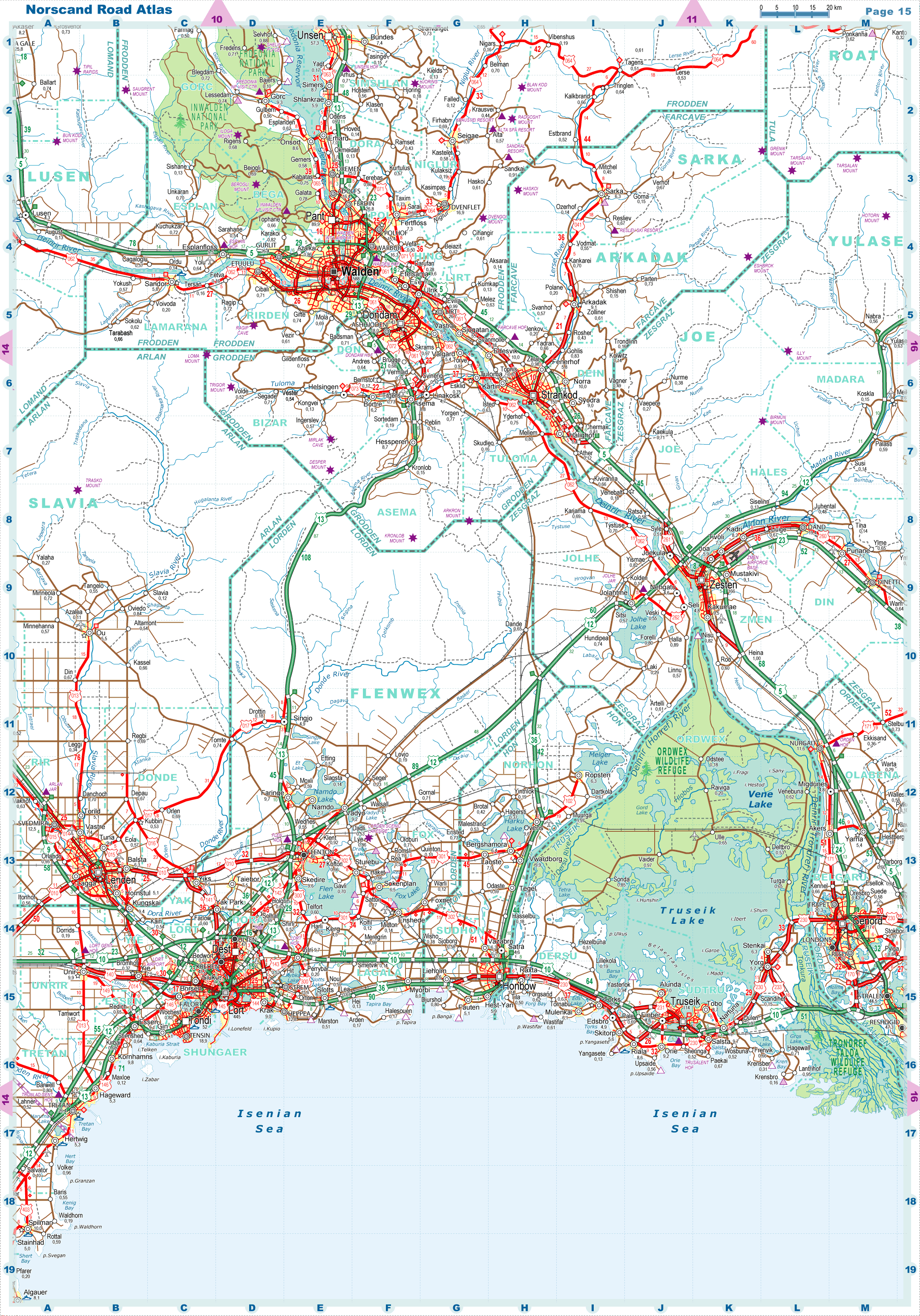
| Road maps for this area |
 |
| |
| |
|
| Location |
Central Tronlad |
| Area |
 Continental Continental |
4 373 sq.km |
| Isles |
0 sq.km |
| Water bodies |
0 sq.km |
| Total |
4 373 sq.km |
| Rank in Tronlad |
17 of 27 |
| Rank in Norscand |
59 of 103 |
| Size comparision |
X |
| Boundaries |
| Land |
211 km |
| Coastal (w/o isles) |
0 km |
| Population |
| Total |
225 100 |
| Rank in Tronlad |
21 of 27 |
| Rank in Norscand |
86 of 103 |
| 5 Largest towns |
| Dondam |
143 188 |
| Ashhjoden |
18 012 |
| Asema |
8 836 |
| Hessperen |
8 684 |
| Tuloma |
7 074 |
| Administrative division |
| # of districts |
4 |
| County seat |
Dondam |
| Transportation |
| Roadways: |
|
| Total length (paved, basic network) |
985km |
| Expressways |
143km |
| Road density |
0,23 km/sq.km |
| Share of expw |
15% |
| Railways |
|
| Total length |
271km |
| High-Speed Lines |
0 km |
| Airports |
|
| Total |
1 |
| Sched.service |
0 |
| Seaports |
|
| Total |
0 |
| |
|
|
|