| |
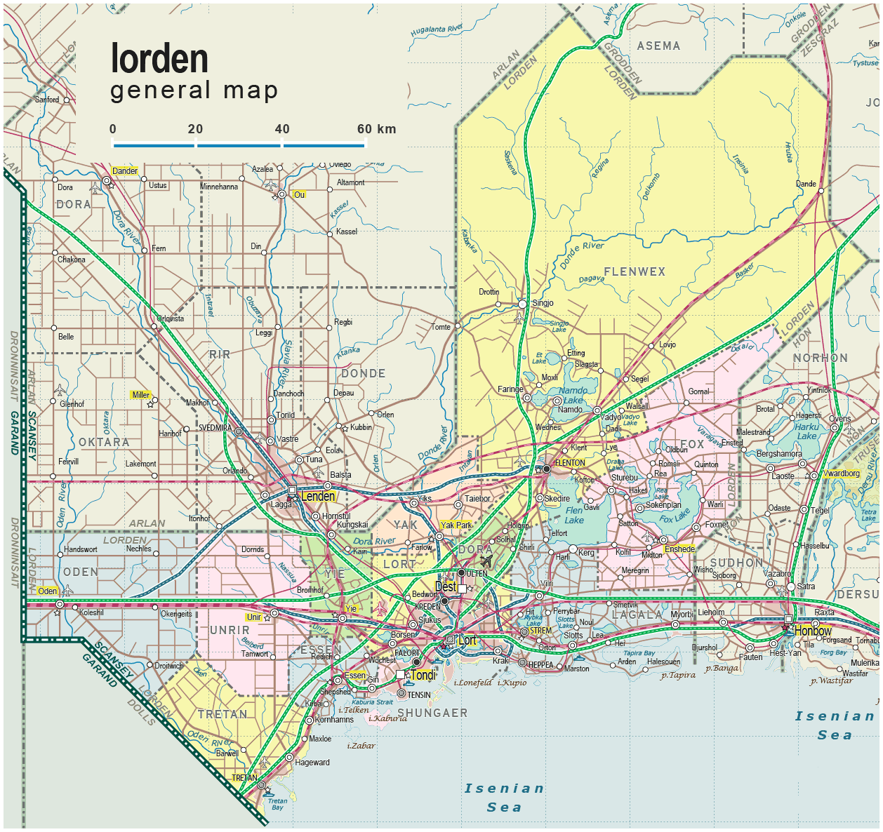
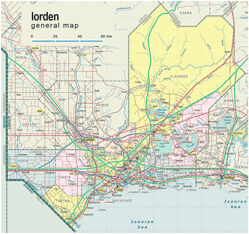
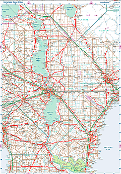
| General map (1258x1186, 0.29 mb) |
 |
| |
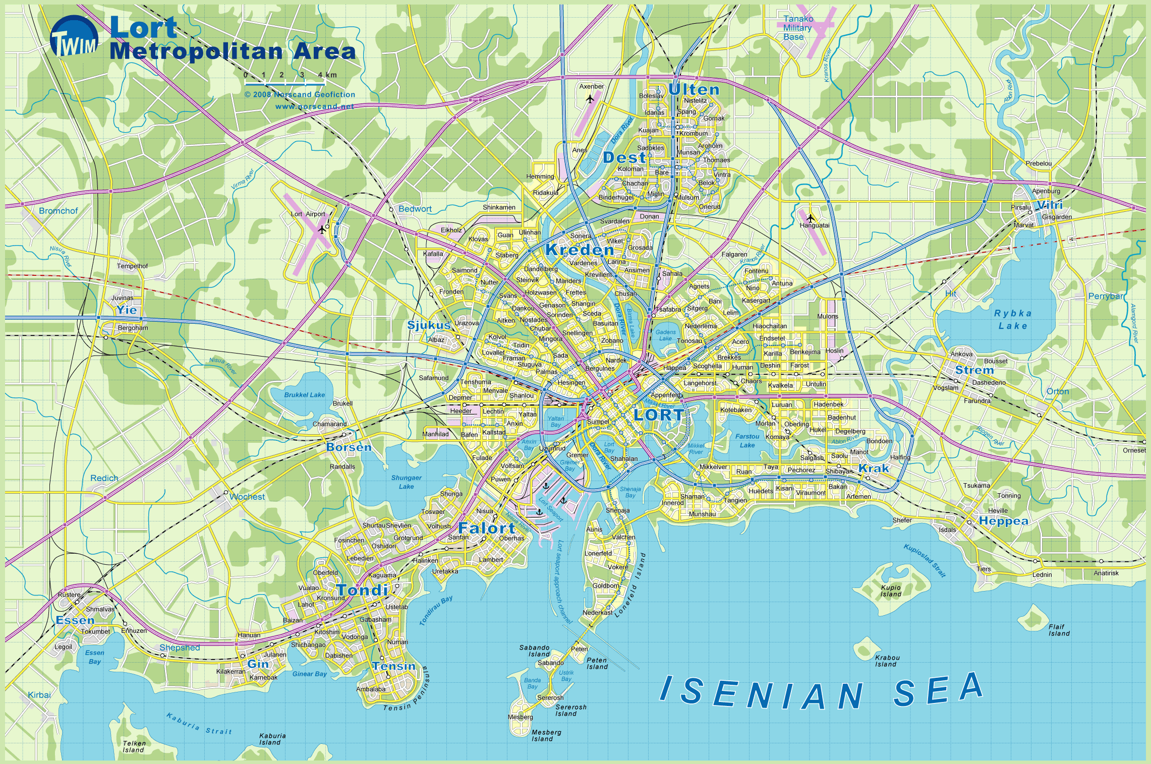
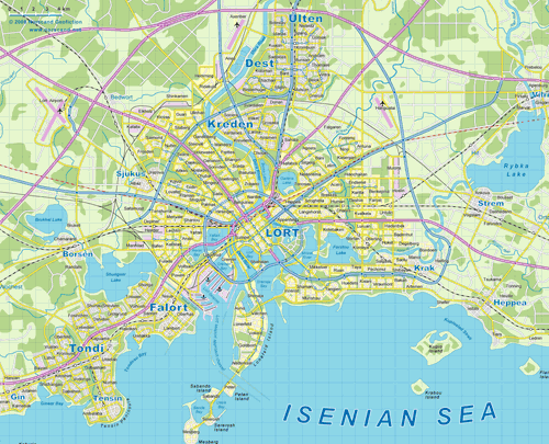
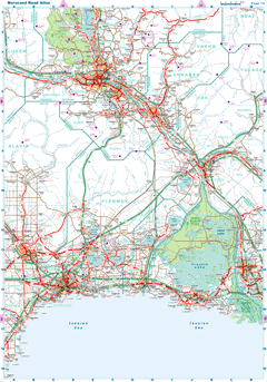
Lort Metro Area Map
(2282x1515 pix, 0.72 Mb) |
 |
| |
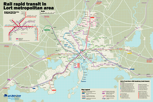
Lort Metro Area Rail Rapid Transit Map
(2313x1545 pix, 0.50 Mb) |
 |
|
|
| Flag |
Coat of Arms |
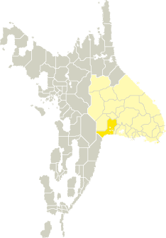
Location |
 |
 |
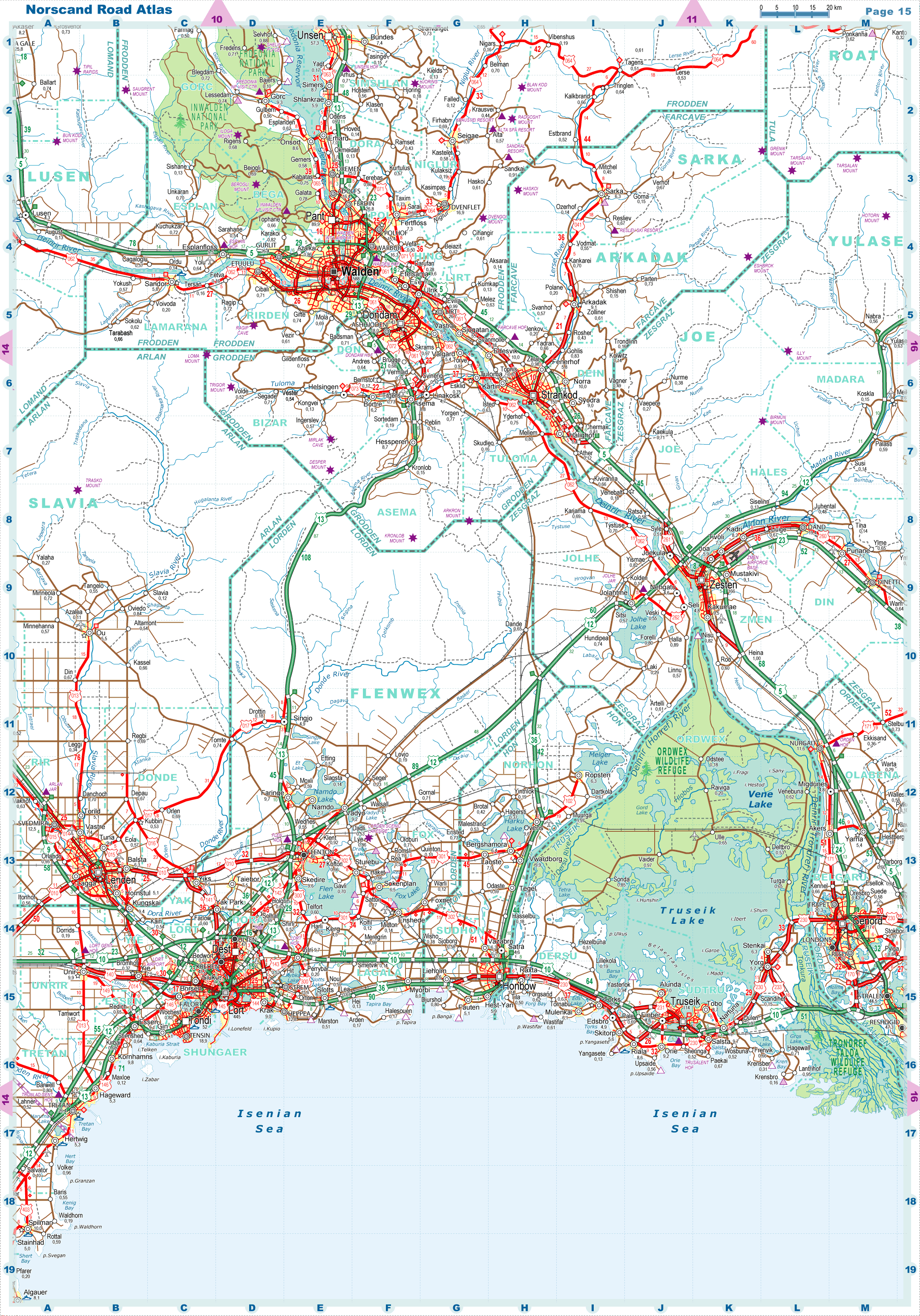
| Road maps for this area |
 |
 |
| |
|
| Location |
Southwestern Tronlad |
| Area |
 Continental Continental |
14 858 sq.km |
| Isles |
54 sq.km |
| Water bodies |
460 sq.km |
| Total |
15 373 sq.km |
| Rank in Tronlad |
10 of 27 |
| Rank in Norscand |
25 of 103 |
| Size comparision |
X |
| Boundaries |
| Land |
553 km |
| Coastal (w/o isles) |
299 km |
| Population |
| Total |
1 047 600 |
| Rank in Tronlad |
3 of 27 |
| Rank in Norscand |
9 of 103 |
| 5 Largest towns |
| Lort |
444 514 |
| Dest |
67 926 |
| Tondi |
52 238 |
| Ulten |
47 200 |
| Flenton |
46 308 |
| Administrative division |
| # of districts |
12 |
| County seat |
Lort |
| Transportation |
| Roadways: |
|
| Total length (paved, basic network) |
5 330km |
| Expressways |
932km |
| Road density |
0,35 km/sq.km |
| Share of expw |
17% |
| Railways |
|
| Total length |
1 087km |
| High-Speed Lines |
157 km |
| Airports |
|
| Total |
7 |
| Sched.service |
1 |
| Seaports |
|
| Total |
4 |
 |
|
|
|