| |
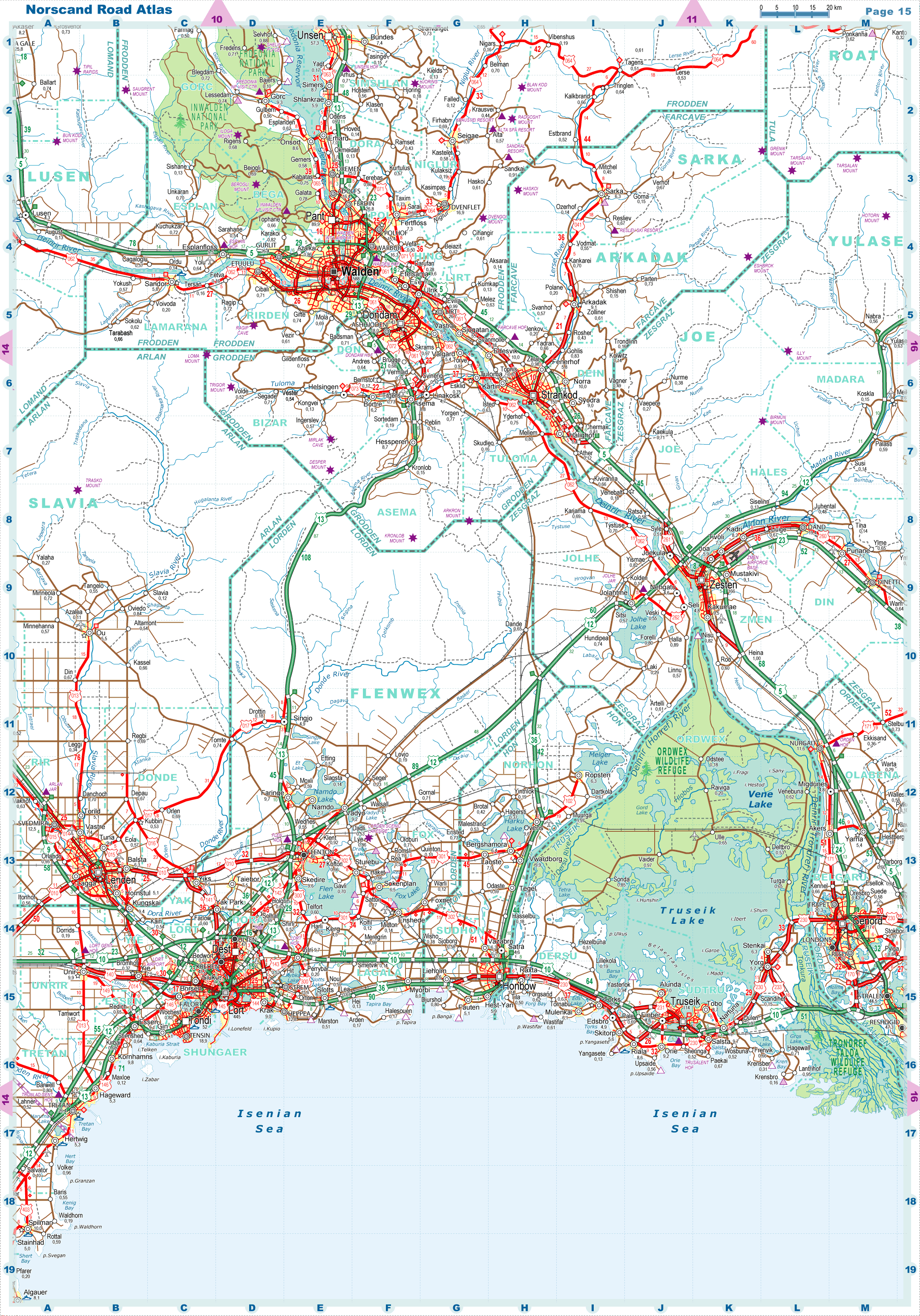
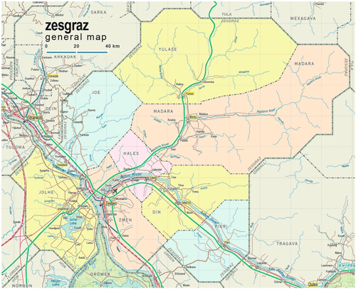
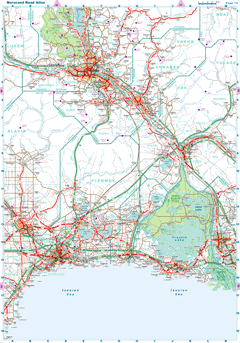
| General map (1389x1124, 0.26 mb) |
 |
|
|
| Flag |
Coat of Arms |
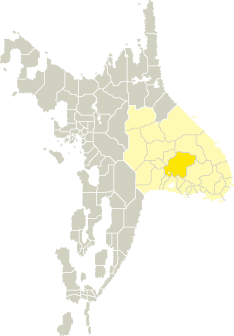
Location |
 |
 |
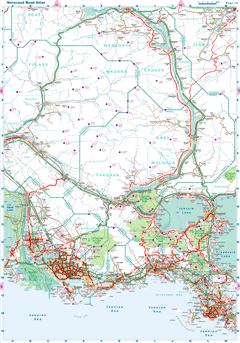
| Road maps for this area |
 |
 |
| |
|
| Location |
Central Tronlad |
| Area |
 Continental Continental |
23 863 sq.km |
| Isles |
5 sq.km |
| Water bodies |
130 sq.km |
| Total |
23 998 sq.km |
| Rank in Tronlad |
4 of 27 |
| Rank in Norscand |
7 of 103 |
| Size comparision |
New Hampshire |
| Boundaries |
| Land |
658 km |
| Coastal (w/o isles) |
0 km |
| Population |
| Total |
299 800 |
| Rank in Tronlad |
12 of 27 |
| Rank in Norscand |
60 of 103 |
| 5 Largest towns |
| Zesten |
166 110 |
| Dand |
19 378 |
| Dinettl |
16 670 |
| Jolahtme |
9 678 |
| Kakumae |
9 522 |
| Administrative division |
| # of districts |
8 |
| County seat |
Zesten |
| Transportation |
| Roadways: |
|
| Total length (paved, basic network) |
2 545km |
| Expressways |
501km |
| Road density |
0,11 km/sq.km |
| Share of expw |
20% |
| Railways |
|
| Total length |
281km |
| High-Speed Lines |
0 km |
| Airports |
|
| Total |
4 |
| Sched.service |
0 |
| Seaports |
|
| Total |
0 |
 |
|
|
|