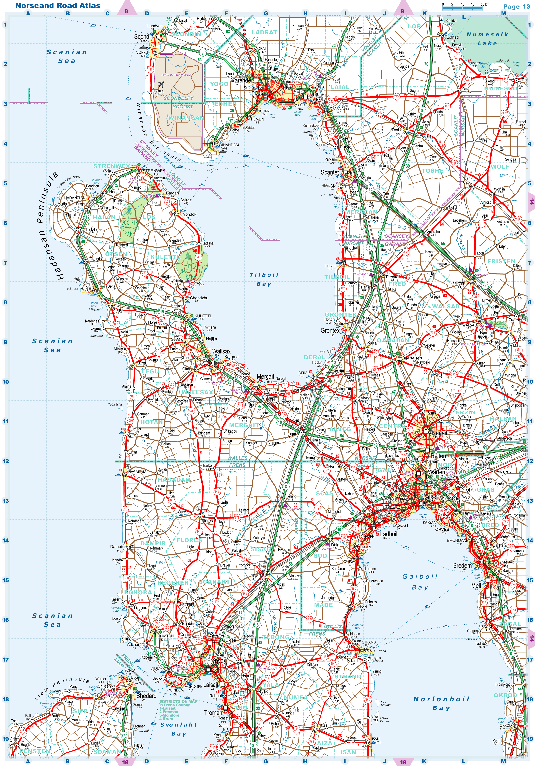
| |
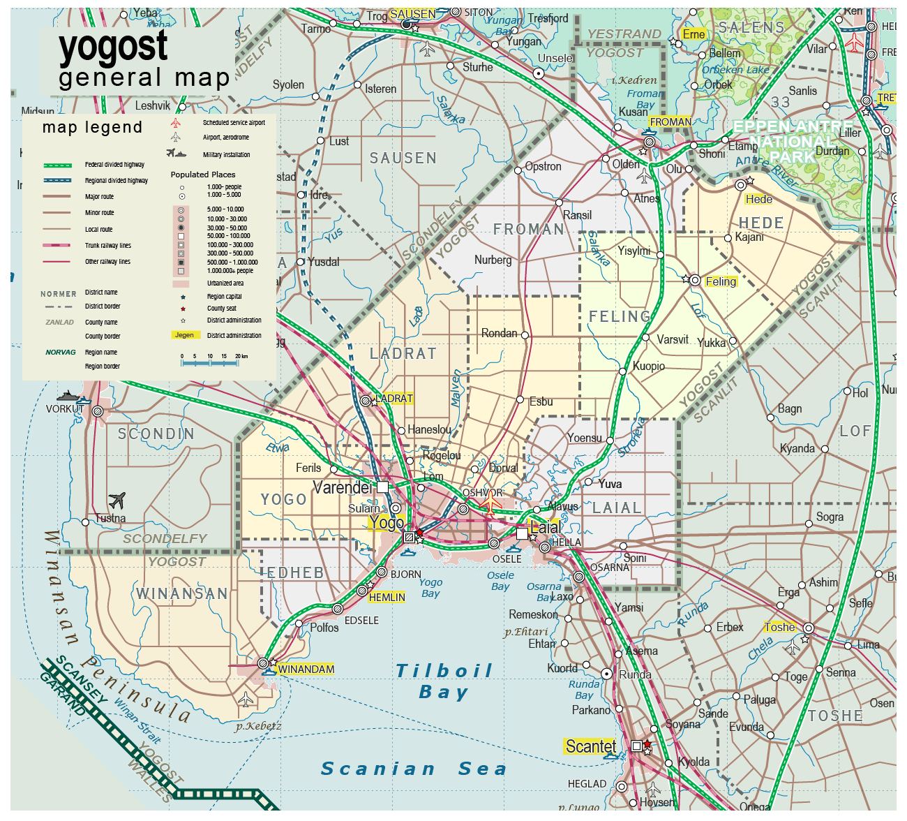
| General map (1300x1176, 290 kb) |
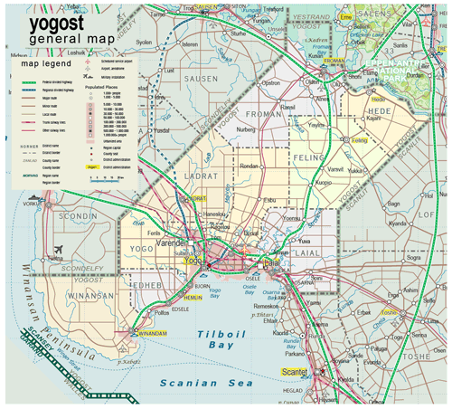 |
| |
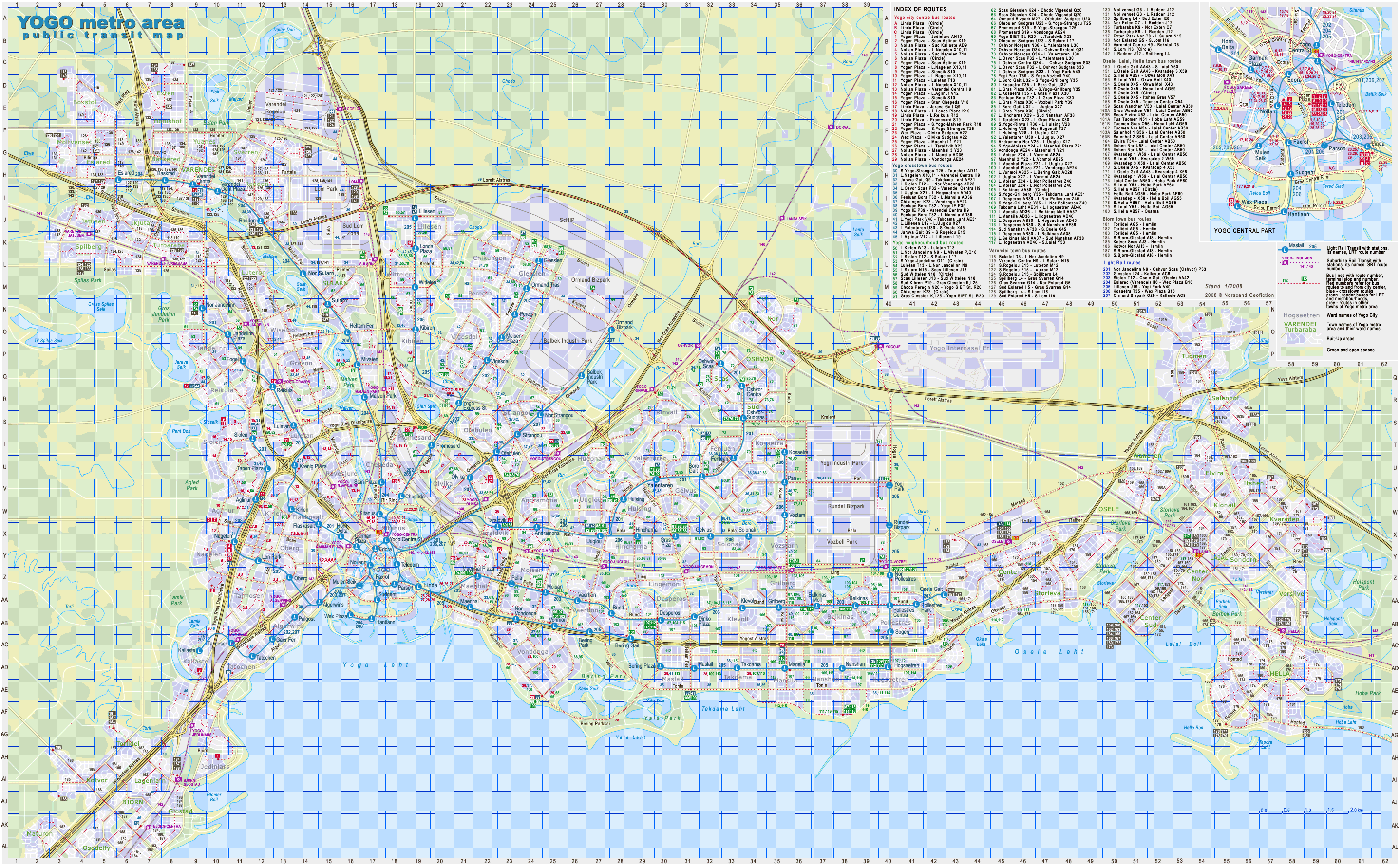
Yogo Metro Area - Public Transit Map
(2874x1779 pix, 1.32 Mb) |
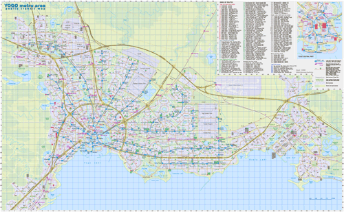 |
| |
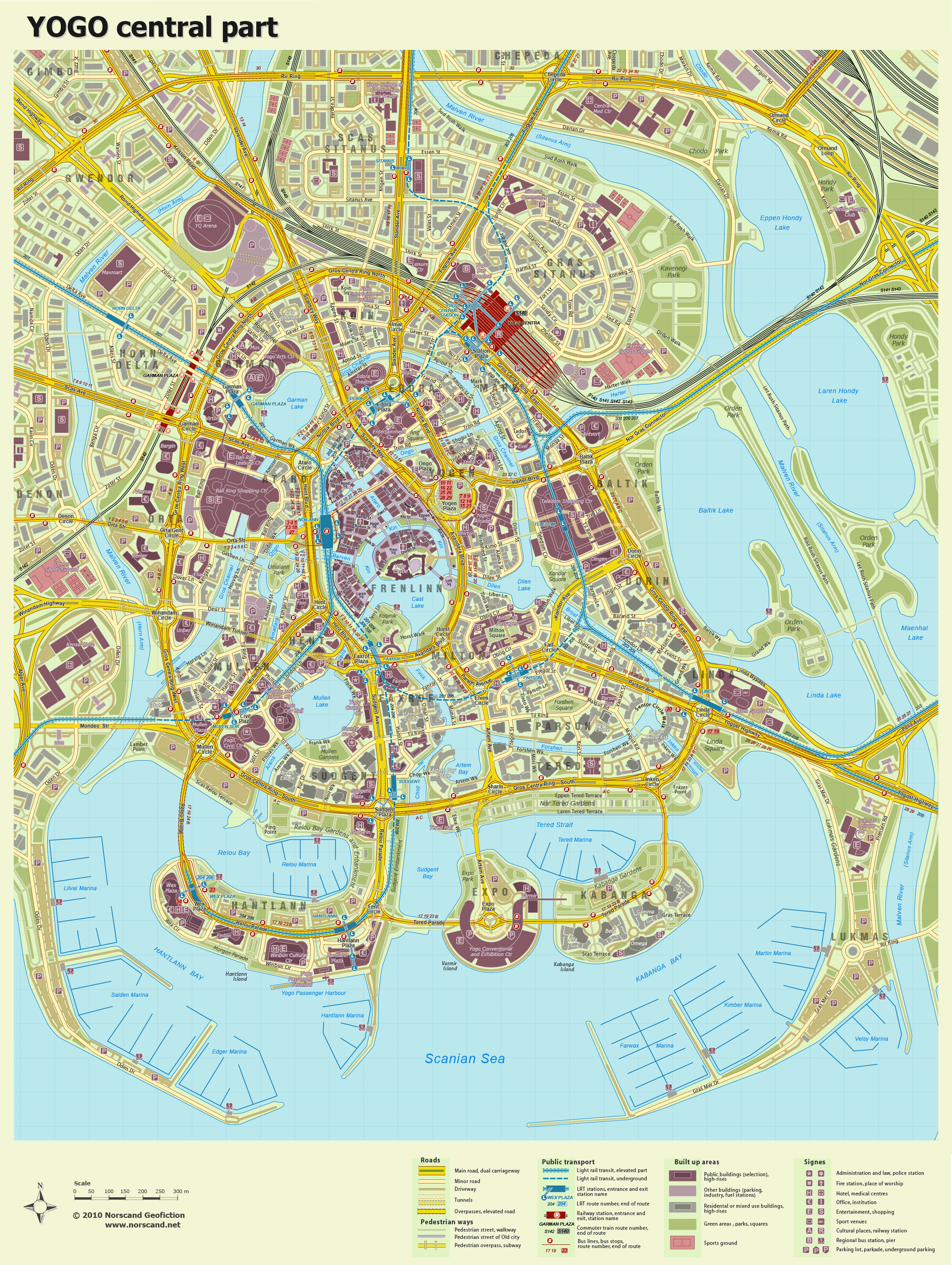
Yogo - Central Part Map
(2080x2764 pix, 4.5 Mb) |
 |
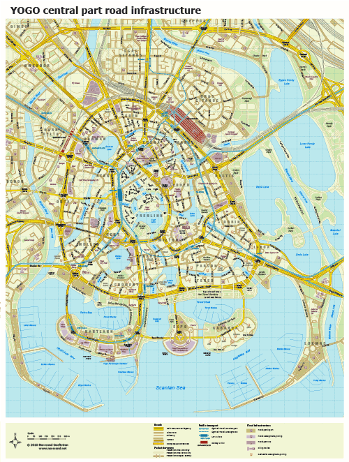
| |
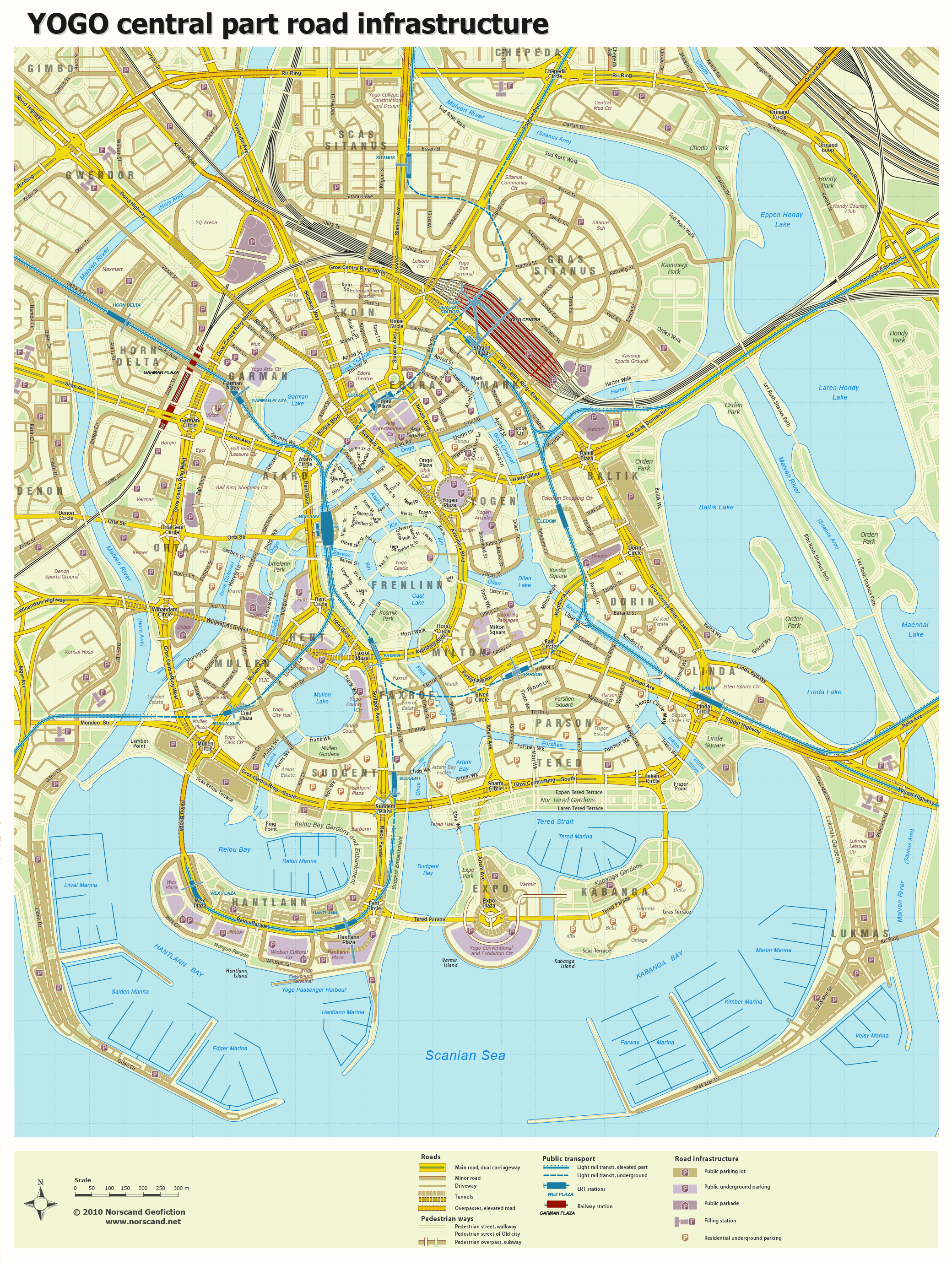
Yogo - Central Part Map - Roads
(2080x2764 pix, 3.8 Mb) |
 |
|
|
| Flag |
Coat of Arms |
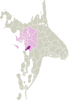
Location |
 |
 |
| Road maps for this area |
 |
 |
| |
|
| Location |
Southern Scansey |
| Area |
 Continental Continental |
6 657 sq.km |
| Isles |
12 sq.km |
| Water bodies |
186 sq.km |
| Total |
6 855 sq.km |
| Rank in Scansey |
7 of 24 |
| Rank in Norscand |
51 of 103 |
| Size comparision |
Delaware |
| Boundaries |
| Land |
245 km |
| Coastal (w/o isles) |
225 km |
| Population |
| Total |
674 700 |
| Rank in Scansey |
3 of 24 |
| Rank in Norscand |
24 of 103 |
| 5 Largest towns |
| Yogo |
320 618 |
| Laial |
79 410 |
| Varendei |
50 587 |
| Froman |
25 982 |
| Osarna |
24 273 |
| Administrative division |
| # of districts |
8 |
| County seat |
Yogo |
| Transportation |
| Roadways: |
|
| Total length (paved, basic network) |
2 560 km |
| Expressways |
320 km |
| Road density |
0,38 km/sq.km |
| Share of expw |
13% |
| Railways |
|
| Total length |
400 km |
| High-Speed Lines |
70 km |
| Airports |
|
| Total |
3 |
| Sched.service |
1 |
| Seaports |
|
| Total |
3 |
 |
|
|
|