| |
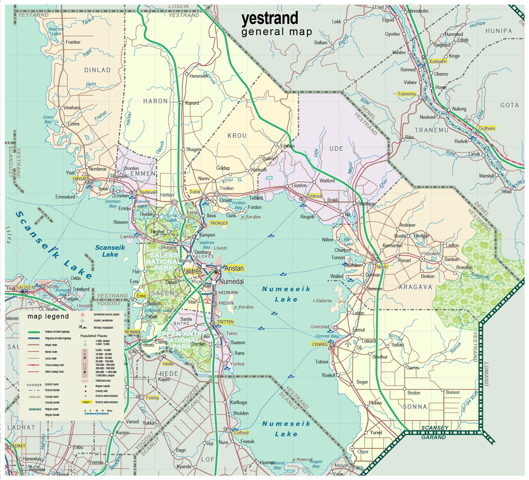
| General map (1838x1668, 472 kb) |
 |
Aristan Urban Area map (1205x1714, 388 kb) |
 |
|
|
| Flag |
Coat of Arms |
Location |
 |
 |

|
| Location |
Southeastern Scansey |
| Area |
 Continental Continental |
18 786 sq.km |
| Isles |
88 sq.km |
| Water bodies |
7 443 sq.km |
| Total |
26 317 sq.km |
| Rank in Scansey |
2 of 24 |
| Rank in Norscand |
18 of 103 |
| Size comparision |
Massachusets |
| Boundaries |
| Land |
405 km |
| Coastal (w/o isles) |
0 km |
| Population |
| Total |
559 400 |
| Rank in Scansey |
5 of 24 |
| Rank in Norscand |
31 of 103 |
| 5 Largest towns |
| Aristan |
137 092 |
| Valdres |
98 260 |
| Numedal |
60 720 |
| Tretten |
24 658 |
| Cenreil |
22 792 |
| Administrative division |
| # of districts |
11 |
| County seat |
Aristan |
| Transportation |
| Roadways: |
|
| Total length (paved, basic network) |
4 365 km |
| Expressways |
560 km |
| Road density |
0,23 km/sq.km |
| Share of expw |
13% |
| Railways |
|
| Total length |
550 km |
| High-Speed Lines |
0 km |
| Airports |
|
| Total |
6 |
| Sched.service |
1 |
| Seaports |
|
| Total |
0 |
 |
|
|
|