| |
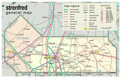
| General map (1156x744, 373 kb) |
 |
|
|
| Flag |
Coat of Arms |
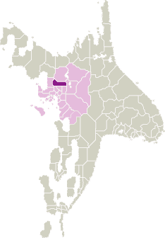
Location |
 |
 |
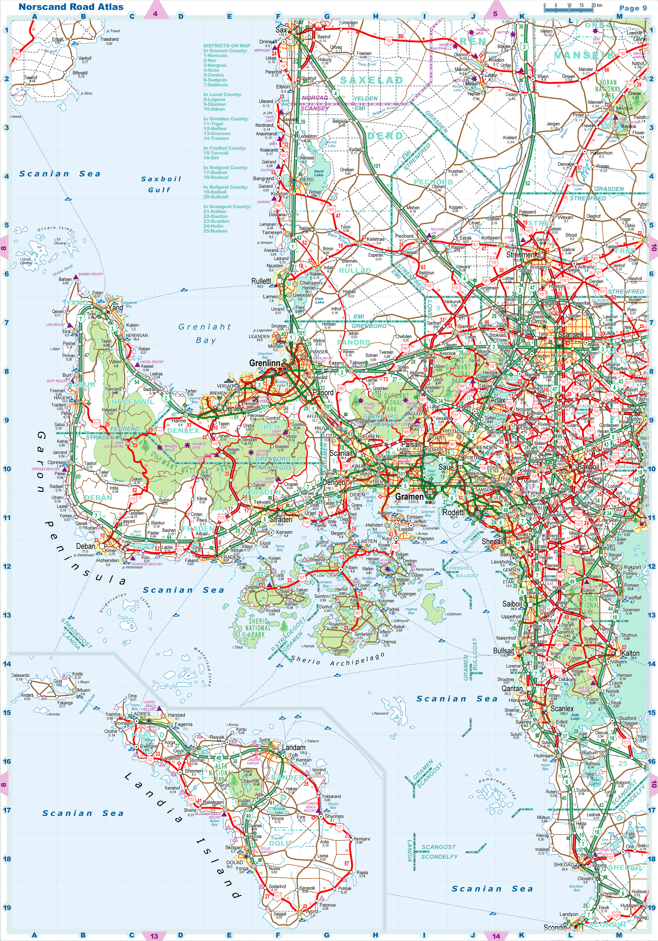
| Road maps for this area |
 |
| |
|
| Location |
Nothern Scansey |
| Area |
 Continental Continental |
6 181 sq.km |
| Isles |
0 sq.km |
| Water bodies |
0 sq.km |
| Total |
6 181 sq.km |
| Rank in Scansey |
8 of 24 |
| Rank in Norscand |
52 of 103 |
| Size comparision |
Delaware |
| Boundaries |
| Land |
365 km |
| Coastal (w/o isles) |
0 km |
| Population |
| Total |
190 700 |
| Rank in Scansey |
20 of 24 |
| Rank in Norscand |
96 of 103 |
| 5 Largest towns |
| Strenmen |
118 960 |
| Pechord |
9 740 |
| Wexan |
9 674 |
| Shod |
9 226 |
| Haston |
8 654 |
| Administrative division |
| # of districts |
3 |
| County seat |
Strenmen |
| Transportation |
| Roadways: |
|
| Total length (paved, basic network) |
1 415 km |
| Expressways |
190 km |
| Road density |
0,23 km/sq.km |
| Share of expw |
13% |
| Railways |
|
| Total length |
360 km |
| High-Speed Lines |
95 km |
| Airports |
|
| Total |
1 |
| Sched.service |
0 |
| Seaports |
|
| Total |
0 |
| |
|
|
|