| |
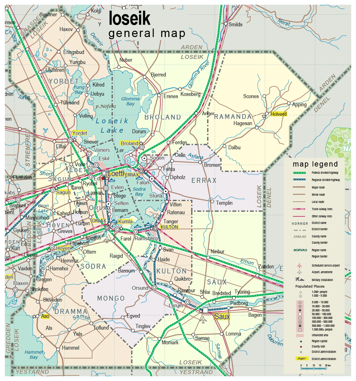
| General map (1136x1215, 253 kb) |
 |
|
|
| Flag |
Coat of Arms |
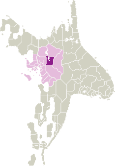
Location |
 |
 |
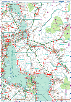
| Road maps for this area |
 |
| |
|
| Location |
Eastern Scansey |
| Area |
 Continental Continental |
11 247 sq.km |
| Isles |
20 sq.km |
| Water bodies |
1 451 sq.km |
| Total |
12 718 sq.km |
| Rank in Scansey |
5 of 24 |
| Rank in Norscand |
38 of 103 |
| Size comparision |
Connecticut |
| Boundaries |
| Land |
420 km |
| Coastal (w/o isles) |
0 km |
| Population |
| Total |
399 900 |
| Rank in Scansey |
7 of 24 |
| Rank in Norscand |
46 of 103 |
| 5 Largest towns |
| Loettl |
118 594 |
| Saux |
80 192 |
| Kulton |
23 292 |
| Orlax |
18 878 |
| Errax |
10 094 |
| Administrative division |
| # of districts |
13 |
| County seat |
Loettl |
| Transportation |
| Roadways: |
|
| Total length (paved, basic network) |
2 575 km |
| Expressways |
545 km |
| Road density |
0,23 km/sq.km |
| Share of expw |
21% |
| Railways |
|
| Total length |
495 km |
| High-Speed Lines |
0 km |
| Airports |
|
| Total |
4 |
| Sched.service |
0 |
| Seaports |
|
| Total |
0 |
| |
|
|
|